You will get Mapbox WebGIS Software Development Service
Project details
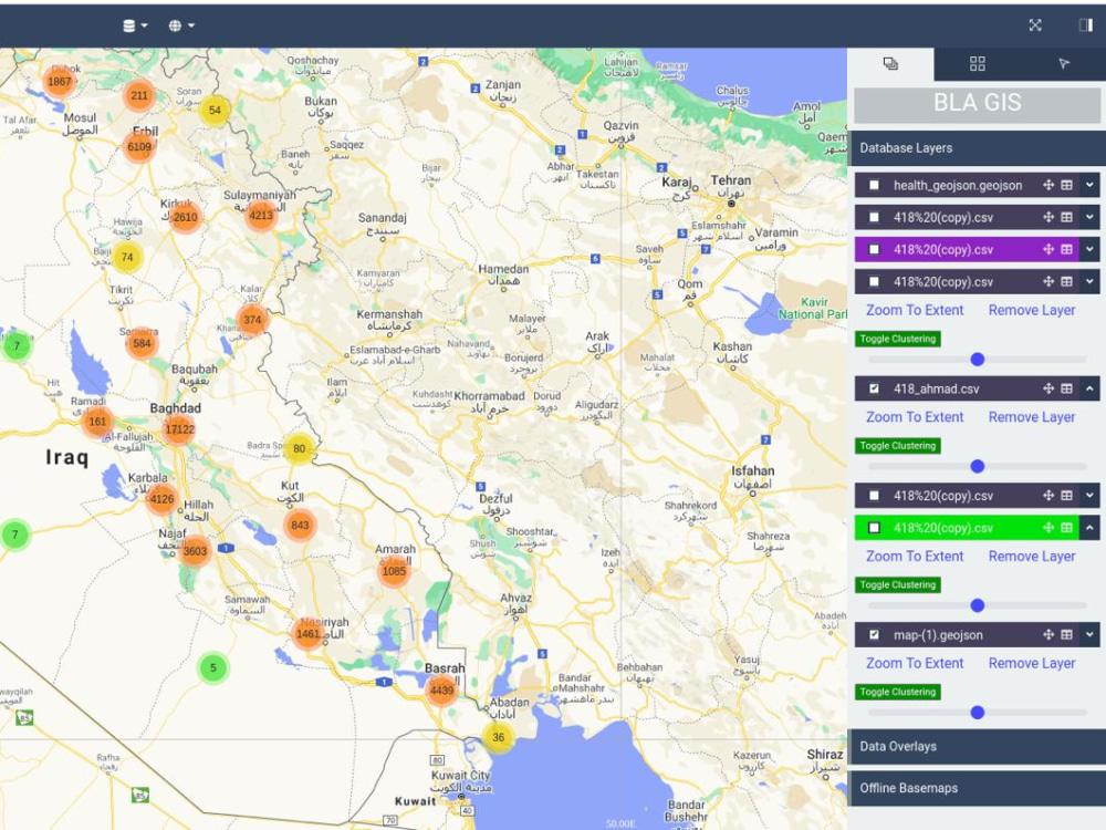
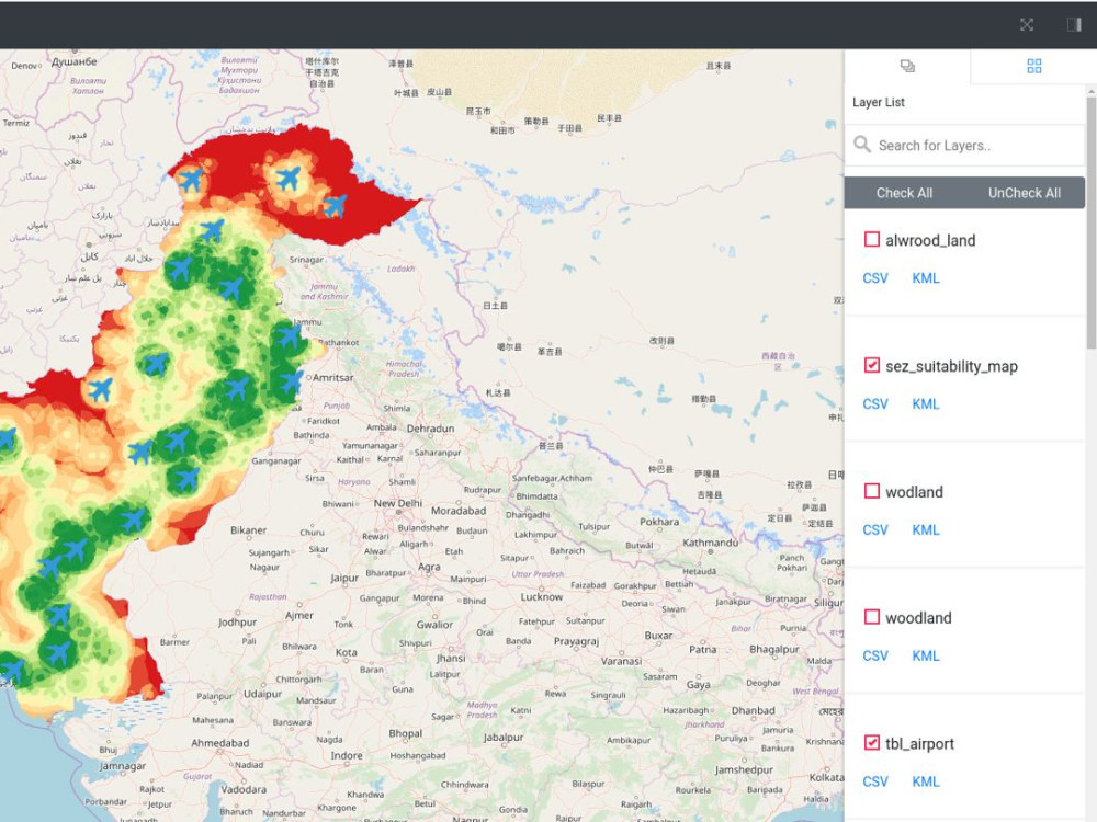
You will get full stack custom WebGIS application with ReactJS as client library and backend can be ASP.NET (C#), Django Rest API (Python), Flask (Python), ExpressJS (Node). You will also get deployment as well if you needed.
NOTE: I have mentioned hourly rate on the project which $40/hr.
NOTE: I have mentioned hourly rate on the project which $40/hr.
Programming Languages
JavaScript, Python, C#Coding Expertise
Cross Browser & Device Compatibility, Performance Optimization, SecurityWhat's included $40
These options are included with the project scope.
$40
- Delivery Time 1 day
- Number of Revisions 5
- Number of Pages 1
- Design Customization
- Content Upload
- Responsive Design
- Source Code
19 reviews
(18)
(1)
(0)
(0)
(0)
This project doesn't have any reviews.
VM
Vincent M.
Apr 28, 2025
GIS Expert in ArcGIS, Spatial Analysis, Remote Sensing and MapBox
KC
Kevin C.
Nov 14, 2024
GeoPackage loader to PostGIS DB written in Python
Muhammad is skilled in Postgres and database engineering. We were able to solve some tricky problems.
GK
Gerald K.
Apr 7, 2022
SpatiaLite connector for Franchise
Abdullah is a professional programmer working concentrated on the project, communicating technical aspects very comprehensive and resolving problems with a high quality. I definitely would contract him again.
SW
Shaun W.
Mar 13, 2022
Shortest-path generation and display on map_PGrouting_PostgreSQL_QGIS_intermodal transportation
Nice job and nice freelancer.
OJ
Olli J.
Dec 14, 2020
Import Shapefile (.shp) to PostGIS and route with pgRouting extension.
About Muhammad
Full Stack GIS Developer | Remote Sensing & GIS Specialist
82%
Job Success
Lahore, Pakistan - 9:50 pm local time
Provide consultancy and development services related to GIS based decision support systems, establishment of enterprise level GIS systems, GeoAI projects.
🌐 GIS Servers:
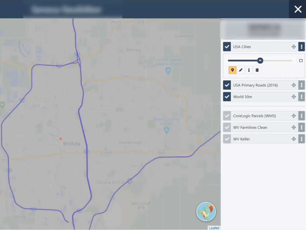
• Worked with open source GIS servers to leverage OGC (Open Geospatial Consortium) standards (WMS, WFS, WFST and WPS) like GeoServer and MapServer.
• Worked with other GIS servers which are not OGC complaint but serves specific GIS capabilities, i.e., MapProxy, KoopJS etc.
• Worked with ESRI's ArcGIS Server and ArcGIS Online.
🌐 ESRI Development Expertise:
• Have expertise in ArcGIS for Desktop and ArcGIS Pro Addin development using .NET ArcObjects and ArcGIS Pro SDK respectively and have developed geoprocessing tools using ArcPy.
• Have expertise in setting up ArcGIS Enterprise and configuring license.
• Have been automating ArcGIS Online hosted data using Python for ArcGIS.
🌐 Google Earth Engine (GEE) and Sentinel Hub Expert:
• Have done complex analysis in Google Earth Engine (GEE) and Sentinel Hub.
• Also have experience of apps development using Earth Engine Apps.
🌐 Cloud Expertise:
• Extensively worked on Amazon cloud (AWS).
• Have used AWS EC2, AWS S3, AWS RDS, AWS Iot Core, AWS Route 53, AWS Elastic Beanstalk etc.
• Worked Azure and Google cloud as well but very little as compared to Amazon (AWS).
🌐 Backend Expertise:
- Python:
• Developed several projects using Flask and Django (GeoDjango and Django rest framework). I use to decide which framework to use based on requirements, i.e., for small APIs only I prefer Flask otherwise Django Rest and Obviously for GIS related stuff GeoDjango.
• Experience of writing scripts for GIS data scrapping from different sources.
• Pre-processing the data from scrapping and then add into database.
- DotNET (C#):
• Worked on both window specific dotnet framework and cross-plateform dotnet core.
• Have experience of working on an enterprise level application which 32+ projects plus couple of microservices as well.
• Worked on a highly secure application as one of the consultant was a banking application developer which led us to secure request and responses. So I have indepth knowledge of making APIs secure using cryptographic techniques.
• Worked on implementation of OpenID Connect and OAuth 2.0 using Microsoft Identity framework.
- NodeJS:
• Worked on Fastify, ExpressJS and NestJS frameworks.
• Got a chance to work on realtime updates of data from Iot devices through AWS IoT Core (via MQTT protocol) which I add in Postgres database. I worked on MQTT, WebSockets and Http protocols.
- PHP:
• Started my career initially with PHP and worked on several government level projects with frameworks such as Slim, Laravel and Lumen.
🌐 Database Management System (DBMS):
- PostgreSQL:
• Extensively worked on PostgreSQL with spatial extensions like PostGIS, pgRouting etc for creating geodatabase.
• Done several GIS analysis using only PostGIS and pgRouting e.g., Overlay analysis, building side length detection on each four sides (North, South, East, West), developed a routing engine using pgRouting, distance matrix calculation and many more.
• Carry good experience in database and query optimizations both for non-spatial and spatial databases.
• Worked on both cloud based PostgreSQL and On-Premises database installations.
- MySQL:
• Worked with MySQL and its spatial capabilities to work with geodatabase.
• Found PostgreSQL to be more robust than this but in some cases already developed applications I have to work with MySQL as well many time.
SQLite:
• Worked with sqlite and sqlite spatial depends on project requirements.
• Worked on specific formats of sqlite spatial, i.e., geopackage.
- ESRI Geodatabases:
• Worked in ESRI proprietary environment. i.e., with all types of ESRI geodatabases (File geodatabases, Mobile geodatabases and Enterprise geodatabases).
🌐 Frontend Expertise:
- JavaScript frameworks:
• Developed several projects using React JS and then because of security reasons I shifted to Next JS. Though I have worked with Angular 10 as well but not stick to it. But I can work using React JS, Next JS and Angular.
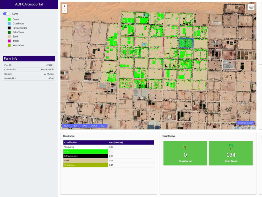
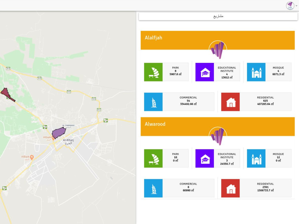
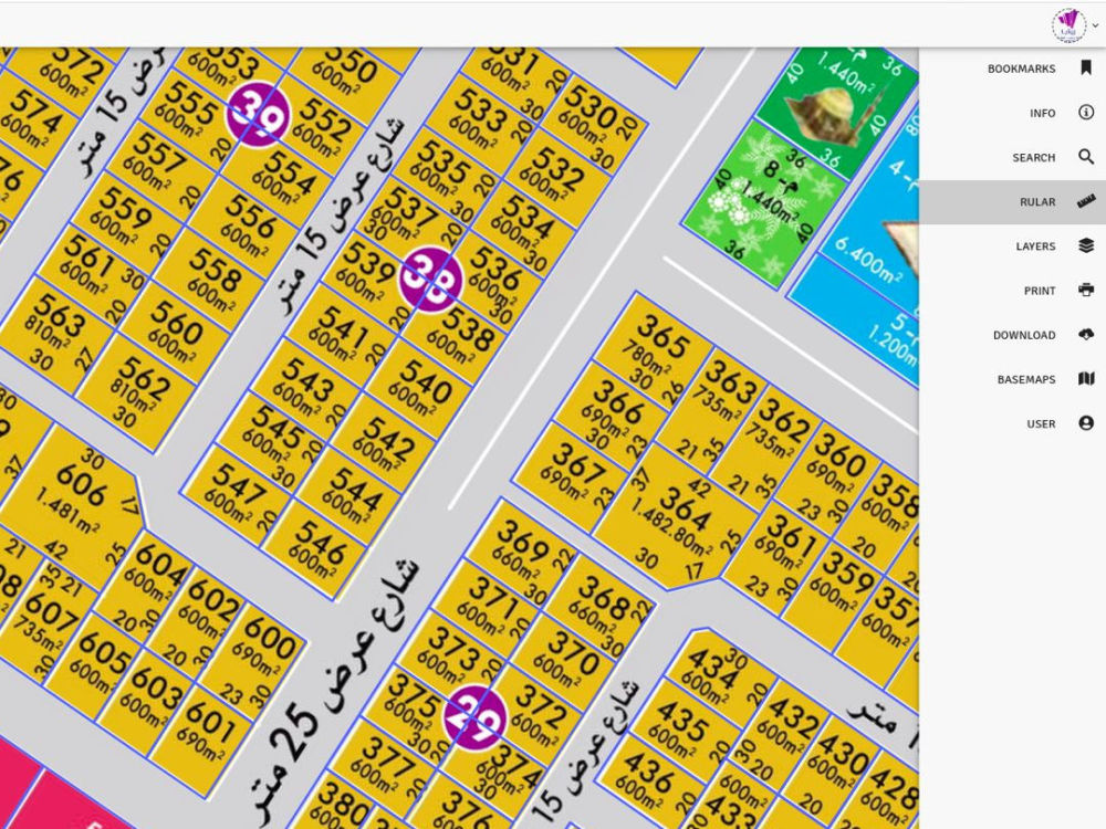
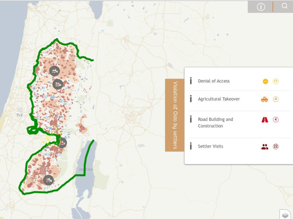
- GIS Mapping:
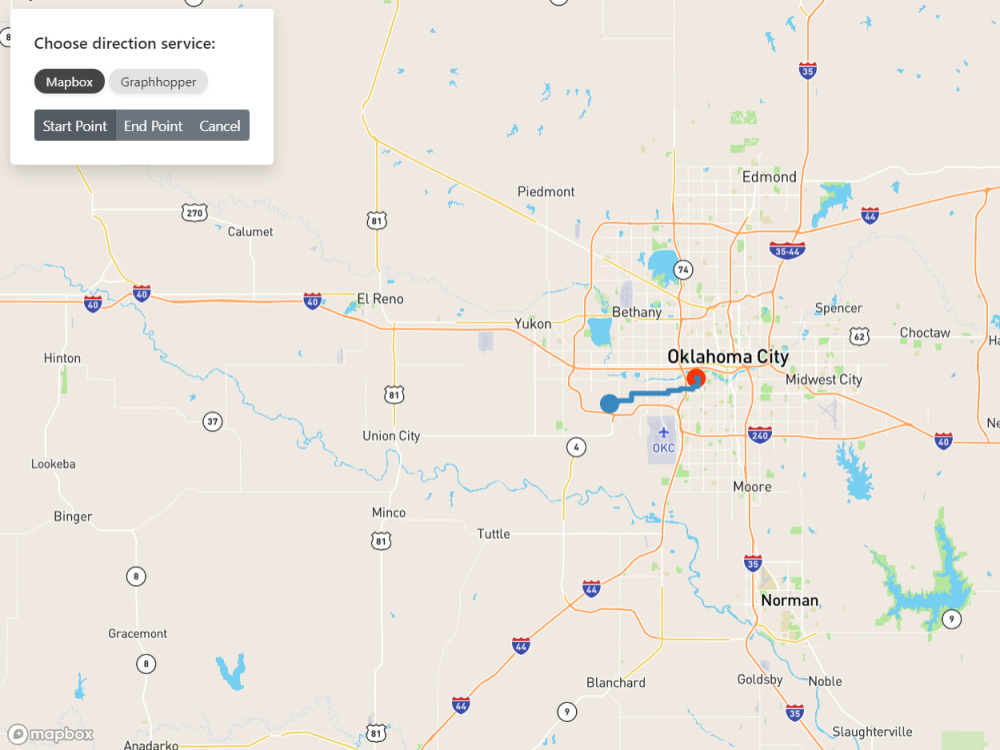
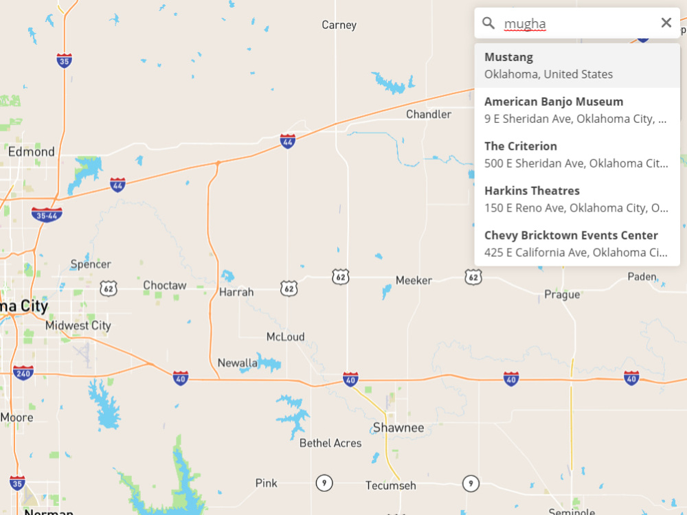
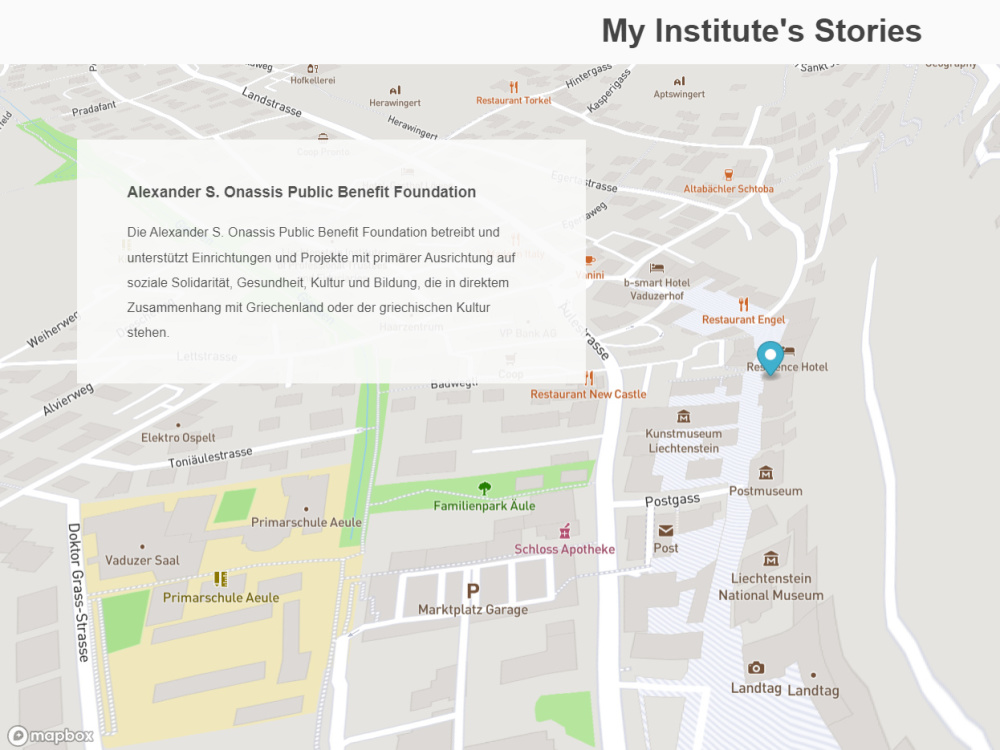
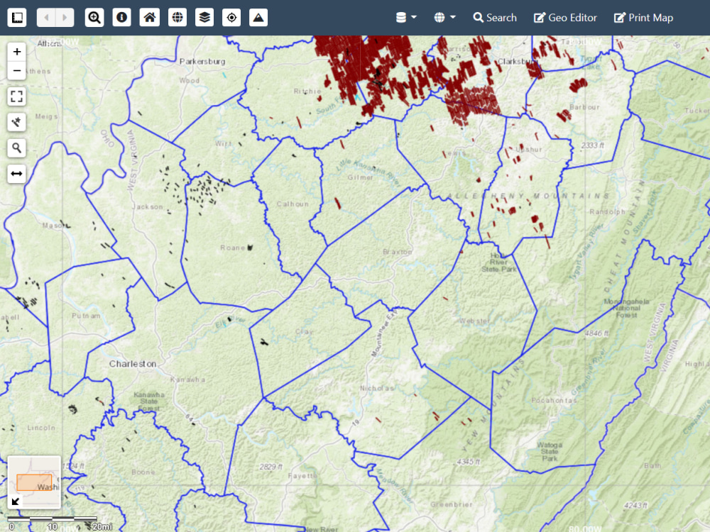
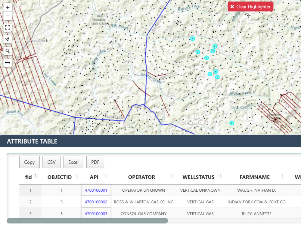
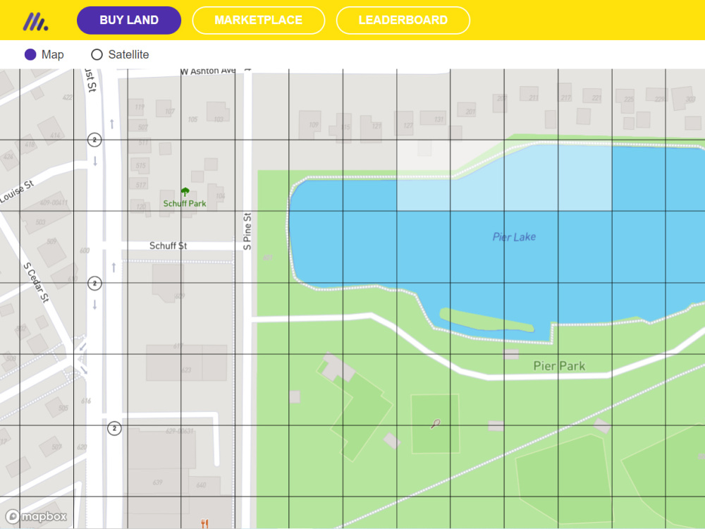
• Worked on different libraries for mapping like Openlayers, Leaflet JS, Mapbox GL JS, Maplibre GL, ArcGIS 3D JavaScript, Google Maps API, Cesium, Kepler GL, Turf JS and many other based on requirements.
🌐 Deployment & Server Management:
- Servers:
• Worked on both Window and Linux (Ubuntu and Centos) servers.
- Web Servers:
• Worked with IIS, Apache, Tomcat and Nginx.
• Deployed applications on servers (mostly develop a pipeline for automatic deployment from github).
🌐Education:
• MPhil in Remote Sensing (RS) and Geographic Information Systems (GIS).
• BS Hons. in Space Science.
Steps for completing your project
After purchasing the project, send requirements so Muhammad can start the project.
Delivery time starts when Muhammad receives requirements from you.
Muhammad works on your project following the steps below.
Revisions may occur after the delivery date.
React application setup with Mapbox GL JS