Development & IT Consultation with Vincenzo M.
Development & IT Consultation with Vincenzo M.
During the consultation, I can help you clarify the scope of your project, review your current map or prototype, identify the right technical architecture, evaluate data structure and performance issues, and define realistic next steps for development.
Typical topics include Mapbox GL JS and related web libraries, GIS data, custom map interfaces, filters and search, dashboards, data visualization, API/database integrations, performance optimization, mobile behavior, and project planning.
• A 30-minute session is ideal for a focused review or feasibility discussion.
• A 60-minute session is better for deeper project scoping, technical planning, or reviewing an existing platform in detail.
Whether you are starting from an early idea or already have a working prototype, I’ll help you understand what is possible, what to prioritize, and how to move forward with more clarity.
Get personalized advice on:
AI & Machine Learning
AI Integration
Data Analysis & Reports
Database Development
Web Programming
gis
mapbox
interactive maps
geospatial dashboards
data visualization
You’re covered with payment protection so you can cancel and get a full refund up to 24 hours before your consultation.
About Vincenzo
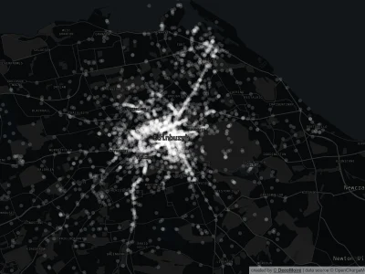
Mapbox Expert | Interactive Maps, Geospatial Dashboards & Data Stories
89%
Job Success
Milan, Italy - 3:21 pm local time
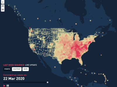
With 11+ years of experience and 140+ completed projects, I help companies, startups, research teams, and organizations turn complex geographic data into clear, fast, and engaging digital products through Deepmoire, my personal practice for geospatial interfaces and interactive data platforms.
My work combines GIS, frontend engineering, data visualization, UX, Mapbox, backend integrations, and product thinking.
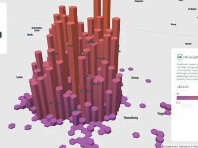
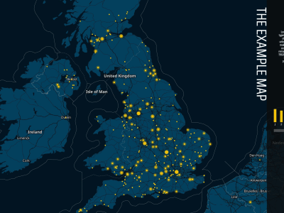
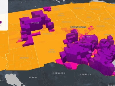
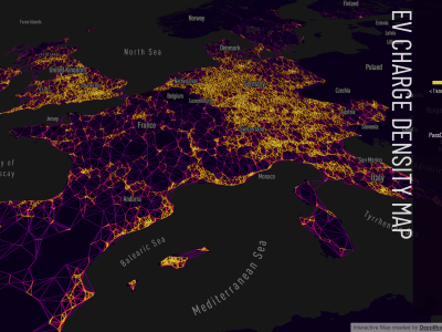
I can help you build:
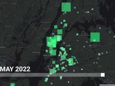
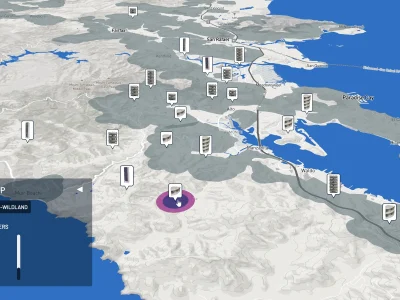
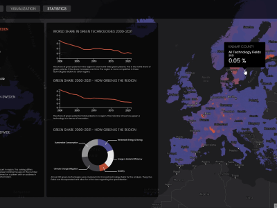
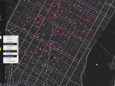
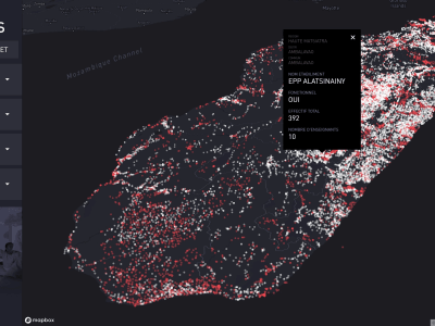
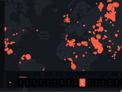
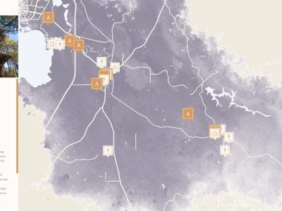
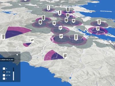
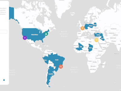
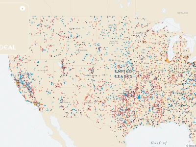
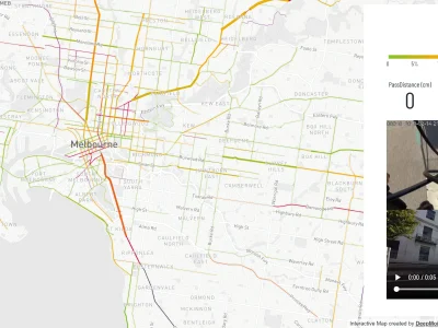
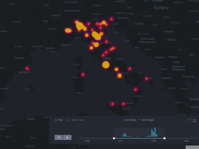
• Custom interactive maps;
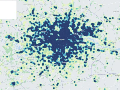
• Geospatial dashboards;
• Location intelligence platforms;
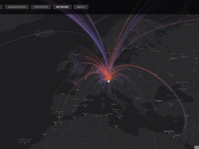
• Data storytelling experiences;
• Map-based SaaS MVPs;
• Research, climate, real estate, tourism, culture, and event mapping tools;
• High-performance Mapbox GL JS / d3.js / Turf.js / MapLibre / Deck.gl libraries and applications;
• Spatial data processing and automation pipelines;
• API, database, and cloud integrations for geospatial products.
My role is to manage the full workflow behind a geospatial digital product: understanding the data, defining the structure, designing the user experience, building the interface, integrating the required systems, and preparing the application for production.
This end-to-end approach is especially useful for projects that involve complex datasets, custom interactions, performance requirements, or a need for both technical accuracy and visual clarity.
If your project requires more than a standard web map, and needs a reliable structure across data, design, development, deployment, and product logic, I can help turn it into a complete, well-built geospatial application.
What to expect
Schedule the consultation
Choose from the freelancer’s available days and times.
Get advice for your custom needs
Share details about your project and what you want to talk about. The freelancer will review and reach out if they have questions.
Join the Zoom meeting
1-on-1 meeting with the freelancer to discuss your needs and project.
Approve the work
The freelancer will finish up the documents you asked for and send them to you for approval:
Before the consultation
Here’s what Vincenzo will need to know before you meet
- Please briefly describe your project, idea, or current map/platform. What are you trying to build, improve, or understand during the consultation?
- If you already have a prototype, website, map, dataset, brief, screenshots, or design references, please share them here before the consultation.
- What would be the most useful outcome for you: technical direction, project scope, architecture review, data review, cost/time estimate, or next steps?
Frequently asked questions
(93)
(90)
(3)
(0)
(0)
(0)
AN
Adam N.
Aug 1, 2025
MW
Mike W.
Feb 6, 2025
GB
Greg B.
Feb 4, 2025
Great support thanks Vincenzo
MW
Matt W.
Aug 30, 2024
JC
Jarrod C.
May 7, 2024
JM
Jack M.
May 27, 2026
Mapbox Demo for Updated Live Map
Vincenzo was great to work with, would highly recommend him for any data visualization or custom map UI requirements. Thanks again, Vincenzo! We look forward to our next project with you.
AN
Adam N.
May 15, 2026
Story Maps
Vincenzo was fantastic, highly skilled, responsive, and proactive. He built a clean StoryMap experience and, more importantly, created a scalable workflow (Google Sheet as live source-of-truth + local media folder + color theme sheet) that makes ongoing collaboration easy and reliable. Great UX instincts and strong engineering execution. Would hire again without hesitation.
MO
Molly O.
Feb 22, 2026
Partnership for Miami- Miami Dade Public School Map
Vincenzo was wonderful to work with. Very responsive and the end product is not just functional, but informative, and beautiful.
DT
Doneshia T.
Feb 18, 2026
Microsite Map
If you're considering Vincenzo, know that he doesn’t just “make it function” — he makes sure every map he creates integrates seamlessly into the broader user experience.
He’s responsive, solution-oriented, and dependable with timelines.
Most importantly, he’s consistent. We’ve worked together on multiple projects, and the quality has remained high across the board.
He’s responsive, solution-oriented, and dependable with timelines.
Most importantly, he’s consistent. We’ve worked together on multiple projects, and the quality has remained high across the board.
BS
Blake S.
Jan 29, 2026
Support with store counts by zip and county