Angelo isn't taking new orders for this project right now. Here are some similar projects to explore.
You will get Design of an urban park
Project details
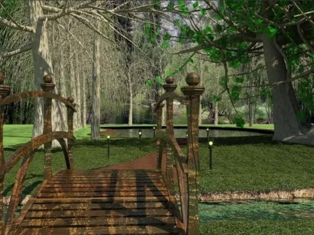
Design of an urban park with native vegetation and addition of trees and plants and design of paths, furniture and lighting through the use of renewable sources.
Type
ResidentialFile Format
DWG, SKP, FBX, TIFF, PDFSoftware
Autodesk AutoCAD, SketchUpWhat's included
| Service Tiers |
Starter
$250
|
Standard
$375
|
Advanced
$500
|
|---|---|---|---|
| Delivery Time | 5 days | 7 days | 8 days |
Number of Revisions | 3 | 5 | 8 |
Number of Renderings | 4 | 4 | 4 |
3D Modeling | |||
Environment | |||
Source File | - | ||
Landscape Walkthrough | - | - |
48 reviews
(45)
(2)
(0)
(0)
(1)
This project doesn't have any reviews.
MN
Marmota N.
Feb 2, 2024
Aggiornamento Planimetria stabilimento produttivo
RW
Ralph W.
Nov 28, 2023
Creation of a single 2D Map including all cadastral data for a ~2000 hectare area in Italy
A true professional, very responsive and highly capable. I would recommend to all.
RD
Robin D.
Nov 5, 2023
Topography job
NP
Nikos P.
Jun 12, 2023
Convert 2d maps to 3d maps.
AM
Arthur M.
Jun 6, 2023
Convert Autocad to KMZ File
Converted CAD files to KMZ files for me. Competed all assigned tasks. Was prompt and responsive. Would hire again.
About Angelo
BIM-GIS specialist and Senior CAD Technician
Catania, Italy - 4:20 pm local time
As a surveyor I have gained a rich and diversified experience through multidisciplinary consultancy and, over time, I have been involved in a wide range of projects in a variety of professional roles.
My passion for innovation has oriented me to manage work with GIS and CAD technologies, and BIM methodology.
EDUCATION:
➡️ Geomatics Surveyor;
➡️ GIS-GPS expert and technician;
➡️ Urban planning and reuse;
➡️ Master BIM Specialist, Architecture and MEP.
SKILLS:
➡️ Geographic Information System (GIS);
➡️ Geospatial Analysis;
➡️ Topography and Cartography;
➡️ Building Information Modeling (BIM);
➡️ BIM architecture;
➡️ BIM Quantity Takeoff;
➡️ Land volume calculation.
WHAT I OFFER:
➡️ GIS and geodatabase;
➡️ Thematic, Choropleth, Isopleth Maps;
➡️ Digital Terrain Model and Digital Surface Model;
➡️ 3D BIM modeling of terrain and building;
➡️ BIM Quantity Takeoff.
SOFTWARE:
➡️ QGIS;
➡️ AutoCAD;
➡️ Edificius 3D/BIM;
➡️ SketchUp Pro;
➡️ Microsoft Excel.
IT CERTIFICATIONS:
➡️ ICDL GIS - Specialised Level;
➡️ ICDL CAD - Specialised Level;
➡️ ICDL CAD 3D - Specialised Level;
➡️ QGIS basic and advanced;
➡️ SketchUp and 3D modeling;
➡️ Acca Software - Edificius - BIM Version 3;
➡️ Microsoft Office Specialist for Excel;
➡️ SQL Language / Spatial databases.
WORK EXPERIENCE:
- AutoCAD designer (2000-2001): design of works - drafting of the executive project.
- Internship for Surveyor (2003-2005): Topography and cadastre, Construction, Valuation.
- Surveyor (2006-2009): Construction, Urban Planning and Environment; Geomatics and cadastral activities; Surveying and estimation activities.
- GIS technician and AutoCAD designer (2010-2021): Choropleth, Isopleth, Proporzional Symbol Map; Urban furniture design; 3D modeling of cultural heritage; 3D modeling of surfaces and solids, parametric modeling; Rendering.
- GIT/S and BIM modeler (2023-): Geospatial Analysis; Thematic maps and geodatabases; Digital Terrain Model and Digital Surface Model; Point Cloud to BIM; 3D BIM modeling of terrain and building; BIM Quantity Takeoff; 3D CAD design; Rendering.
Steps for completing your project
After purchasing the project, send requirements so Angelo can start the project.
Delivery time starts when Angelo receives requirements from you.
Angelo works on your project following the steps below.
Revisions may occur after the delivery date.
Contact for the interview
Description of the place and main use.
Job assignment
Analysis of the territory and urban fabric to harmonize the context of the park with the surrounding environment and the functions within the park.