You will get Drone Image Processing to 3D Model, Orthophoto & Point Cloud
Project details
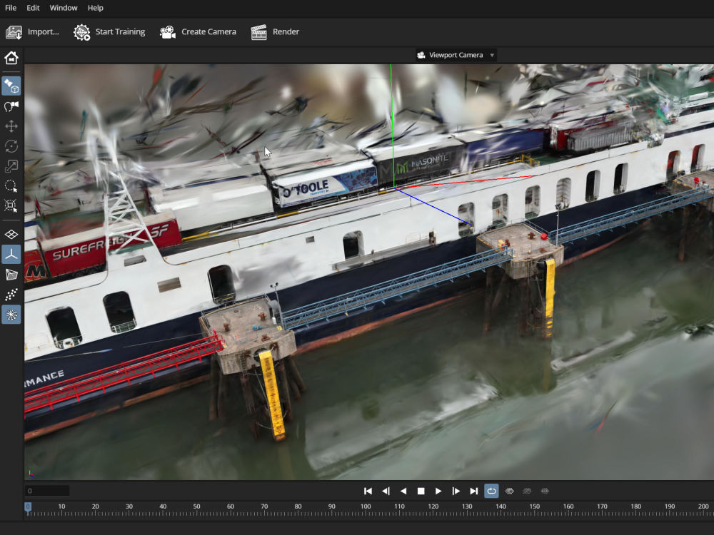
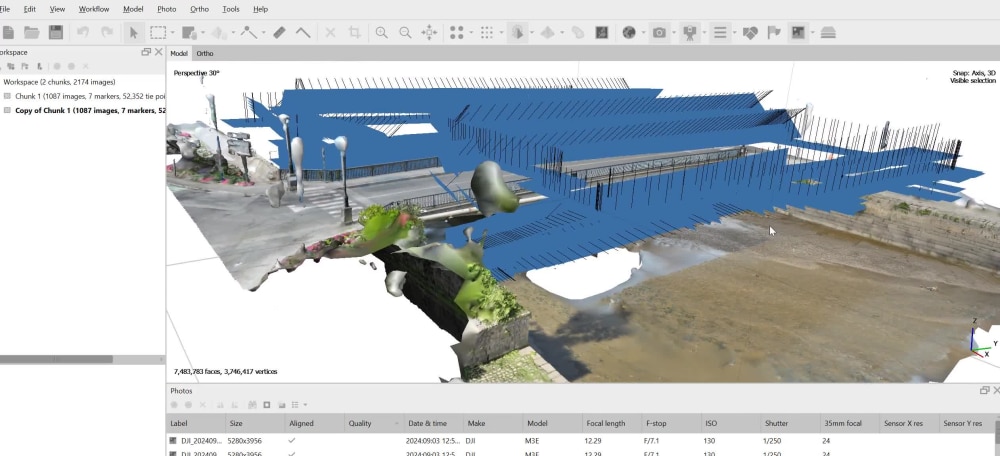
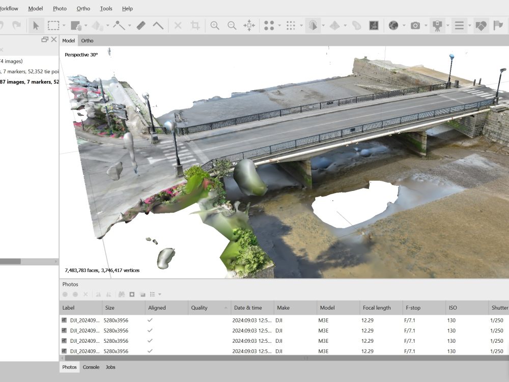
You will receive a complete and professional photogrammetry workflow for your drone images. I process your aerial photos using Metashape, Pix4D, or PostShot, delivering high-resolution outputs such as:
• Orthophoto (.tif or .jpg)
• Point cloud (.las/.laz)
• DSM/DTM terrain models
• 3D textured model (.obj/.fbx/.glb)
I am a GIS and 3D mapping specialist with 15+ years of experience in geospatial data processing. I can also optimize your models for web viewing, integration, or terrain analysis.
• Orthophoto (.tif or .jpg)
• Point cloud (.las/.laz)
• DSM/DTM terrain models
• 3D textured model (.obj/.fbx/.glb)
I am a GIS and 3D mapping specialist with 15+ years of experience in geospatial data processing. I can also optimize your models for web viewing, integration, or terrain analysis.
Materials
OtherDesign Software
Adobe CC, Blender, CorelDRAW, MeshLab, OtherFile Format
OBJ, PDF, STL, OtherWhat's included
| Service Tiers |
Starter
$100
|
Standard
$250
|
Advanced
$500
|
|---|---|---|---|
| Delivery Time | 2 days | 5 days | 7 days |
Number of Revisions | 1 | 2 | Unlimited |
3D Modeling | - | - | |
Texturing & Lighting | - | - | - |
Animation | - | - | - |
Source Files | - |
Frequently asked questions
11 reviews
(10)
(1)
(0)
(0)
(0)
This project doesn't have any reviews.
DM
David M.
Sep 26, 2025
Lidar Data cleaning and Environemental Visualization
Marc did an excellent job on my LiDAR project. He handled multiple tasks professionally - from cleaning and processing raw datasets to creating accurate and visually appealing 3D outputs. Great communication, attention to detail, and fast delivery. Highly recommended and would definitely work with him again!
pw
philippe w.
Jun 19, 2025
Gis Specialist to convert data and create equirectangular projection of the earth
AM
Amir M.
Sep 12, 2024
Spatial Analyst
VO
Vincent O.
May 14, 2024
In addition of this job on FME
Excellent work, great communicator and highly knowledgeable with FME. Went above and beyond to assist me and provide solutions for me FME workbench.
RK
Robin K.
Apr 16, 2024
Get all Zip Codes included in the 70km radius from (3100 St. Pölten, Austria)
great as always!
About Marc
GIS Automation | DATA | PIPELINE | 2D/3D Mapping
100%
Job Success
Saint-Cezert, France - 10:33 pm local time
I specialize in GIS automation, LiDAR processing, and 2D/3D cartography delivering clean data, smart workflows, and high-quality visuals.
💡 What I can do for you:
GIS automation (Python, QGIS, FME)
LiDAR & point cloud processing
Remote sensing & spatial analysis
Map design (publication-ready & web)
3D modeling (Blender, Geometry Nodes)
Data pipelines & geospatial workflows
⚙️ Tools I master:
Python | QGIS | FME | Blender | Global Mapper | Illustrator
🎯 Why clients work with me:
✔ I automate repetitive GIS tasks → save you time & money
✔ I deliver clean, reliable, production-ready results
✔ I understand both technical + business needs
✔ Fast communication & professional mindset
📊 Proven track record:
🔥 100+ completed projects
🔥 75+ satisfied clients (Upwork, Fiverr, private)
🔥 Top Rated | 100% Job Success
CLIENT REVIEWS⭐⭐⭐⭐⭐
💬 What you get:
Clear communication, fast delivery, and solutions that actually work and not just “nice maps”.
👉 If your project involves GIS, automation, LiDAR, 3D, or spatial data, let’s talk.
Steps for completing your project
After purchasing the project, send requirements so Marc can start the project.
Delivery time starts when Marc receives requirements from you.
Marc works on your project following the steps below.
Revisions may occur after the delivery date.
Review photos & prepare project
Check image quality, metadata, overlap, and organize the photogrammetry file
Align and reconstruct scene
Generate tie points, dense cloud, mesh, DEM, and orthophoto with Metashape or Pix4D