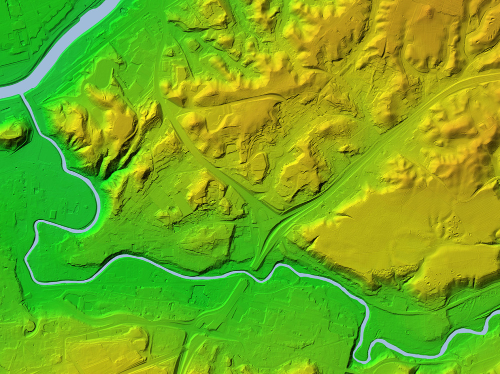
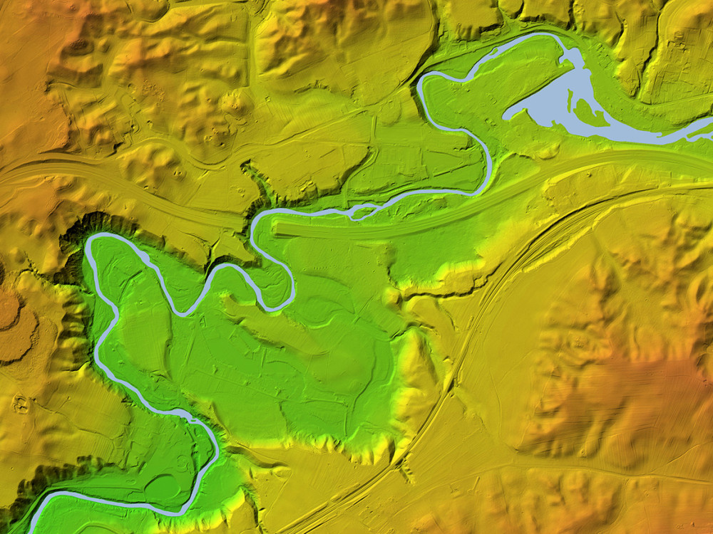
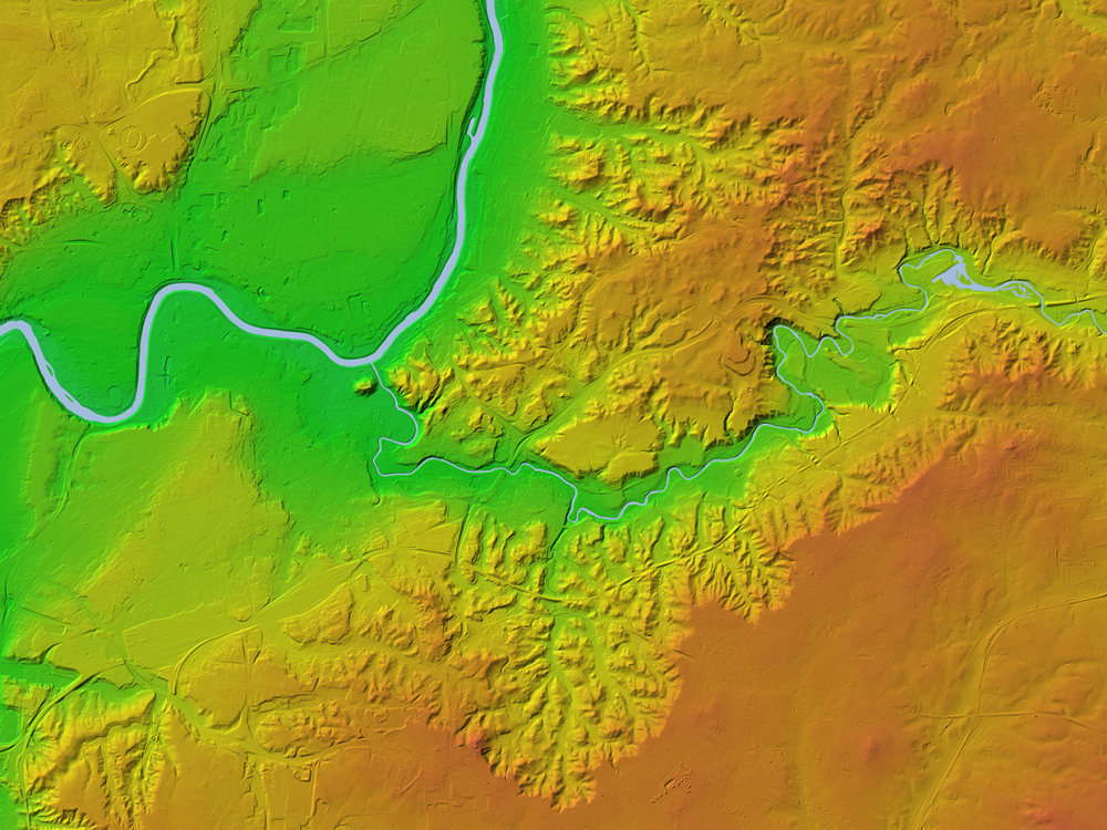
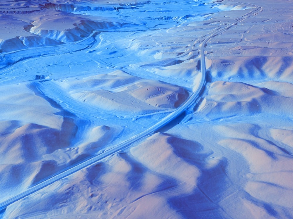
You will get shaded relief elevation map
Top Rated
Top Rated
Project details
You will get a shaded relief map for you area of interest. I can deliver the elevation map in *.png or *.tiff (geotiff) format.
File Format
PDF, PNGInfographic Type
GeographicWhat's included $30
These options are included with the project scope.
$30
- Delivery Time 2 days
- Number of Revisions 1
142 reviews
(135)
(6)
(0)
(0)
(1)
This project doesn't have any reviews.
TA
Tanya A.
Jun 22, 2026
Tanya Ahuja
CW
Cosmo W.
Apr 6, 2026
GIS Data, Cuyahoga Valley
Fast, thorough, good communication and rates.
JJ
Joe J.
Mar 24, 2026
GIS Projects for PFAS and Brownfield Sites Mapping
SImonas was absolutely fantastic on this project - I have very little GIS experience and he helped me collect the information I needed and processed it to deliver outcomes quickly and clearly.
MM
Michael M.
Aug 28, 2025
Meisal Floodwater analysis
IB
Isidora B.
Aug 4, 2025
ARCA Sustainability
About Simonas
GIS & Geospatial Analyst | Map Maker
100%
Job Success
Vilnius, Lithuania - 11:54 pm local time
I'm passionate about using geospatial tools to make sense of the data. I'm skilled in GIS development, data visualization, and spatial analysis, and I'm ready to use my expertise to help you discover the insights hidden in your data. I'm proficient in a variety of tools, including ESRI software like ArcGIS Pro, ArcMap, and ArcGIS Online, as well as QGIS, Carto, and Google Earth. Let's work together to create visually stunning maps and dashboards that will help you make informed decisions.
Skills:
• GIS (ArcGIS, ArcGIS Online, QGIS, Carto, LasTools, Tau DEM, Google Earth)
• Spatial data analysis, digital mapping, data visualization & illustration
• Geospatial Data: mining, data entry, data scraping & cleaning
• Web map Applications & map centered dashboards
• 3D, Lidar, remote sensing, data processing, georeferencing
• Geolocation, business intelligence, market analysis & research
Key Services:
• Real estate available parcel and demographic analysis, site selection, overlays
• Map visualizations, illustrations
• Interactive web maps, apps & dynamic dashboards
• Vector and raster GIS data analysis and business intelligence
• LiDAR point cloud processing, remote sensing & 3D mapping
• Data mining, georeferencing, vectorization
I have experience working with clients from a variety of industries, including real estate, telecommunications, infrastructure, solar, targeted marketing, health, nature protection and biodiversity, forestry, water resource management, and geology/mining. I'm a fast learner who thrives on problem-solving and remains dedicated to helping achieve your goals. I view every project as an opportunity to build a collaborative partnership. Understanding your unique needs and objectives is foundational to delivering tailored solutions that exceed expectations.
Let's connect!
Steps for completing your project
After purchasing the project, send requirements so Simonas can start the project.
Delivery time starts when Simonas receives requirements from you.
Simonas works on your project following the steps below.
Revisions may occur after the delivery date.
Contact me to discuss teh requirements