You will get As Built Topography, Site Plan from Lidar point cloud Scan
Top Rated
Project details
I have 8+ years of experience in topography survey domains, worked with Ireland Dublin City Council and the Saudi Arabia Ministry of Transport as a survey CAD manager.
Now, with huge potential and inspiration, I am open to sharing my knowledge and experience as a Freelancer, bringing the BEST result on the market.
We produce Topographic Mapping to accurately determine ground relief, provide contour mapping, and map the location of natural & man-made features across Construction & Development Sites.
We are providing our best services:
Topographic survey maps with coordination and spot elevations
Point Cloud to Civil 3D, CAD Topography
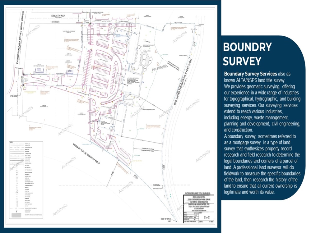
Boundry survey
Topographic map from Google Earth
Maj & Min Contours map
Layout Plans
Sitting out Plans
Geotechnical survey
We meet the deadline without reducing the working quality.
Please contact us before placing the order
Thanks
Now, with huge potential and inspiration, I am open to sharing my knowledge and experience as a Freelancer, bringing the BEST result on the market.
We produce Topographic Mapping to accurately determine ground relief, provide contour mapping, and map the location of natural & man-made features across Construction & Development Sites.
We are providing our best services:
Topographic survey maps with coordination and spot elevations
Point Cloud to Civil 3D, CAD Topography
Boundry survey
Topographic map from Google Earth
Maj & Min Contours map
Layout Plans
Sitting out Plans
Geotechnical survey
We meet the deadline without reducing the working quality.
Please contact us before placing the order
Thanks
Type
Commercial, Institutional & Public, ResidentialFile Format
DWG, RVT, JPG, PDFSoftware
Autodesk AutoCAD, AutoCAD Civil 3D, Autodesk RevitWhat's included
| Service Tiers |
Starter
$70
|
Standard
$150
|
Advanced
$330
|
|---|---|---|---|
| Delivery Time | 3 days | 5 days | 7 days |
Number of 2D Drawings | 1 | 2 | 4 |
Number of Revisions | 1 | 2 | 3 |
Number of Sq. Ft. | 1150 | 2400 | 5000 |
High Level of Details | - | - | |
Source File | |||
Graphic Enhancements | - | ||
Layout Sheets | - |
214 reviews
(200)
(12)
(2)
(0)
(0)
This project doesn't have any reviews.
KB
Kevin B.
Aug 17, 2026
Scan-to-BIM
The collaboration with Bilal was very positive overall. This was a large and demanding project involving the creation of detailed 3D models and corresponding 2D drawings of two existing buildings based on our 3D laser scan data.
Bilal was always constructive in responding to our feedback and requested changes and showed a high level of commitment throughout the project. We particularly appreciated the good communication regarding technical questions and his willingness to work together to find solutions and further develop the models until the desired result was achieved.
We are very satisfied with the final result and now have an excellent basis for our further planning.
We would be happy to work with Bilal again, both for further work on this project and for future projects.
Bilal was always constructive in responding to our feedback and requested changes and showed a high level of commitment throughout the project. We particularly appreciated the good communication regarding technical questions and his willingness to work together to find solutions and further develop the models until the desired result was achieved.
We are very satisfied with the final result and now have an excellent basis for our further planning.
We would be happy to work with Bilal again, both for further work on this project and for future projects.
SP
Shannon P.
Aug 3, 2026
Floor Level Survey Report
RK
Randy K.
Aug 3, 2026
Convert PDF Site Plans to DWG
Bilal did a fantastic job of converting a PDF site plan to DWG. Would rehire for sure.
PH
Paul H.
Aug 2, 2026
Historical Building scan to BIM
went above and beyond
RS
Ricardo S.
Jul 15, 2026
Autodesk Cad & Revit - Scan (Point Cloud) to CAD & BIM - Small Farm 10.000 sqm
About Bilal
Expert in Matterport, Point Cloud, Lidar Scan To Revit BIM, MEP, DWG
96%
Job Success
Islamabad, Pakistan - 10:31 pm local time
1- Specialise in Point Cloud To BIM, MEP
2- Matterport Scan To DWG
3- LiDAR Scan To Topography Survey / Civil 3D
4- Revit 3D Modelling / CAD 2D Drafting
5- P&ID Diagram, Hand Sketch, PDF to DWG
6- DWG 2D Conversion Into 3D
7- Point Cloud To Revit, SketchUp
8- Permit Set Drafting, Corrections and Modifecations
9- Existing Site Plan for city permit
10- Revit with Dwg integration on Georeference
11- Revise Engineering & Architectural Drawings
Being a Top Rated freelancer on Upwork places me in the top 10% of freelancers who have received this accolade.
This recognition underscores my consistent ability to meet deadlines and deliver high-quality results. I am dedicated to upholding this standard of excellence in every project I undertake.
With over 290 completed projects on Upwork and a diverse global clientele, I have established a reputation for reliability, quality, and expertise. My Upwork profile features a 94% success rating, reflecting my commitment to fulfilling client expectations over the last 3 years.
I have consistently delivered projects on time, without sacrificing quality or accuracy, while safeguarding client data privacy.
We have been providing our Building Information Modelling expertise to a variety of sectors, including multi-residential, commercial, hotels, educational institutions, communities, hospitals, retail, government Offices, warehouse/storage, manufacturing, and geospatial topography surveys.
I lead a team of specialists dedicated to delivering exceptional services to clients globally.
This indicates that I have access to a plethora of resources and expertise.
We have completed more than 1500 projects across the USA, UK, Italy, Ireland, France, Spain, Austria, Belgium, Dubai, Germany, Switzerland, and the Netherlands
Best regards,
Bilal Hussain
Steps for completing your project
After purchasing the project, send requirements so Bilal can start the project.
Delivery time starts when Bilal receives requirements from you.
Bilal works on your project following the steps below.
Revisions may occur after the delivery date.
point cloud to CAD Topography
We take a point cloud from clients and turn into a CAD topography plans