You will get a commercial satellite imagery analysis and land cover AI mapping pipeline
Project details
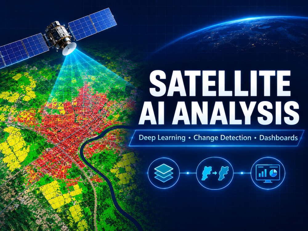
I provide commercial geospatial data science and satellite imagery analysis services for agriculture, environmental organizations, urban planning, and real estate analytics.
USING SATELLITE DATA TO SOLVE REAL-WORLD PROBLEMS:
• Land Use & Land Cover (LULC) Classification: Automated mapping of vegetation, urban structures, water bodies, and agricultural land.
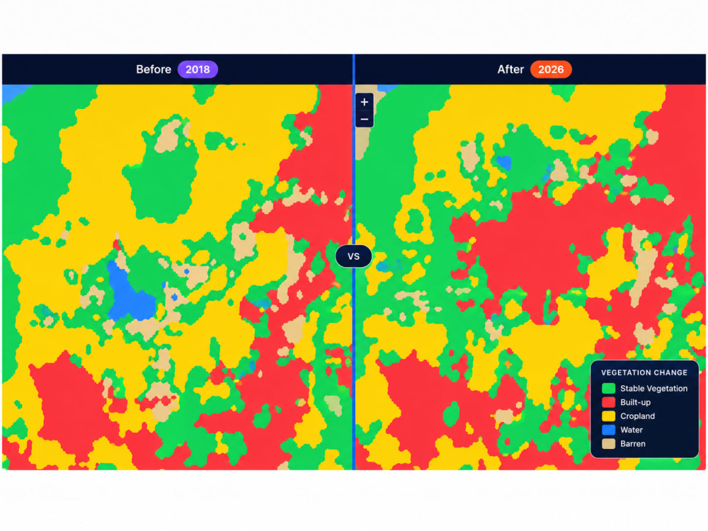
• Bi-Temporal Change Detection: Quantifying environmental and urban changes between two historical time periods.
• Vegetation & Crop Health Monitoring: Extracting multispectral indices (NDVI, NDWI, EVI) from Sentinel-2 and Landsat data.
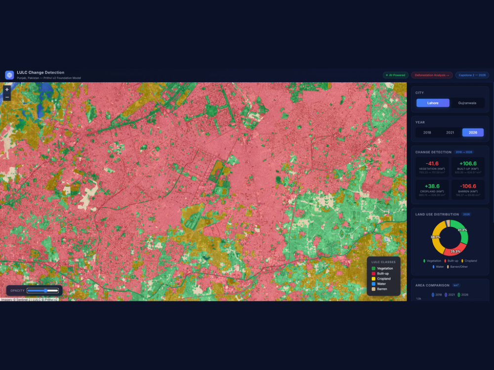
• Interactive Map Dashboards: Custom web dashboards built in Next.js to visualize geospatial metrics directly in a web browser.
TECHNICAL CAPABILITIES:
PyTorch, Google Earth Engine API, GDAL/Rasterio, Sentinel-2, Landsat-8, OpenCV, Next.js, Vercel.
DELIVERABLES:
GeoTIFF rasters, clean vector shapefiles/GeoJSON, analytical PDF summaries, complete source code, and live web dashboard links (Advanced Tier).
USING SATELLITE DATA TO SOLVE REAL-WORLD PROBLEMS:
• Land Use & Land Cover (LULC) Classification: Automated mapping of vegetation, urban structures, water bodies, and agricultural land.
• Bi-Temporal Change Detection: Quantifying environmental and urban changes between two historical time periods.
• Vegetation & Crop Health Monitoring: Extracting multispectral indices (NDVI, NDWI, EVI) from Sentinel-2 and Landsat data.
• Interactive Map Dashboards: Custom web dashboards built in Next.js to visualize geospatial metrics directly in a web browser.
TECHNICAL CAPABILITIES:
PyTorch, Google Earth Engine API, GDAL/Rasterio, Sentinel-2, Landsat-8, OpenCV, Next.js, Vercel.
DELIVERABLES:
GeoTIFF rasters, clean vector shapefiles/GeoJSON, analytical PDF summaries, complete source code, and live web dashboard links (Advanced Tier).
Machine Learning Tools
ArcGIS, Google AutoML, Keras, NumPy, NVIDIA AI Platform, OpenCV, pandas, Python, Python Scikit-Learn, PyTorch, scikit-learn, SciPy, TensorFlowWhat's included
| Service Tiers |
Starter
$150
|
Standard
$400
|
Advanced
$850
|
|---|---|---|---|
| Delivery Time | 3 days | 7 days | 14 days |
Number of Revisions | 1 | 2 | 3 |
Number of Model Variations | 1 | 2 | 3 |
Number of Scenarios | 1 | 2 | 4 |
Number of Graphs/Charts | 2 | 5 | 10 |
Model Validation/Testing | |||
Model Documentation | |||
Data Source Connectivity | - | ||
Source Code |
Optional add-ons
You can add these on the next page.
Additional Revision
+$40
Additional Model Variation
(+ 2 Days)
+$150
Data Source Connectivity
(+ 1 Day)
+$100About Muhammad Hamza
Data Scientist & AI/ML Engineer | RAG Chatbots & Computer Vision
Gujranwala, Pakistan - 3:19 pm local time
I don't just build models in Jupyter notebooks. I deliver production-ready AI applications complete with FastAPI backends, Next.js user interfaces, and live cloud deployment.
CORE CAPABILITIES:
• RAG & LLMs: Custom document Q&A pipelines (LangChain, FAISS, Llama 3 via Groq), LoRA fine-tuning, and hybrid search.
• Computer Vision: Object detection, semantic segmentation (U-Net, SegFormer, SAM 2), image classification, and domain adaptation.
• Geospatial AI: Land cover mapping (LULC), satellite imagery analysis (Sentinel-2, Landsat), and change detection with foundation models (NASA/IBM Prithvi).
• Full-Stack Deployment: FastAPI REST APIs, Next.js interactive web dashboards, and Docker containerization.
PROVEN DELIVERABLES:
• AskDoc AI: Full-stack RAG web application for real-time document querying deployed live.
• GreenWatch: Interactive satellite change detection dashboard deployed on Vercel.
Whether you need an MVP for investors, an enterprise RAG system over your documents, or a custom computer vision web application; I build it end-to-end.
Let's discuss your project!
Steps for completing your project
After purchasing the project, send requirements so Muhammad Hamza can start the project.
Delivery time starts when Muhammad Hamza receives requirements from you.
Muhammad Hamza works on your project following the steps below.
Revisions may occur after the delivery date.
Area of Interest Definition & Data Scoping
Define target geographic bounding box, date ranges, and satellite image resolution requirements with the client.
Satellite Data Acquisition & Preprocessing
Fetch Sentinel-2 or Landsat imagery via Google Earth Engine API, remove cloud cover, and build composite rasters.