You will get a custom AI-powered GIS dashboard with interactive 3D maps
Project details
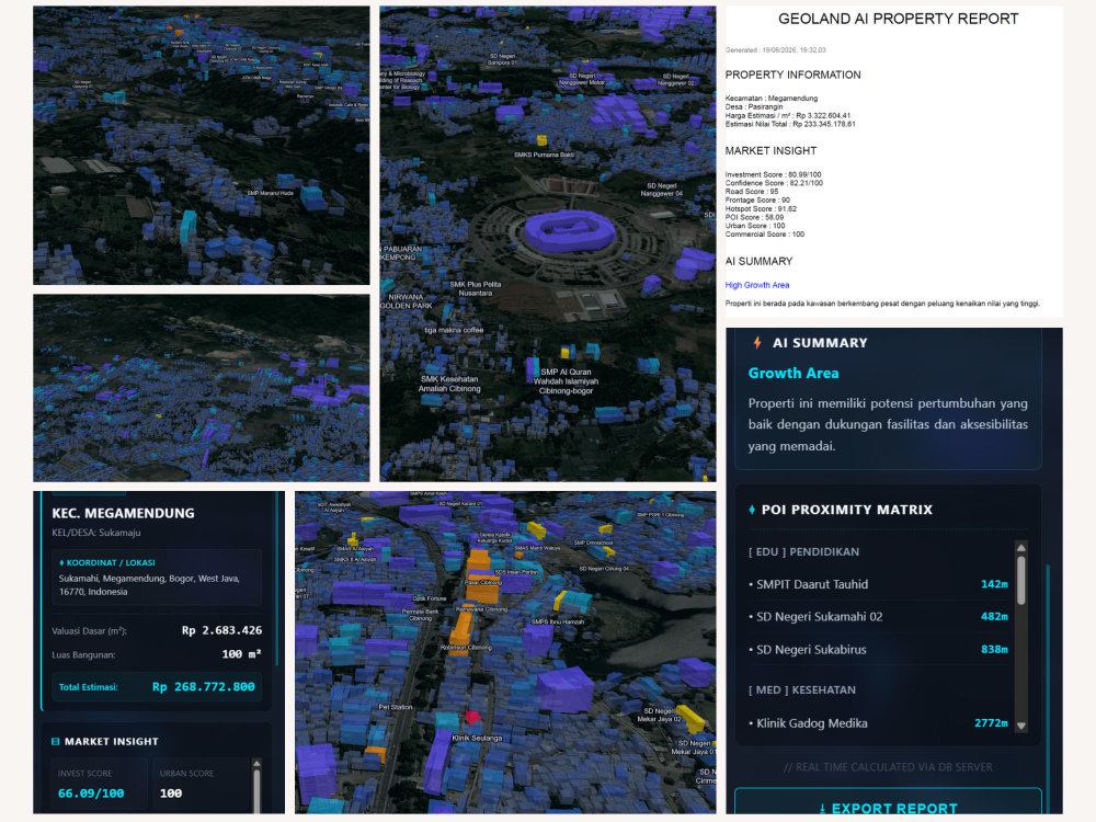
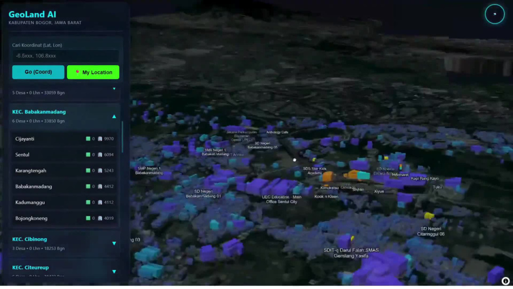
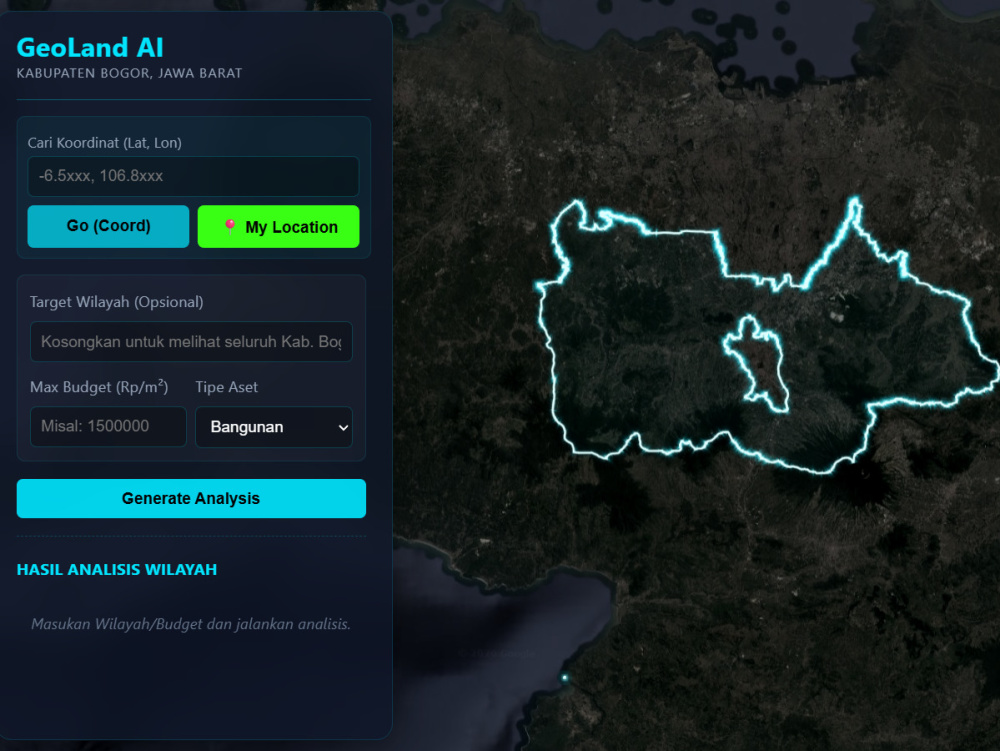
You will get a custom geospatial web application designed to transform your spatial data into actionable insights.
"before you read a long description, you can send me a messages and i'll give you link to see the sample result of the dashboard so you can try"
I specialize in building modern GIS dashboards with interactive 2D/3D maps, spatial analytics, and AI-powered decision systems. Each solution is tailored to your business needs, whether for real estate, urban planning, asset management, or location-based analytics.
Unlike generic templates, every project is fully custom-built using scalable geospatial architecture, including PostGIS databases, vector tile systems, and modern web technologies like React and MapLibre.
My focus is not just visualization, but helping you understand patterns, optimize decisions, and unlock value from your geographic data.
What you can expect:
• Interactive GIS dashboards
• 2D & 3D map visualization
• AI-based spatial analysis & scoring
• Real estate & land evaluation systems
• Database design (PostGIS)
• API integration & deployment
The final product is a production-ready system that is scalable, maintainable, and built for real-world use.
"before you read a long description, you can send me a messages and i'll give you link to see the sample result of the dashboard so you can try"
I specialize in building modern GIS dashboards with interactive 2D/3D maps, spatial analytics, and AI-powered decision systems. Each solution is tailored to your business needs, whether for real estate, urban planning, asset management, or location-based analytics.
Unlike generic templates, every project is fully custom-built using scalable geospatial architecture, including PostGIS databases, vector tile systems, and modern web technologies like React and MapLibre.
My focus is not just visualization, but helping you understand patterns, optimize decisions, and unlock value from your geographic data.
What you can expect:
• Interactive GIS dashboards
• 2D & 3D map visualization
• AI-based spatial analysis & scoring
• Real estate & land evaluation systems
• Database design (PostGIS)
• API integration & deployment
The final product is a production-ready system that is scalable, maintainable, and built for real-world use.
Programming Languages
HTML & CSS, JavaScript, PythonWhat's included
| Service Tiers |
Starter
$249
|
Standard
$499
|
Advanced
$1,399
|
|---|---|---|---|
| Delivery Time | 5 days | 10 days | 30 days |
Number of Revisions | 1 | 3 | 5 |
Number of Pages | 1 | 3 | 5 |
Design Customization | |||
Content Upload | |||
Responsive Design | |||
Source Code |
Optional add-ons
You can add these on the next page.
Additional Revision
+$25
Additional Page
(+ 2 Days)
+$50Frequently asked questions
About Bayu
GIS & Remote Sensing Analyst | WebGIS Developer | Spatial Data Analyst
Bogor, Indonesia - 9:42 pm local time
I help businesses and organizations transform complex spatial data into accurate, production-ready maps, dynamic dashboards, and live WebGIS solutions.
My expertise covers end-to-end geospatial workflows, specializing in processing large datasets, automated spatial databases, and deploying clean web map applications that deliver clear analysis results.
Core Skills:
• GIS Analysis & High-Scale Spatial Data Processing
• WebGIS Architecture & Dashboard Development
• Remote Sensing & Automated Raster Analysis
• Spatial Database Management (PostGIS / PostgreSQL)
• Georeferencing, Digitizing & Topology Cleaning
• Drone Photogrammetry & Orthomosaic 3D Mapping
• Advanced Cartography & National Standard Mapping
I focus on building reliable, clean, and practical geospatial solutions—from raw data preparation to fully deployed web map applications. If you need clean spatial data, advanced mapping, or a custom WebGIS setup, I’m ready to deploy it for you.
Tools & Technologies:
QGIS | ArcGIS | PostGIS | PostgreSQL | Leaflet | JavaScript | GeoJSON | ERDAS Imagine | ENVI | Global Mapper | Visual Studio
Steps for completing your project
After purchasing the project, send requirements so Bayu can start the project.
Delivery time starts when Bayu receives requirements from you.
Bayu works on your project following the steps below.
Revisions may occur after the delivery date.
Requirement Collection & Onboarding
Client purchases the project and shares requirements, goals, and available data.
System Analysis & Planning
I analyze the data and define system architecture, features, and technical approach.