You will get a custom interactive web map with Leaflet or Mapbox
Project details
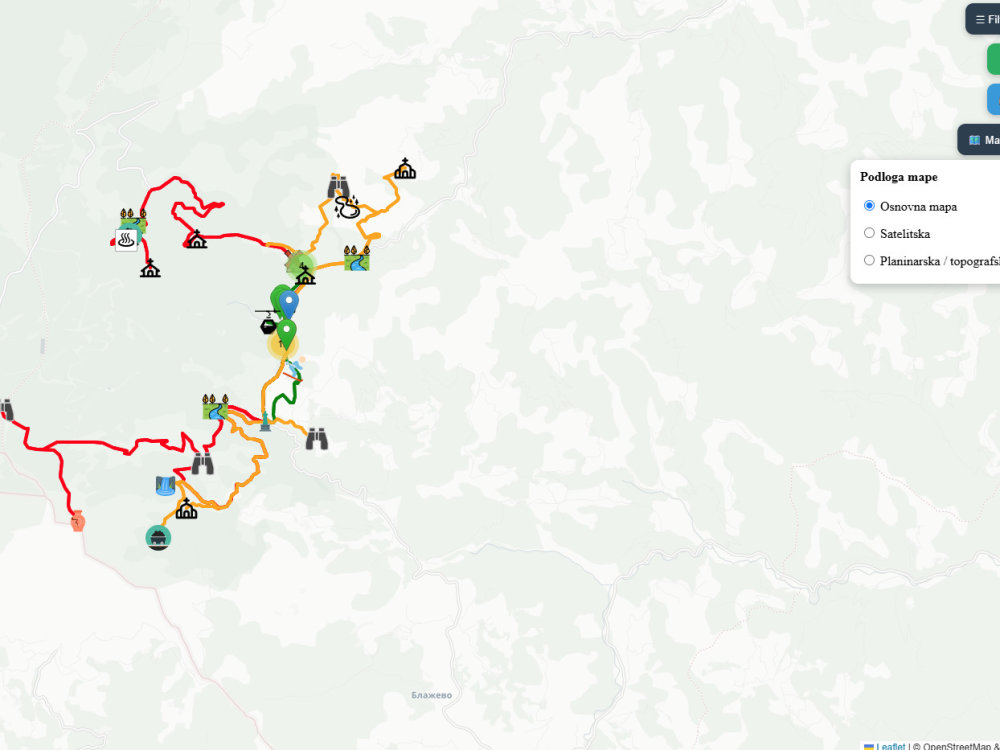
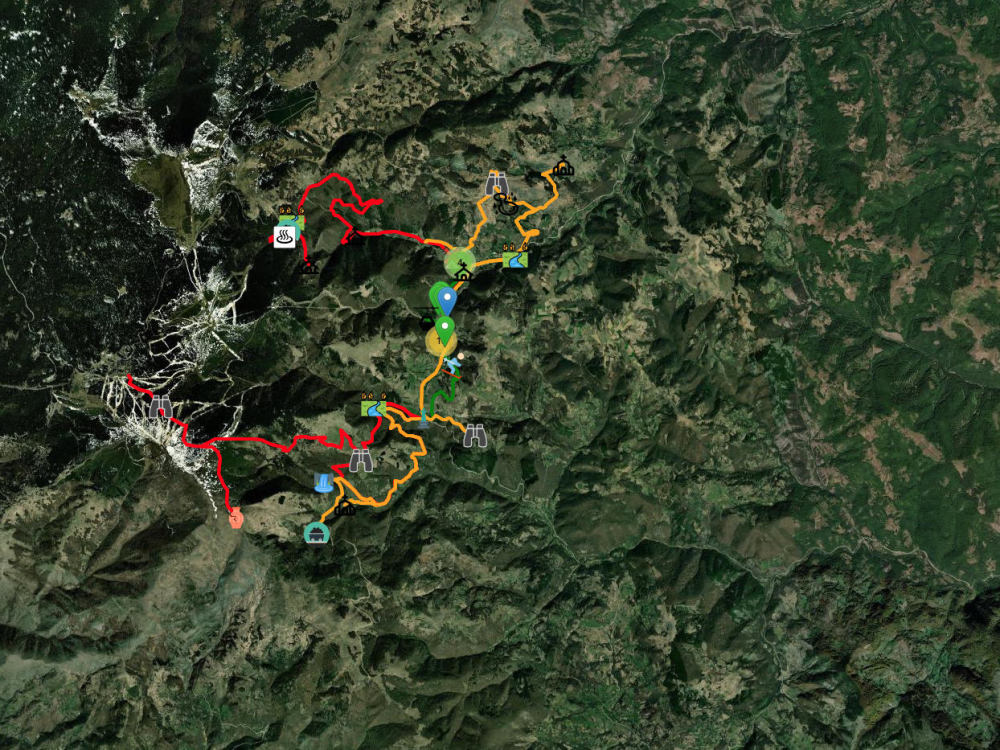
Get a high-performance, custom interactive web map tailored for tourism, outdoor trail guides, real estate, or local directories. Built with Leaflet, Mapbox, or OpenLayers.
From basic location maps to complex GIS web apps with dynamic filtering and route navigation, I deliver clean, mobile-responsive solutions.
Key Features Included:
Interactive UI: Custom sidebars, responsive popups, and detailed info panels.
Dynamic Filtering: Multi-category filters (by difficulty, type, amenities, location).
Spatial Data Integration: Full support for GeoJSON, KML, GPX, or CSV data.
Outdoor Tools: Route polylines, elevation profiles, and basemap toggles (Satellite/Topo).
Easy CMS Embed: Simple integration for WordPress, Webflow, Shopify, or HTML sites.
Why Work With Me?
Fast-loading, lightweight code.
Mobile-first design optimized for smartphones.
Expert advice on structuring your spatial data.
Please message me before placing an order to discuss your dataset and goals!
From basic location maps to complex GIS web apps with dynamic filtering and route navigation, I deliver clean, mobile-responsive solutions.
Key Features Included:
Interactive UI: Custom sidebars, responsive popups, and detailed info panels.
Dynamic Filtering: Multi-category filters (by difficulty, type, amenities, location).
Spatial Data Integration: Full support for GeoJSON, KML, GPX, or CSV data.
Outdoor Tools: Route polylines, elevation profiles, and basemap toggles (Satellite/Topo).
Easy CMS Embed: Simple integration for WordPress, Webflow, Shopify, or HTML sites.
Why Work With Me?
Fast-loading, lightweight code.
Mobile-first design optimized for smartphones.
Expert advice on structuring your spatial data.
Please message me before placing an order to discuss your dataset and goals!
Programming Languages
HTML & CSS, JavaScript, PythonWhat's included
| Service Tiers |
Starter
$50
|
Standard
$120
|
Advanced
$220
|
|---|---|---|---|
| Delivery Time | 2 days | 4 days | 6 days |
Number of Revisions | 2 | 3 | Unlimited |
Source Code | - | - | - |
About Darko
Geographic Information Systems Analyst
Belgrade, Serbia - 12:50 pm local time
-I have the knowledge to work with GIS programs ( ArcMap, QGIS, Geomedia, Idrisi, Global Mapper, Google Earth), also with Python and Microsoft excel, word and powerpoint.
-I have basic knowledge from two other programs (R studio and autocad).
Steps for completing your project
After purchasing the project, send requirements so Darko can start the project.
Delivery time starts when Darko receives requirements from you.
Darko works on your project following the steps below.
Revisions may occur after the delivery date.
Requirements & Data Collection
We discuss your project goals, dataset (GeoJSON, GPX, KML, CSV), and design preferences.
Map Architecture & Setup
I set up the core mapping library (Leaflet/Mapbox), configure base layers, and import your spatial data.