You will get a Custom Webmap Using Google Maps API with Advanced Features
Top Rated
Top Rated
Project details
Here is the optimized text in English, adhering to the 1200-character limit.
Custom Web Maps with Google Maps API: Advanced & Intuitive
Transform your data into a powerful, interactive map.
I build custom web maps using the Google Maps API, a robust and reliable platform for all your mapping needs. As a Top Rated Plus expert, I ensure every map is interactive, user-friendly, and optimized for peak performance.
Your project will include:
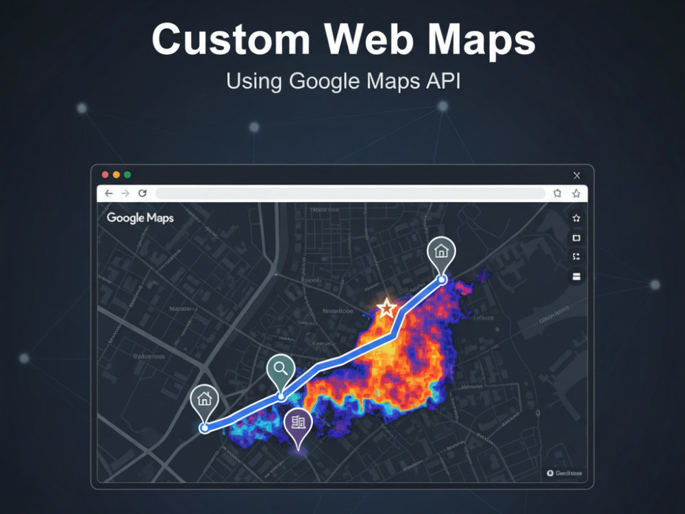
Custom Map Design: Tailored base map styling and seamless integration with all Google Maps services.
Core Functionality: Intuitive zoom, pan, and layer controls.
Advanced Features: Geolocation, search functionality, and custom markers/popups.
Data Overlays: Visualize your data with overlays from KML, GeoJSON, and other formats.
Interactive Tools: Add drawing, measuring, and other tools for deeper user engagement.
Responsive UI: A design that works flawlessly on any device.
My process covers everything from initial consultation to final deployment and support, guaranteeing a smooth and professional experience.
Let's create a map that stands out.
Custom Web Maps with Google Maps API: Advanced & Intuitive
Transform your data into a powerful, interactive map.
I build custom web maps using the Google Maps API, a robust and reliable platform for all your mapping needs. As a Top Rated Plus expert, I ensure every map is interactive, user-friendly, and optimized for peak performance.
Your project will include:
Custom Map Design: Tailored base map styling and seamless integration with all Google Maps services.
Core Functionality: Intuitive zoom, pan, and layer controls.
Advanced Features: Geolocation, search functionality, and custom markers/popups.
Data Overlays: Visualize your data with overlays from KML, GeoJSON, and other formats.
Interactive Tools: Add drawing, measuring, and other tools for deeper user engagement.
Responsive UI: A design that works flawlessly on any device.
My process covers everything from initial consultation to final deployment and support, guaranteeing a smooth and professional experience.
Let's create a map that stands out.
Programming Languages
PHP, HTML & CSS, JavaScriptWhat's included
| Service Tiers |
Starter
$100
|
Standard
$250
|
Advanced
$1,000
|
|---|---|---|---|
| Delivery Time | 7 days | 14 days | 30 days |
Number of Revisions | 0 | 0 | 0 |
Design Customization | - | - | - |
Content Upload | - | - | - |
Responsive Design | - | - | - |
Source Code | - | - | - |
17 reviews
(16)
(1)
(0)
(0)
(0)
This project doesn't have any reviews.
TA
Trudy A.
Feb 23, 2026
Remote Sensing & GIS Specialist – NDVI & NDMI Mapping for Coastal Land
I had a very positive experience working with Budi on this project. He delivered work to a high standard, demonstrated strong attention to detail, and was highly responsive to feedback, implementing revisions thoughtfully and accurately. His commitment to quality and excellence was evident throughout the process, and the final outcome fully met my requirements.
Budi is professional, reliable, and easy to collaborate with. I would confidently recommend him to anyone looking for trustworthy support and high-quality results.
Budi is professional, reliable, and easy to collaborate with. I would confidently recommend him to anyone looking for trustworthy support and high-quality results.
TJ
Thomas J.
Jan 29, 2026
Flood Analysis Using Hec RAS dan Hec HMS
Fantastic work, very helpful and gave us exactly what we needed. Couldn't be happier.
TJ
Thomas J.
Sep 28, 2025
Flood Analysis
Fantastic job, everything we were looking for on flood analysis for our commercial property.
CJ
Corey J.
May 26, 2025
Hydrologic/Hydraulic Flood Study, Drainage Area Map, and Report
Great to work with and incredibly detailed!
VS
Vidushi S.
Apr 21, 2025
mini project on Remote sensing ENVI
About Budi Prasetyo
GIS & RS Specialist, Photogrammetries, Hydrologist, WebGIS Developer
100%
Job Success
Depok, Indonesia - 8:41 pm local time
Looking for a specialist who can combine **GIS, Remote Sensing, WebGIS, spatial data science, and Artificial Intelligence** into a practical solution?
I’m a **GIS Developer, GeoAI Specialist, Remote Sensing Expert, and Geospatial Data Scientist** with **10+ years of professional experience** delivering mapping, spatial analytics, surveying, LiDAR, hydrology, and custom geospatial applications.
My focus is no longer limited to creating maps. I build **intelligent geospatial systems** that transform spatial data into actionable insights using **AI, Machine Learning, automation, predictive analytics, and interactive WebGIS dashboards**.
### 🚀 What I Can Help You Build
✅ **WebGIS & Geospatial Platforms**
Interactive GIS dashboards, asset management systems, spatial decision-support systems, location intelligence platforms, and mobile GIS applications.
✅ **GeoAI & Machine Learning**
Spatial prediction, site suitability modeling, classification, clustering, XGBoost, deep learning, explainable AI (SHAP), spatial feature engineering, and predictive geospatial analytics.
✅ **AI-Powered GIS Applications**
Integration of GIS platforms with **LLMs, AI assistants, automated analytics, intelligent search, NLP, sentiment analysis, and AI-generated spatial insights**.
✅ **Remote Sensing & Earth Observation**
Satellite imagery analysis, land-use/land-cover classification, NDVI/NDMI, change detection, image processing, and Google Earth Engine workflows.
✅ **LiDAR, Drone & Surveying**
LiDAR point-cloud processing, UAV photogrammetry, terrestrial/mobile mapping, DEM/DSM/DTM generation, contour mapping, 3D reconstruction, and survey data processing.
✅ **Hydrology & Flood Modeling**
HEC-RAS, HEC-HMS, watershed analysis, floodplain mapping, terrain analysis, and hydrological modeling.
✅ **GIS Automation & Data Engineering**
Python geoprocessing, automated spatial workflows, ETL pipelines, spatial databases, APIs, and large geospatial dataset processing.
### 🧠 Technology Stack
**GIS & WebGIS:**
ArcGIS, QGIS, GeoServer, Leaflet, Mapbox, OpenLayers, Google Maps API
**GeoAI & Data Science:**
Python, XGBoost, TensorFlow, Keras, Scikit-learn, SHAP, NLP, Machine Learning, Deep Learning
**Remote Sensing:**
Google Earth Engine, ENVI, ERDAS Imagine, GDAL, Rasterio
**Spatial Database & Backend:**
PostgreSQL/PostGIS, Django, Node.js, REST API, MySQL
**Frontend & Mobile:**
React, JavaScript, React Native
**LiDAR & Photogrammetry:**
Agisoft Metashape, Pix4D, Global Mapper, CloudCompare, Trimble workflows
**Hydrology & 3D:**
HEC-RAS, HEC-HMS, SketchUp, Blender, RockWorks
**Cloud & Deployment:**
AWS, Google Cloud, Docker, Linux
### 💡 Why Work With Me?
✔ **10+ years in GIS, mapping, surveying, and geospatial technology**
✔ **Top Rated Plus on Upwork**
✔ Experience building production-level **WebGIS and geospatial dashboards used by 100+ users/clients**
✔ Strong combination of **geospatial domain expertise + software development + AI/data science**
✔ Able to handle projects from **raw spatial data → analysis → AI model → database → API → interactive WebGIS**
✔ Clear communication and a strong focus on delivering solutions that are technically sound and actually useful
Whether you need a **GIS analysis, GeoAI model, LiDAR workflow, remote sensing analysis, AI-powered dashboard, or complete WebGIS platform**, I can help you turn your geospatial data into a working solution.
**Let’s discuss your project and build something useful from your data.**
Steps for completing your project
After purchasing the project, send requirements so Budi Prasetyo can start the project.
Delivery time starts when Budi Prasetyo receives requirements from you.
Budi Prasetyo works on your project following the steps below.
Revisions may occur after the delivery date.
Initial Consultation:
Discuss project requirements and objectives. Define specific features and functionalities needed.
Design and Development:
Map Design: Custom base map design using Google Maps API. Functionality: Zoom, pan, and layer control. Geolocation and search functionality. User Interface: Responsive design for different devices (desktop, tablet, mobile).