You will get A Full-Stack Web GIS Platform with Interactive Maps
Project details
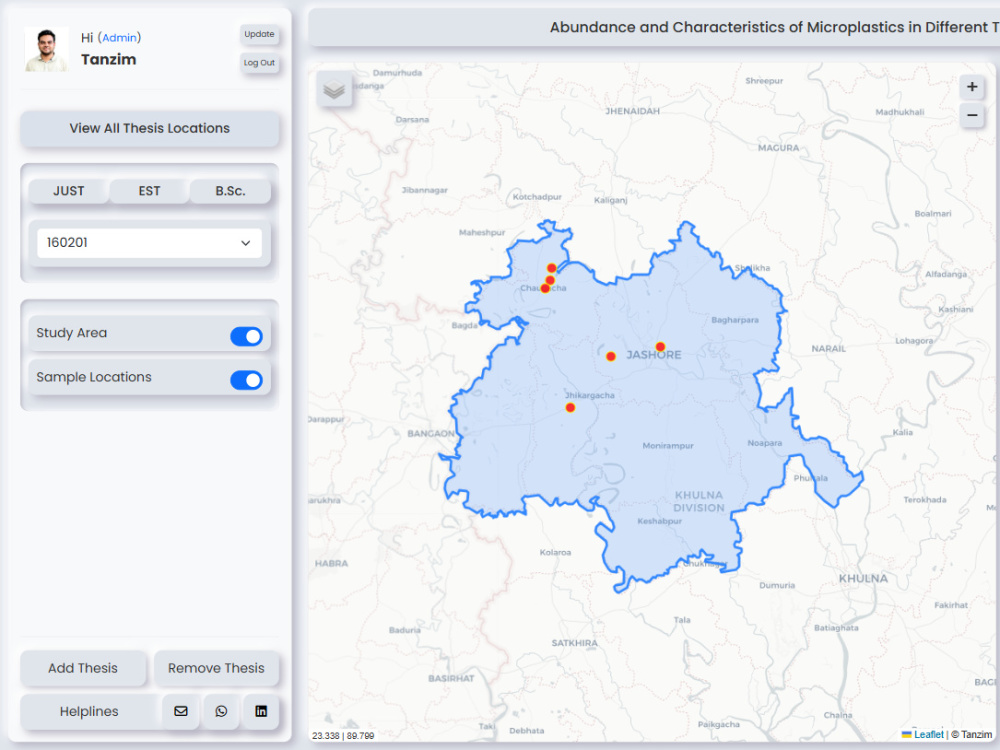
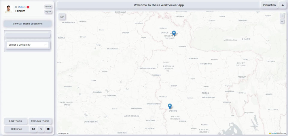
You will get a custom full-stack Web GIS application tailored to your needs for interactive spatial data visualization, management, and analysis. Whether you need a research portal, asset management system, location-based dashboard, or custom GIS solution, I will build a secure, scalable, and user-friendly application using modern GIS technologies.
I specialize in building Web GIS applications with Flask, Python, PostgreSQL/PostGIS, Leaflet, GeoServer, JavaScript, HTML, CSS, and Bootstrap. Every project is developed with clean, maintainable code and optimized database design for performance and scalability.
My services can include:
• Interactive Leaflet maps
• PostGIS spatial database integration
• GeoServer WMS/WFS services
• User authentication and role management
• Admin dashboard (CMS)
• Advanced search and filtering
• Data upload and management
• Email notifications
• Deployment and source code delivery
I deliver reliable, production-ready GIS applications with clear communication throughout the project. Whether you're a university, business, NGO, or government organization, I can transform your spatial data into an interactive Web GIS platform.
I specialize in building Web GIS applications with Flask, Python, PostgreSQL/PostGIS, Leaflet, GeoServer, JavaScript, HTML, CSS, and Bootstrap. Every project is developed with clean, maintainable code and optimized database design for performance and scalability.
My services can include:
• Interactive Leaflet maps
• PostGIS spatial database integration
• GeoServer WMS/WFS services
• User authentication and role management
• Admin dashboard (CMS)
• Advanced search and filtering
• Data upload and management
• Email notifications
• Deployment and source code delivery
I deliver reliable, production-ready GIS applications with clear communication throughout the project. Whether you're a university, business, NGO, or government organization, I can transform your spatial data into an interactive Web GIS platform.
Programming Languages
HTML & CSS, JavaScript, PythonCoding Expertise
Cross Browser & Device Compatibility, Performance Optimization, SecurityWhat's included
| Service Tiers |
Starter
$250
|
Standard
$700
|
Advanced
$1,500
|
|---|---|---|---|
| Delivery Time | 7 days | 30 days | 60 days |
Number of Revisions | 2 | 5 | Unlimited |
Number of Pages | 5 | 10 | |
Design Customization | |||
Content Upload | |||
Responsive Design | - | ||
Source Code |
Optional add-ons
You can add these on the next page.
Additional Revision
+$10
Additional Page
(+ 5 Days)
+$25
Documentation & Installation Guide
(+ 2 Days)
+$50
Deployment to Render/AWS/VPS
(+ 7 Days)
+$200Frequently asked questions
About Tanzim
GIS Developer
Dhaka, Bangladesh - 7:01 pm local time
Hi there! I’m a 𝗚𝗜𝗦 𝗽𝗿𝗼𝗳𝗲𝘀𝘀𝗶𝗼𝗻𝗮𝗹, dedicated to delivering 𝘀𝗺𝗮𝗿𝘁, 𝘀𝗰𝗮𝗹𝗮𝗯𝗹𝗲, 𝗮𝗻𝗱 𝘀𝘂𝘀𝘁𝗮𝗶𝗻𝗮𝗯𝗹𝗲 𝗴𝗲𝗼𝘀𝗽𝗮𝘁𝗶𝗮𝗹 𝘀𝗼𝗹𝘂𝘁𝗶𝗼𝗻𝘀.
Specialize in Geospatial Data Analysis, Python Scripting & Automation, Workflow Optimization, Interactive Dashboards & Spatial Tools, GIS Web Applications (ArcGIS, QGIS, Leaflet, etc.)
Whether you need to 𝗮𝘂𝘁𝗼𝗺𝗮𝘁𝗲 𝗿𝗲𝗽𝗲𝘁𝗶𝘁𝗶𝘃𝗲 𝗚𝗜𝗦 𝘁𝗮𝘀𝗸𝘀, build 𝗰𝘂𝘀𝘁𝗼𝗺 𝘀𝗽𝗮𝘁𝗶𝗮𝗹 𝗮𝗻𝗮𝗹𝘆𝘀𝗶𝘀 𝘁𝗼𝗼𝗹𝘀, or develop 𝗶𝗻𝘁𝗲𝗿𝗮𝗰𝘁𝗶𝘃𝗲 𝗱𝗮𝘀𝗵𝗯𝗼𝗮𝗿𝗱𝘀 for better decision-making, I’m here to help turn your ideas into impactful, real-world solutions.
With a focus on innovation and sustainability, I blend 𝘁𝗲𝗰𝗵𝗻𝗶𝗰𝗮𝗹 𝗲𝘅𝗽𝗲𝗿𝘁𝗶𝘀𝗲 with 𝗮 𝗽𝗿𝗼𝗯𝗹𝗲𝗺-𝘀𝗼𝗹𝘃𝗶𝗻𝗴 𝗺𝗶𝗻𝗱𝘀𝗲𝘁 to tackle complex challenges and deliver measurable results.
Steps for completing your project
After purchasing the project, send requirements so Tanzim can start the project.
Delivery time starts when Tanzim receives requirements from you.
Tanzim works on your project following the steps below.
Revisions may occur after the delivery date.
Requirement Analysis
I review your requirements, discuss the project scope, and finalize the development plan before starting.
System Design
I design the application architecture, database structure, user interface, and GIS workflow.