You will get a image classification algorithm
Top Rated
Top Rated
Project details
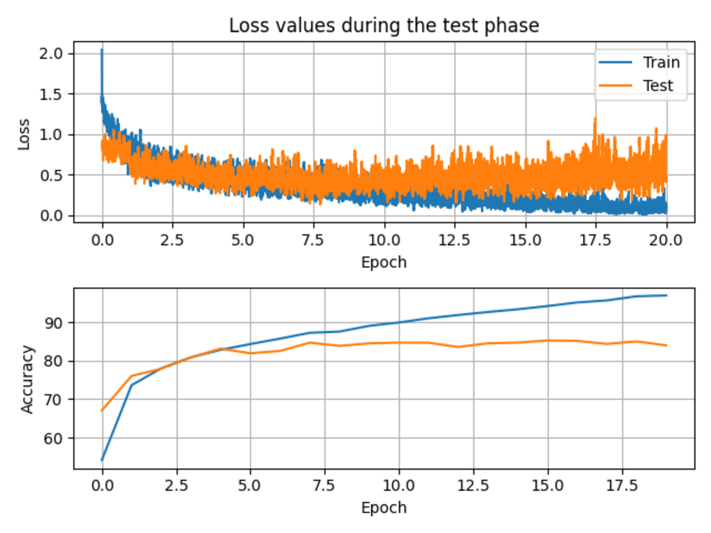
You will receive an image classification code, with all the weights needed to get a good % of correct classification (80-90% at least). Everything you need is to tell me what you need to classify, and some possible data sources to get information from. If you don't know where to find it, send me a message anyway, and we can discuss the better option for you.
What's included
| Service Tiers |
Starter
$1,000
|
Standard
$1,500
|
Advanced
$2,000
|
|---|---|---|---|
| Delivery Time | 30 days | 45 days | 60 days |
Number of Revisions | 1 | 2 | 3 |
Number of Model Variations | 1 | 2 | 3 |
Number of Scenarios | 1 | 2 | 3 |
Number of Graphs/Charts | 1 | 2 | 3 |
Model Validation/Testing | |||
Model Documentation | - | ||
Data Source Connectivity | - | - | |
Source Code | - | - | - |
Optional add-ons
You can add these on the next page.
Fast Delivery
+$500 - $1,000
Additional Revision
+$200
Additional Model Variation
(+ 7 Days)
+$100
46 reviews
(43)
(2)
(1)
(0)
(0)
This project doesn't have any reviews.
DS
David S.
Jan 27, 2026
60 minute consultation
DA
Dina A.
Nov 5, 2025
Land Cover Analysis with Deep Learning
Great experience working with Felipe. He's skilled, responsive and reliable. Would definitely hire again.
KT
Koko T.
Mar 28, 2025
Developer GeoPortal
Nd
Nicolas d.
Jun 1, 2024
Vision Language Model (VLM) for brazilian market
Excelente working with Felipe, he was very quick and always available. Will work with him in the future.
DA
Dina A.
Feb 19, 2024
Deep learning for mapping deforestation and change analysis
I highly recommend Felipe for any project requiring expertise in remote sensing imagery. He consistently delivered every milestone on time and was always available for communication and adjustments when needed. His professionalism and reliability stand out, and I will certainly choose him again for my next project
About Felipe Matheus
GIS/Remote Sensing Specialist, Python programming and data analysis
100%
Job Success
Sao Lourenco do Oeste, Brazil - 7:10 am local time
I'm a Geospatial Data Engineer with 8+ years of experience building scalable geospatial pipelines, AI models, and WebGIS applications.
I specialize in turning raw geospatial data (satellite, UAV, vector) into automated, production-ready systems — from data ingestion to analysis, APIs, and visualization.
I’ve worked across forestry, environmental monitoring, and custom client solutions, delivering tools that reduce manual work and enable real decision-making.
What I do best:
Remote Sensing & Geospatial Processing
- End-to-end pipelines using Sentinel, Landsat, UAV imagery
- Large-scale raster processing (GDAL, Rasterio, Numpy)
- Change detection, NDVI workflows, land monitoring
- Experience with STAC APIs and satellite data automation
Data Engineering for Geospatial
- Building ETL pipelines for spatial data (Python, Pandas, SQL)
- PostgreSQL/PostGIS schema design and optimization
- Automated workflows replacing manual GIS tasks
- Handling large datasets efficiently (cloud + local processing)
AI for Geospatial Applications
- Semantic segmentation (land cover, deforestation, etc.)
- Object detection (ships, wind turbines, infrastructure)
- Custom computer vision models using PyTorch
- Applied ML (Scikit-learn, OpenCV)
WebGIS & Backend Development
- FastAPI / Django backend development
- Building REST APIs for geospatial systems
- Interactive maps (Leaflet, MapLibre)
- GeoServer and spatial services integration
Cloud & Deployment
- AWS (EC2, S3, Lambda)
- Dockerized applications
- Deploying scalable geospatial systems
- Selected Experience
- Built automated pipelines for satellite data processing and analysis
- Developed WebGIS platforms for real-time geospatial visualization
- Created AI models for environmental monitoring and object detection
- Delivered custom ETL solutions integrating complex spatial datasets
Why clients hire me?
I don’t just “analyze maps” — I build complete geospatial systems.
My focus is always:
- Automation (less manual GIS work)
- Scalability (ready for real-world data)
- Clean, maintainable code
If you need someone who can go from raw geospatial data → production system, let’s talk.
Steps for completing your project
After purchasing the project, send requirements so Felipe Matheus can start the project.
Delivery time starts when Felipe Matheus receives requirements from you.
Felipe Matheus works on your project following the steps below.
Revisions may occur after the delivery date.
Find data sources
We need to find the satellite that suits best the task you need.
Create dataset
This is the most time-consuming task. We will need to find a way to automate it, and then, we will be able to train the model.