You will get Cleaned and validated GIS data ready for reliable spatial analysis
Project details
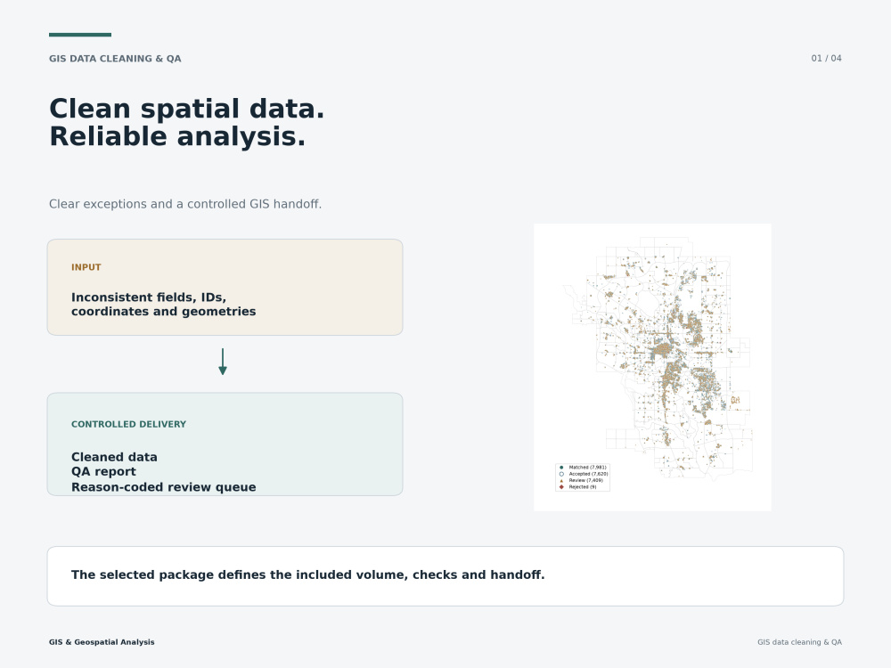
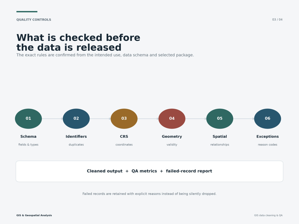
I will clean, validate and organize your vector GIS data so it is reliable for mapping, spatial analysis and operational use. I inspect schemas, attributes, identifiers, duplicates, CRS, coordinates and geometry; standardize fields; repair eligible geometry issues; and route unresolved records to a reason-coded exception table instead of silently forcing them into the cleaned output.
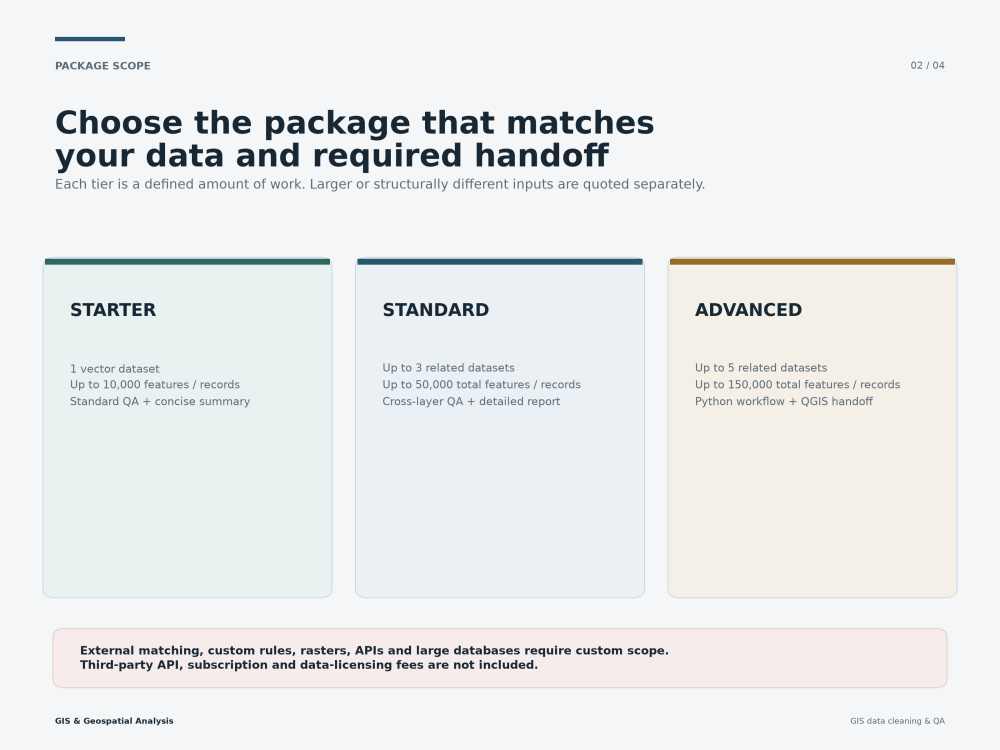
Every tier includes cleaned data in the agreed format and tier-appropriate QA documentation. Standard adds multi-layer QA and a detailed report. Advanced adds a reusable Python workflow and a portable QGIS handoff. The result is controlled spatial data with traceable changes, documented limitations and clear next actions.
Scope is limited by both the number of GIS layers/tables and the total record volume shown in the selected tier. Geocoding, external matching, custom rule design, raster processing, API/database integration, extensive manual correction or larger volumes require a custom offer.
Every tier includes cleaned data in the agreed format and tier-appropriate QA documentation. Standard adds multi-layer QA and a detailed report. Advanced adds a reusable Python workflow and a portable QGIS handoff. The result is controlled spatial data with traceable changes, documented limitations and clear next actions.
Scope is limited by both the number of GIS layers/tables and the total record volume shown in the selected tier. Geocoding, external matching, custom rule design, raster processing, API/database integration, extensive manual correction or larger volumes require a custom offer.
Data Tool
PythonWhat's included
| Service Tiers |
Starter
$120
|
Standard
$350
|
Advanced
$1,200
|
|---|---|---|---|
| Delivery Time | 5 days | 8 days | 12 days |
Number of Revisions | 1 | 2 | 2 |
Optional add-ons
You can add these on the next page.
Additional GIS dataset
(+ 2 Days)
+$100Frequently asked questions
About Sviatoslav
GIS & Geospatial Analyst | Spatial Analysis & Location Intelligence
Billingstad, Norway - 12:55 pm local time
You can hire me for:
• GIS and spatial analysis
• Spatial data cleaning, matching, QA/QC and coordinate validation
• Location intelligence, accessibility and site-selection screening
• Parcel, land, terrain, drainage and flood-constraint screening
• Remote-sensing change detection and review prioritization
• Professional maps and structured GIS handoff packages
My workflows can deliver QGIS projects, GeoPackage and CSV files, maps, tables, QA reports and concise decision briefs. I also work with GeoPandas, DuckDB, GDAL, OSMnx and NetworkX when a project requires reproducible processing or network analysis.
Selected project results:
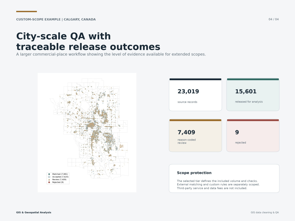
• Converted 23,019 commercial-place records into 15,601 controlled records ready for analysis
• Reduced 624 retail territories to five priority areas
• Reduced 990 industrial parcels to five due-diligence candidates
• Prioritized 31 satellite-derived land-change signals for review
• Reduced 2,503 parcels to five flood-screening priorities
Send me your dataset, area of interest and the decision you need to make. I will review the inputs, define a practical scope and propose an efficient GIS workflow and clear deliverables.
Steps for completing your project
After purchasing the project, send requirements so Sviatoslav can start the project.
Delivery time starts when Sviatoslav receives requirements from you.
Sviatoslav works on your project following the steps below.
Revisions may occur after the delivery date.
Data audit and validation plan
I inspect the file structure, schema, CRS, geometry, identifiers and record volume, then define the validation plan for the selected tier.
Data cleaning and quality control
I standardize fields, validate coordinates and identifiers, repair eligible geometry issues and assign reason codes to exceptions.