You will get Interactive Web GIS Mapping Application with Custom Features
Project details
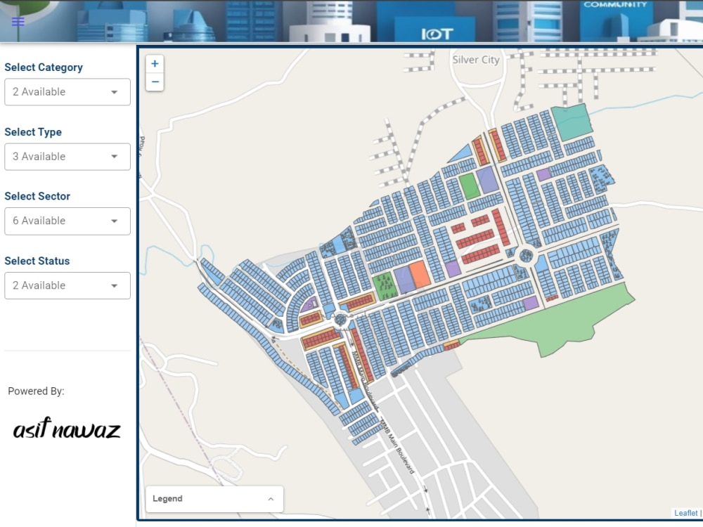
This project delivers a complete web-based GIS solution that transforms your spatial data into an interactive, user-friendly mapping application.
Key features include:
Interactive map interface with zoom, pan, and search functionality
Custom styling to match your brand identity
Responsive design that works on desktop and mobile devices
Layer controls for toggling different data sets
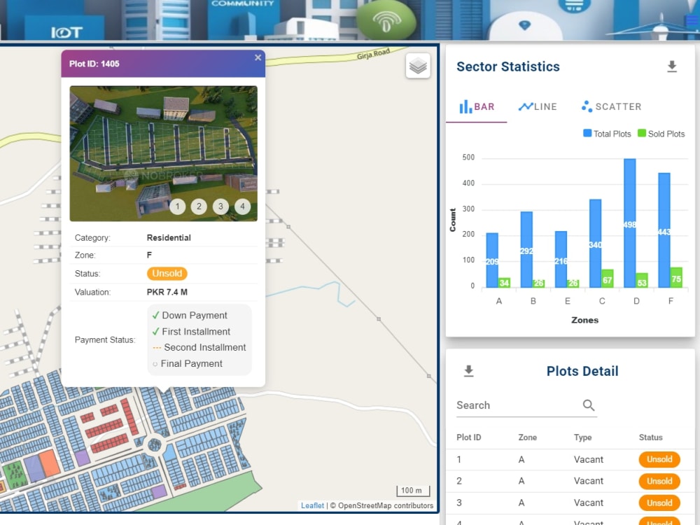
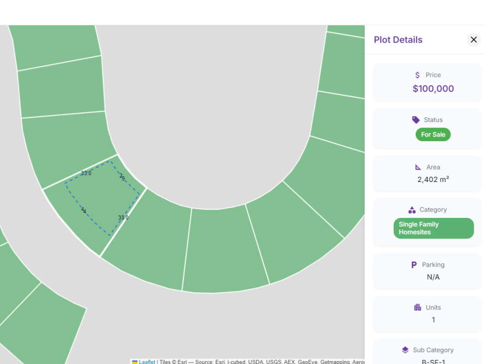
Pop-up information windows with custom data displays
Advanced filtering capabilities based on attributes
Export and sharing options
The application is built using modern web technologies (React/Vue.js, Leaflet) ensuring optimal performance, cross-browser compatibility, and long-term maintainability.
Key features include:
Interactive map interface with zoom, pan, and search functionality
Custom styling to match your brand identity
Responsive design that works on desktop and mobile devices
Layer controls for toggling different data sets
Pop-up information windows with custom data displays
Advanced filtering capabilities based on attributes
Export and sharing options
The application is built using modern web technologies (React/Vue.js, Leaflet) ensuring optimal performance, cross-browser compatibility, and long-term maintainability.
Programming Languages
HTML & CSS, JavaScript, TypeScriptCoding Expertise
Cross Browser & Device Compatibility, Performance OptimizationWhat's included
| Service Tiers |
Starter
$500
|
Standard
$850
|
Advanced
$1,300
|
|---|---|---|---|
| Delivery Time | 4 days | 10 days | 25 days |
Number of Revisions | Unlimited | 5 | 5 |
Number of Pages | 1 | 1 | 3 |
Design Customization | |||
Content Upload | - | - | |
Responsive Design | |||
Source Code |
About Asif
WebGIS Developer | NUXT | Node.js | Kobo Toolbox
Islamabad, Pakistan - 5:56 am local time
I combine full-stack development expertise with advanced geospatial knowledge to build:
🌐 Interactive mapping applications with real-time data visualization
📍 Location-based services with custom analytics
📱 Data collection systems with geospatial components
🗺️ Web-based GIS portals with user-friendly interfaces
My technical toolbox includes:
⚡ Frontend: React, Vue.js, NUXT, JavaScript, TypeScript, Tailwind CSS
⚙️ Backend: Node.js, Express.js, Nest.js, PostgreSQL/PostGIS
🧩 GIS Tools: Leaflet, ArcGIS Suite, GeoServer, KoboToolbox, Google Earth Engine
📊 Project Management: Agile methodologies, team leadership, client consultation
💫 I've successfully delivered solutions for government agencies, environmental organizations, real estate companies, and telecom providers. My background in Remote Sensing & GIS (Master's from NUST) and Space Science (Bachelor's from IST) gives me unique insights into spatial data challenges.
🚀 Ready to discuss how my hybrid expertise can solve your technical and spatial challenges. Contact me to explore how we can bring your project to life with the perfect blend of code and cartography.
Steps for completing your project
After purchasing the project, send requirements so Asif can start the project.
Delivery time starts when Asif receives requirements from you.
Asif works on your project following the steps below.
Revisions may occur after the delivery date.
Accessing Requirements
implementation based on requirements