You will get webGIS interactive map (Leaflet/Mapbox) with custom functionality
Top Rated
Top Rated
Project details
Hi!
I specialize in building custom WebGIS solutions tailored to your specific needs.
What I Offer:
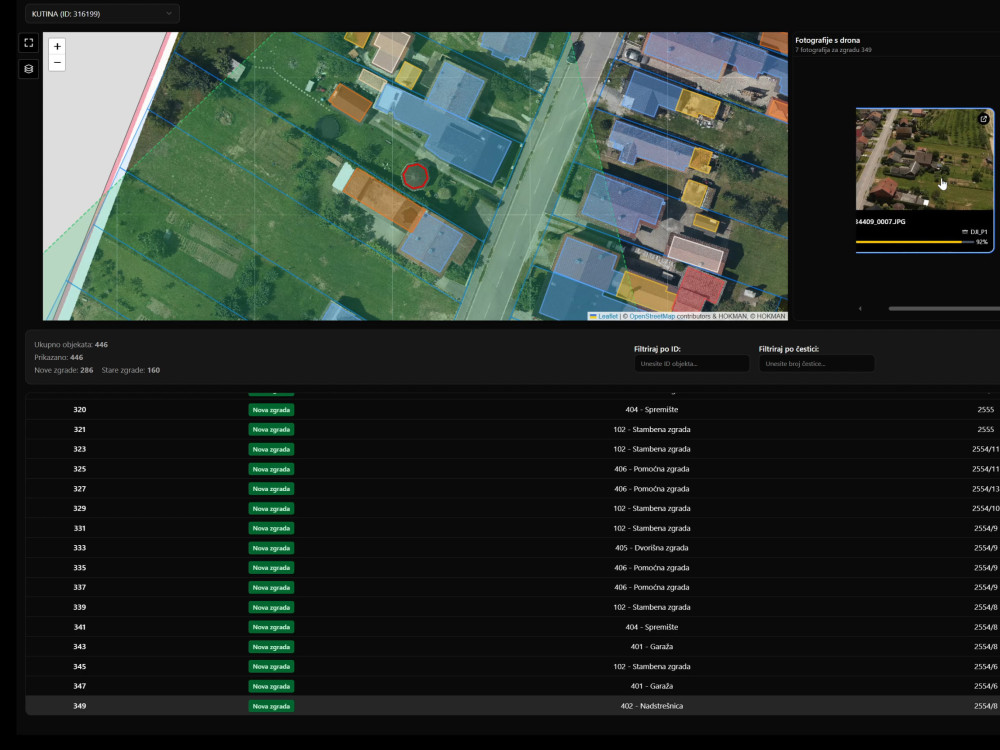
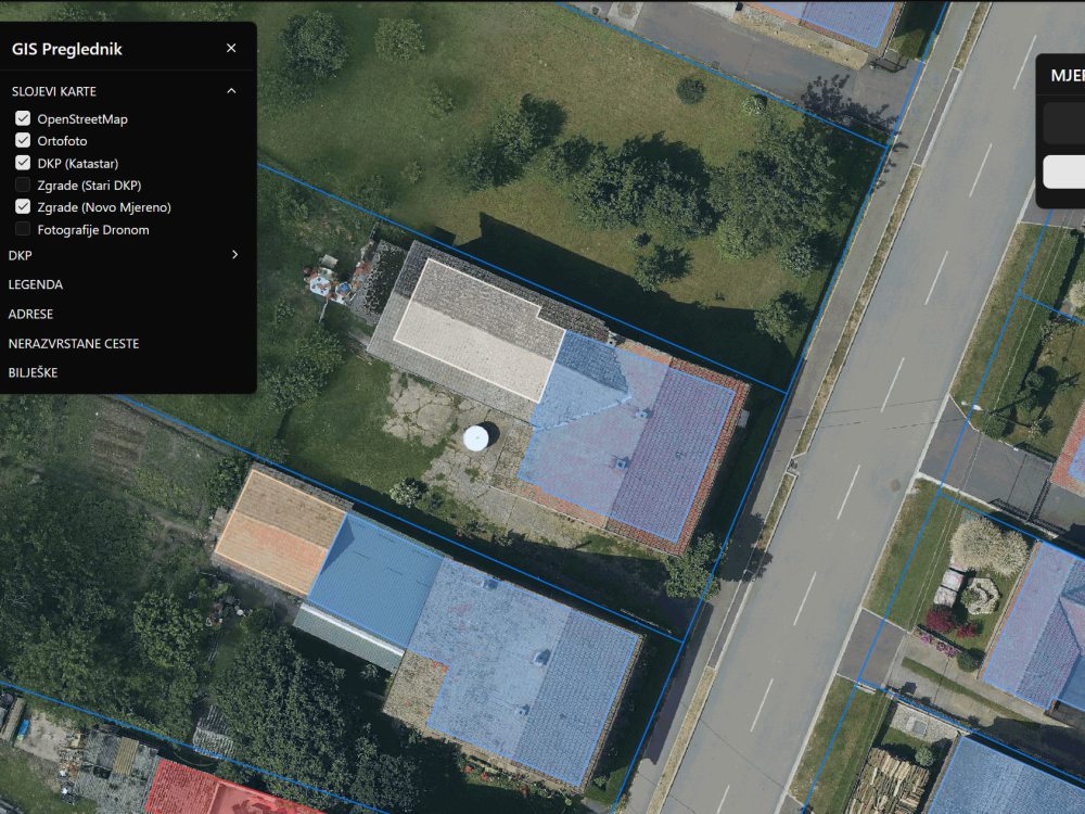
Custom Leaflet / Mapbox Integration — fully interactive maps with smooth performance and clean UI
Layer & Toolbox Systems — easily toggle layers, switch basemaps, and manage data visibility
Feature Info & Popups — detailed information on click, hover, or selection events
Custom Functionality — filters, clustering, search, routing, heatmaps, and more
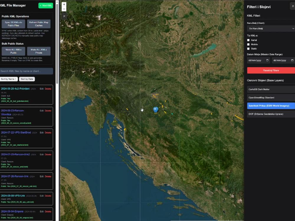
Backend & Data Integration — using PostgreSQL (PostGIS) for spatial data storage and querying
Cloud Hosting Setup — data hosting on Google Cloud or AWS S3, deployed through Vercel or your preferred provider
Modern Tech Stack — TypeScript + Next.js for a fast, maintainable, and scalable frontend
Every project is built with performance, usability, and scalability in mind — ensuring that your mapping solution looks great and runs smoothly across all devices.
Let’s turn your geospatial data into an intuitive, interactive experience.
Send me a message to discuss your project — I’d love to help you bring your map to life!
I specialize in building custom WebGIS solutions tailored to your specific needs.
What I Offer:
Custom Leaflet / Mapbox Integration — fully interactive maps with smooth performance and clean UI
Layer & Toolbox Systems — easily toggle layers, switch basemaps, and manage data visibility
Feature Info & Popups — detailed information on click, hover, or selection events
Custom Functionality — filters, clustering, search, routing, heatmaps, and more
Backend & Data Integration — using PostgreSQL (PostGIS) for spatial data storage and querying
Cloud Hosting Setup — data hosting on Google Cloud or AWS S3, deployed through Vercel or your preferred provider
Modern Tech Stack — TypeScript + Next.js for a fast, maintainable, and scalable frontend
Every project is built with performance, usability, and scalability in mind — ensuring that your mapping solution looks great and runs smoothly across all devices.
Let’s turn your geospatial data into an intuitive, interactive experience.
Send me a message to discuss your project — I’d love to help you bring your map to life!
Programming Languages
JavaScript, TypeScriptCoding Expertise
Cross Browser & Device Compatibility, DesignWhat's included $35
These options are included with the project scope.
$35
- Delivery Time 10 days
- Number of Revisions Unlimited
10 reviews
(10)
(0)
(0)
(0)
(0)
This project doesn't have any reviews.
EB
Edwin B.
May 18, 2026
Point Cloud Cleaning & Classification — Drone + TLS Exterior Dataset
EB
Edwin B.
May 4, 2026
Point Cloud Cleaning and Separation
Matej was quick to respond and delivered on everything agreed! He even went further when details ended up being more complex then initially expected to reach my ideal project outcome.
I'd like to work with him again and can only recommend him to others, too!
I'd like to work with him again and can only recommend him to others, too!
AK
Alireza K.
Feb 19, 2026
PointCloud Feature Extraction (Needs Experience with Microstation + Topodot)
The total project cost we estimated was $750 - Layers were not created as Linear features so we asked another digitizer to help and fix it.
It is crucial to follow our work stream and make sure all layers will be produced in same Geometry Type.
We also did not ask for 3D Objects in this project as it was Highway. We usually do many more layers like Traffic Lights, Traffic Signs and even mail boxes by side of the road.
We added $150 as bonus to finalize and cap payment at $750
WH
Wil H.
Feb 6, 2026
Point Cloud Cleaning
Matej was excellent and was great to deal with. He provided punctual responses and his quality of work was terrific.
CA
Chad A.
Feb 1, 2026
Point Cloud Visualization Expert Needed - 60-Second Demo Video (Urgent, 10-Day Deadline)
Great work fast turn around.
About Matej
WebGIS & LiDAR (Topodot) | Point Cloud | Photogrammetry | Scan2BIM
100%
Job Success
Velika, Croatia - 7:14 am local time
As a full-time professional I did projects across Europe - EFLA & Stattnet (Norway), Duna Aszfalt (Hungary). After starting to freelance I've helped larger companies like McElhanney (Canada), Gatik AI (USA) and Castle Surveys Ltd (UK) deliver crucial projects on time. Other companies I've worked with include: L-Projekt, 5D Surveying, 10x10 architecture, etc.
I plug into active projects as reliable overflow capacity, delivering clean, review-ready outputs without delays, rework, or hand-holding.
5+ years of experience supporting civil and infrastructure projects where precision, consistency, and deadline adherence matter.
LiDAR / photogrammetry data extraction from terrestrial, mobile or aerial scans (Cyclone 3DR, Topodot, Microstation, Global Mapper, Terrasolid's Terrascan, Virtual Surveyor, Civil 3D, AutoCAD, ...)
Point cloud classification & modeling (Microstation + Topodot and TerraScan - Terrasolid)
Fullstack experience with NEXT JS, Postgre SQL to create webGIS apps for various use-cases.
GIS analysis & automation (QGIS and Global Mapper)
Comfortable with Python scripting and AI automation.
I typically work on fixed-scope deliverables, but maintain an hourly rate for overflow, short-term support, or defined tasks.
If you need experienced geospatial capacity to keep a project moving, I can step in quickly.
Some keywords for visibility:
Lidar, Riegl, SLAM, 3D modeling, Leica Cyclone 3DR, Point cloud classification, Point cloud extraction, volume calculation, GIS, webGIS, ArcGIS, Typescript, NEXTJS, PostgreSQL, Topodot, Microstation, point cloud analysis, web application, surveying, topography maps, Terrasolid, Agisoft Metashape, Leaflet, Mapbox, Scan2BIM, BIM, Revit, Autocad Civil 3D
Steps for completing your project
After purchasing the project, send requirements so Matej can start the project.
Delivery time starts when Matej receives requirements from you.
Matej works on your project following the steps below.
Revisions may occur after the delivery date.
Consultations
Let me know your project needs first.