You will get a Professional Research Support and Academic Consulting Services
Project details
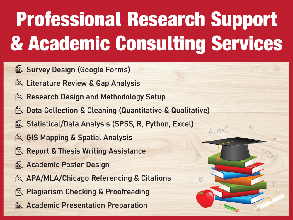
Are you a student, researcher, or professional struggling with academic research, data analysis, or thesis writing? I can help you succeed academically with my expertise. With a strong background in research and data analysis, I provide excellent academic support tailored to your field and level. I help with research paper structure, formatting, editing, thesis and project support, and literature review development. I specialize in qualitative and quantitative research methods, including SPSS, R, Python, and Excel data analysis. Statistical modeling, hypothesis testing, and geospatial analysis with ArcGIS are my specialties. I help format academic citations in APA, MLA, Chicago, and IEEE formats. I create concise graphs, tables, and visualizations for scholarly articles and presentations. Having experience in academic writing and publications, I strive to produce accurate, timely, and scholarly work. To ensure client satisfaction, I offer unlimited revisions and operate with accuracy, confidentiality, and inventiveness. I can help you with your thesis, journal paper, or research.
Target Country
Worldwide, United States, United KingdomWhat's included
| Service Tiers |
Starter
$10
|
Standard
$25
|
Advanced
$50
|
|---|---|---|---|
| Delivery Time | 1 day | 3 days | 7 days |
General Project Consulting | |||
Define Project Goals | |||
Define Deliverables & KPIs | |||
Establish Schedule & Milestones | |||
Risk Management | |||
Resource Management | |||
Budget Management | |||
Project Reports | |||
Project Diagrams Provided |
Frequently asked questions
1 review
(1)
(0)
(0)
(0)
(0)
This project doesn't have any reviews.
JC
Jenn C.
May 13, 2025
Cartographic Design Opportunity
Sakib is a highly skilled GIS professional with a strong command of cartographic design. His maps are not only technically accurate but also visually compelling. I highly recommend his services for any geospatial or mapping-related projects.
About Sakib
GIS & Remote Sensing Analyst | Cartographer | Researcher
Khilgaon, Bangladesh - 11:24 pm local time
I specialize in employing advanced GIS and remote sensing technologies to solve complex spatial problems across diverse domains, including:
🔲 Urban Planning & Infrastructure Development
🔲 Environmental Monitoring & Management
🔲 Hydrology & Water Resource Analysis
🔲 Disaster Risk Assessment & Resilience Planning
🔲 Transportation & Network Analysis
🔲 Agricultural Land Use & Resource Optimization
My core expertise and key skills:
🌐 Advanced Spatial Data Analysis
🌐 High-Quality Cartography and Thematic Mapping
🌐 Remote Sensing Analysis
🌐 Geographic Information Systems (GIS) for Planning & Decision Making
🌐 Comprehensive Geospatial Data Visualization
🌐 Digital & Interactive Mapping
🌐 Spatial Data Extraction and Transformation
🌐 Georeferencing of Raster Maps and Historical Data
🌐 Map Digitization and Vectorization
🌐 Data Mining and Spatial Data Scraping
🌐 Land Use/Land Cover Classification & Change Detection
🌐 Environmental Impact Assessments & Spatial Modeling
🌐 Urban and Regional Planning Support
🌐 Geodatabase Design and Management
🌐 Proficiency in GIS Software: ArcGIS, ArcGIS Pro, QGIS, Global Mapper, AutoCAD, and so on
🌐 Cloud-based Analysis: Google Earth Engine (GEE), Google Earth Pro, My Maps
🌐 OpenStreetMap Data Editing and Integration
🌐 Topographic and Thematic Map Production
🌐 Spatial Statistics and Predictive Modeling
🌐 Satellite Imagery Preprocessing and Enhancement
🌐 Remote Sensing for Agriculture, Forestry, and Water Resources
🌐 Terrain and Elevation Analysis (DEM, Slope, Aspect, and so on)
🌐 Basic Python Scripting for GIS Automation
🌐 SQL-based Spatial Database Management
🌐 Custom Map Styling and Print Map Layouts
🌐 Research Support: Spatial Analysis for Academic and Policy Projects
🌐 Suitability and Site Selection Analysis
🌐 Time-Series Analysis using Remote Sensing
🌐 Spatial Interpolation and Surface Modeling
🌐 Network Analysis (Routing, Service Areas)
If you require high-precision maps, spatial trend analysis, or actionable insights from raw geospatial data, I am available to provide clarity and guidance for your project. Through the integration of advanced spatial analysis, evidence-based geospatial techniques, and superior cartographic outputs, I can assist in achieving your vision with precision and assurance.
Let's connect!
Best regards,
Sakib Hosan
GIS & Remote Sensing Analyst
Steps for completing your project
After purchasing the project, send requirements so Sakib can start the project.
Delivery time starts when Sakib receives requirements from you.
Sakib works on your project following the steps below.
Revisions may occur after the delivery date.
Understanding the Scope
Review all project materials, objectives, and requirements. Clarify goals with the client before starting.
Research and Data Gathering
Conduct literature review, collect relevant data (quantitative or qualitative), and prepare it for analysis.