You will get drone image ( Photogrammetry) data processing e.g. orthomosaics, DEM etc.
Project details
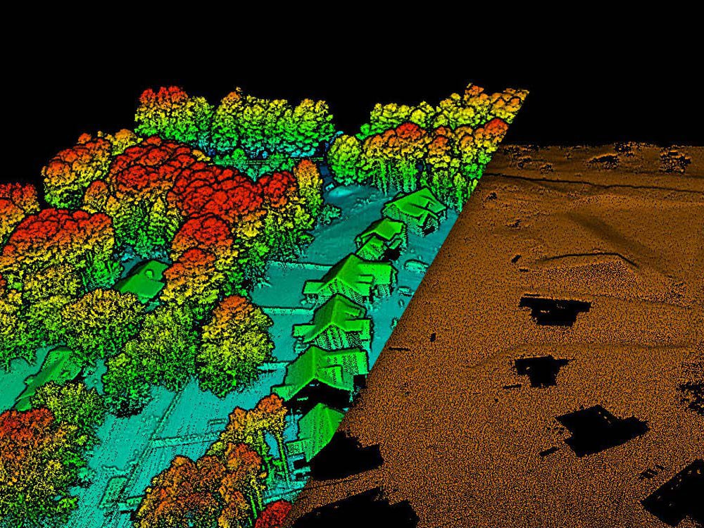
I am a licensed professional engineer surveyor with over 15 years geomatics industry experience in Land survey, Topographic surveys, LIDAR & Photogrammetry, 3D Scanning Point Cloud registration and modeling.
My services include:
Airborne image processing to attain:
Point cloud, Orthophoto, DSM, Classification and Feature Extraction from point cloud data.
Engineering surveys
Volume Calculations
My services include:
Airborne image processing to attain:
Point cloud, Orthophoto, DSM, Classification and Feature Extraction from point cloud data.
Engineering surveys
Volume Calculations
Data Entry Type
Data CleansingWhat's included
| Service Tiers |
Starter
$15
|
Standard
$30
|
Advanced
$45
|
|---|---|---|---|
| Delivery Time | 2 days | 2 days | 2 days |
Number of Revisions | 1 | 1 | 1 |
Formatting & Clean Up | - | - | - |
Graph & Table Creation | - | - | - |
Optional add-ons
You can add these on the next page.
Volume Calculations
+$20About Molefi
LIDAR data processor
Bridgwater, United Kingdom - 11:02 am local time
I am a licensed Professional Engineering Surveyor with over 16 years survey experience in LIDAR, Photogrammetry, Topographic surveys and 3D Laser Scanning.
My services include:
Raw Airborne LIDAR data processing
Trajectory, strip adjustment, horizontal & vertical adjustment, classification, point cloud filtering, and feature extraction
Photogrammetric data processing
Point cloud, Orthophoto, classification and DSM
3D Laser scanning
Point cloud registration, classification, terrain modelling and feature extraction.
Software at my disposal include:
AutoCAD Civil 3D, Pix4D, MicroStation, Terrasolid, Inertial Explorer, Cyclone Register360 and Cyclone 3DR.
Steps for completing your project
After purchasing the project, send requirements so Molefi can start the project.
Delivery time starts when Molefi receives requirements from you.
Molefi works on your project following the steps below.
Revisions may occur after the delivery date.
Image data processing
I will process the images using Pix4D Mapper and the output will be an orthomosaic, DSM and point cloud (classified)