You will get Civil 3D Surface & Earthwork Volume Analysis
Project details
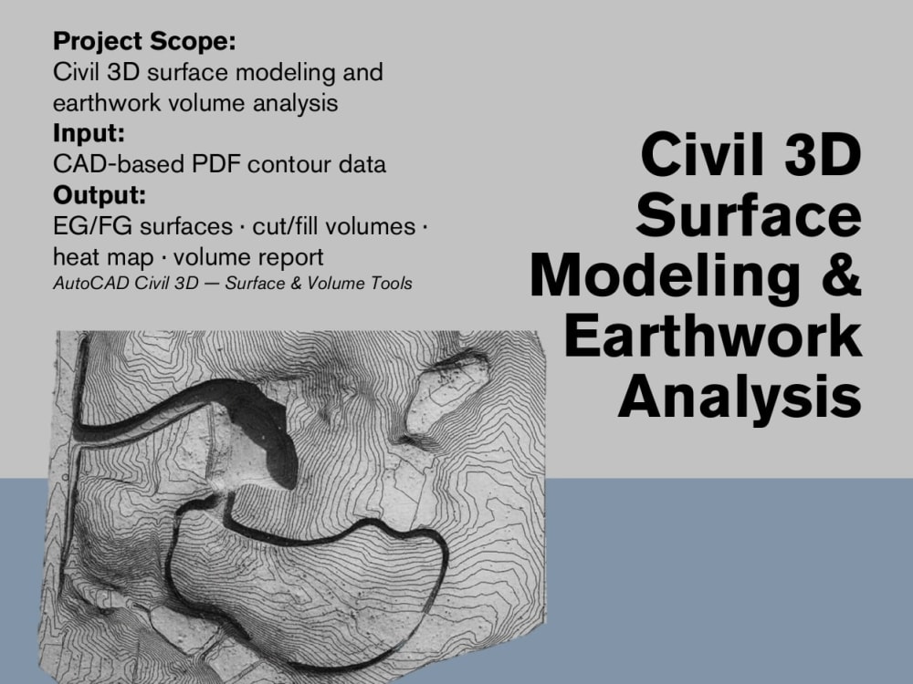
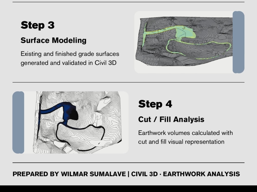
I provide accurate Civil 3D surface modeling and earthwork volume analysis for construction and infrastructure projects. This service focuses on generating reliable Existing Ground (EG) and Finished Grade (FG) surfaces, cut/fill quantities, and clear visual outputs to support planning and cost estimation.
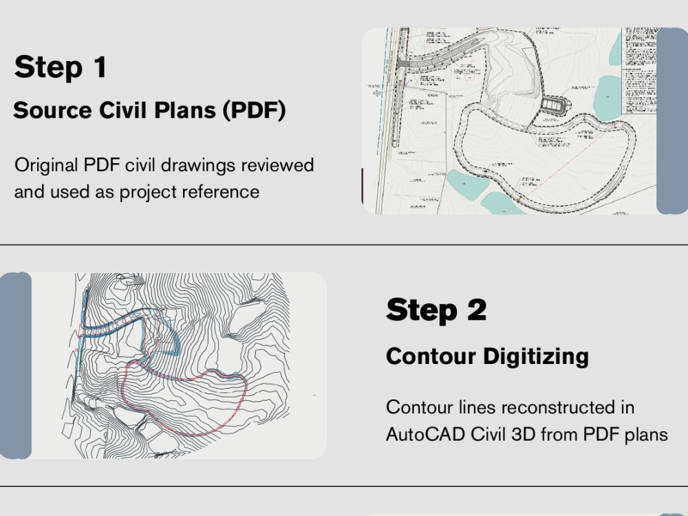
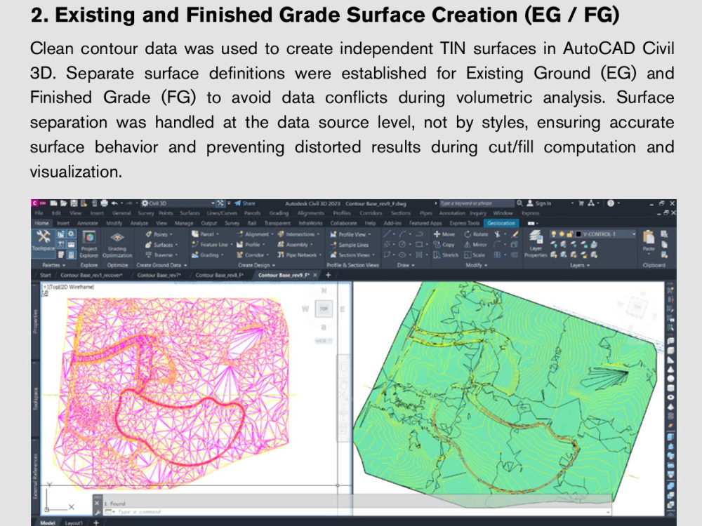
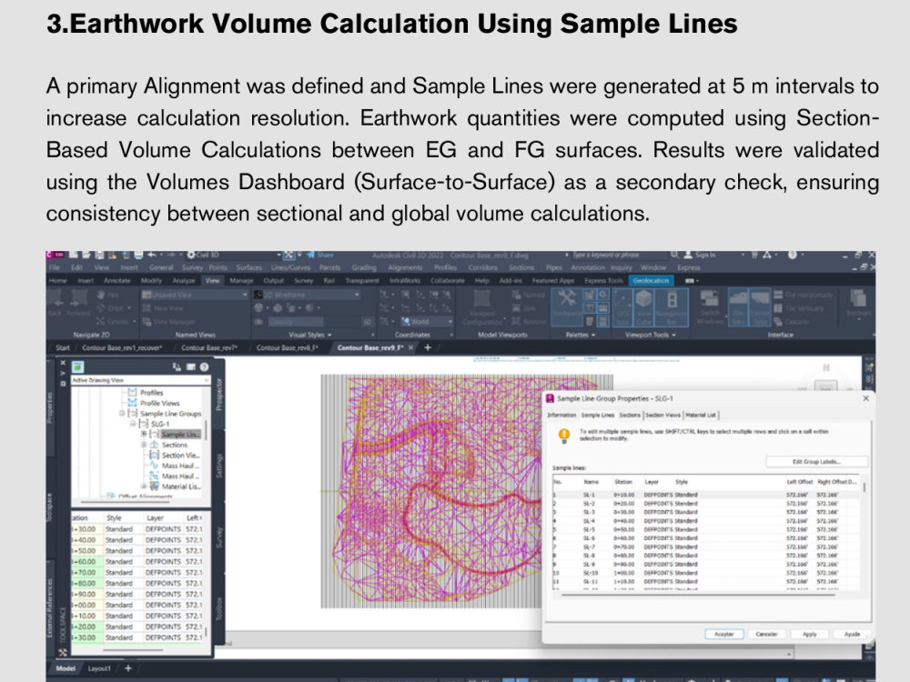
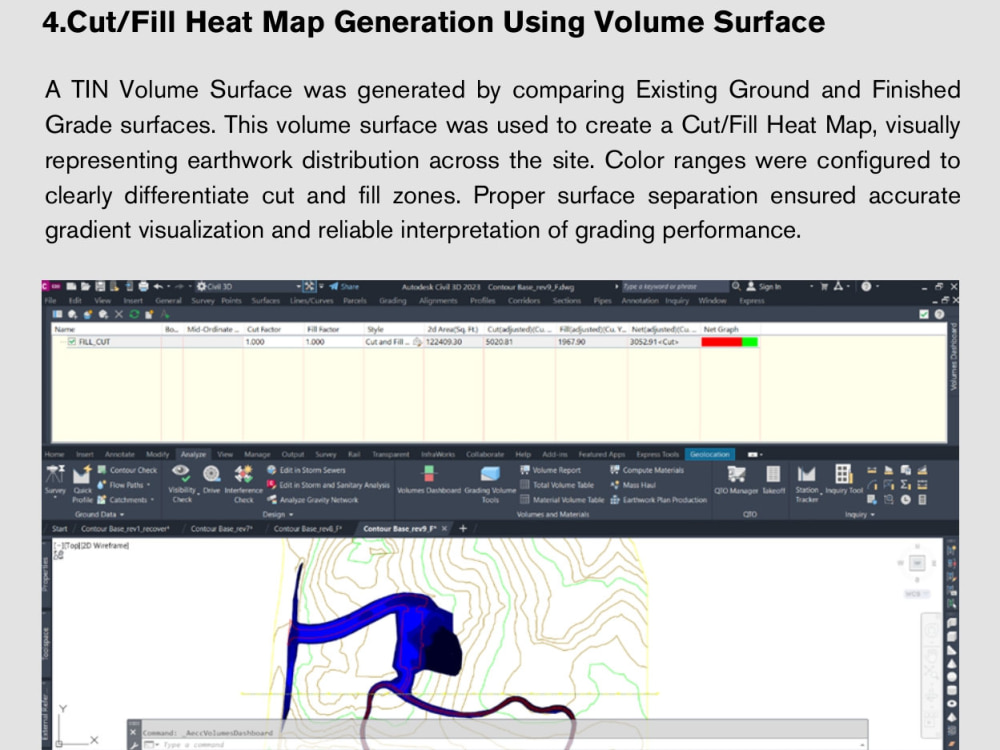
I work directly from survey data, CAD PDFs, and DWG files, carefully cleaning and validating contour linework before surface creation. Independent TIN surfaces are built for EG and FG to avoid data conflicts and ensure correct volume calculations. Quantities are computed using volume surfaces and section-based methods, allowing cross-checking and higher confidence in results.
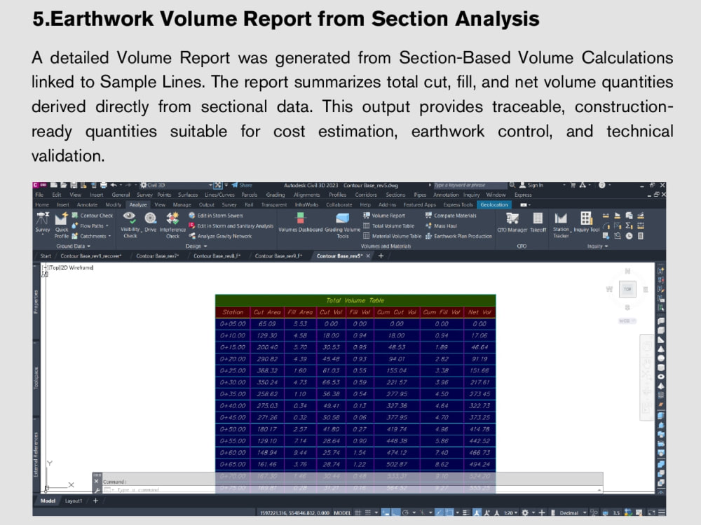
Deliverables include clean, well-structured Civil 3D files, cut/fill heat maps, and volume reports summarizing cut, fill, and net balance. My workflow prioritizes technical accuracy, constructability, and clarity, making the outputs easy to review by engineers and project teams.
With over 4 years of hands-on Civil 3D experience, I focus on precision rather than generic drafting, delivering quantities you can trust for real projects.
I work directly from survey data, CAD PDFs, and DWG files, carefully cleaning and validating contour linework before surface creation. Independent TIN surfaces are built for EG and FG to avoid data conflicts and ensure correct volume calculations. Quantities are computed using volume surfaces and section-based methods, allowing cross-checking and higher confidence in results.
Deliverables include clean, well-structured Civil 3D files, cut/fill heat maps, and volume reports summarizing cut, fill, and net balance. My workflow prioritizes technical accuracy, constructability, and clarity, making the outputs easy to review by engineers and project teams.
With over 4 years of hands-on Civil 3D experience, I focus on precision rather than generic drafting, delivering quantities you can trust for real projects.
Field of Expertise
OtherBuilding Type
IndustrialBIM Software
Autodesk AutoCAD, Autodesk Civil 3D, SketchUpFile Format
DWG, SKP, OtherWhat's included
| Service Tiers |
Starter
$90
|
Standard
$180
|
Advanced
$280
|
|---|---|---|---|
| Delivery Time | 2 days | 3 days | 6 days |
Number of Revisions | 1 | 2 | 2 |
Number of 2D Drawings | 1 | 2 | 3 |
Level of Detail | 1 | 2 | 3 |
Number of Renderings | 0 | 0 | 0 |
Design Analysis | - | - | |
Architectural Walkthrough | - | - | - |
Native BIM Source Files | |||
Model Audit & Verification | - |
Optional add-ons
You can add these on the next page.
Fast Delivery
+$40 - $80
Additional Revision
+$30Frequently asked questions
11 reviews
(10)
(0)
(0)
(0)
(1)
This project doesn't have any reviews.
AQ
Andrew Q.
May 18, 2026
AutoCAD Civil / Site Modeller for Land Projects
Wilmar was very easy to work with and communicated clearly throughout the project. He produced detailed, high-quality Civil 3D modelling work with a strong understanding of terrain, grading and survey integration. Turnaround was good, feedback was incorporated quickly, and the overall workflow was professional and collaborative. Would happily work with him again.
BB
Bruce B.
May 9, 2026
Grading Calculations
Wilmar is a solid professional and doesn’t cut corners.
BB
Bruce B.
Apr 29, 2026
Civil 3D Grading & Production Sheets - Phase 4 Sub
Great job highly recommended
BB
Bruce B.
Apr 8, 2026
Phase 3 & 4 Grading Redesign & Optimization
Great grading plan expertise!!!
DT
David T.
Apr 3, 2026
Civil 3D Grading & Site Plan Optimization
Milestone delivered 9 days late. Core deliverable — the stitched existing surface — was never provided in a readable, verifiable format despite repeated requests. Communication became adversarial when I raised basic QC questions. Could not verify the foundational work and could not approve the milestone.
About Wilmar dunker
Civil 3D Specialist | Site Grading, Earthwork Optimization & Cut/Fill
93%
Job Success
Lima, Peru - 7:52 pm local time
I help engineering firms, developers, and contractors prevent costly construction errors by delivering highly accurate 3D surface models, grading designs, and cut/fill volume analyses using AutoCAD Civil 3D.
With over 4 years of hands-on field and design experience in major infrastructure projects (including work with global firms like ACCIONA), I don't just "draft lines." I build constructible, data-rich 3D models that ensure your site development is optimized, balanced, and ready for construction.
My Core Expertise:
-Site Grading & Earthwork Optimization: Balancing cut and fill to minimize material export/import costs.
-Precise Volume Calculations: Generating reliable Existing Ground (EG) and Finished Grade (FG) TIN surfaces from survey data, DWGs, or PDFs.
-Constructability Review: Identifying potential drainage, slope, or design issues before they become expensive field problems.
-Infrastructure Modeling: Subdivision plans, driveway engineering, platforms, and yard piping networks.
Typical Deliverables:
Clean, native Civil 3D files, Cut/Fill Reports, Heat Maps, Section-based cross-checks, and construction-ready grading plans.
Let’s optimize your next project. Send me a message, and let's discuss how we can ensure your earthworks are accurate and your grading is flawless.
Steps for completing your project
After purchasing the project, send requirements so Wilmar dunker can start the project.
Delivery time starts when Wilmar dunker receives requirements from you.
Wilmar dunker works on your project following the steps below.
Revisions may occur after the delivery date.
Review input data and project requirements
I review survey data, CAD/PDF files, contour quality, units, and scope to confirm feasibility, accuracy, and workflow before modeling.
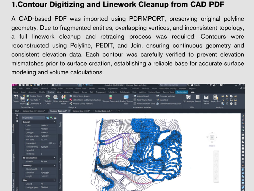
Contour digitizing and linework cleanup
Import CAD-based PDFs or DWGs and clean contour linework using polylines, joins, and elevation checks to ensure continuous, accurate geometry.