You will get E-Plantation Management System for Tea Lands
Project details
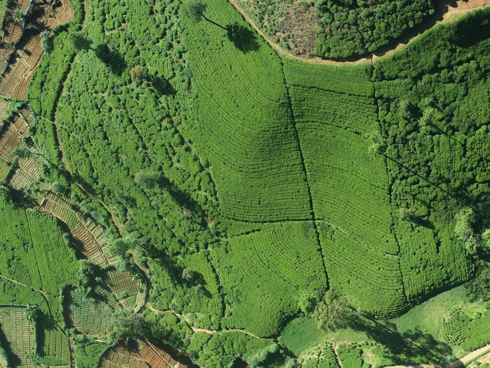
1. Mapping the precise boundaries of the company owned line gardens
2. Accurately calculate the relevant land areas by block wise
3. Create a digital map for all line gardens of Mathurata Estate and update land use changes
4. To prepare estate database including important general attributes which gives information on socio-economic and environmental factors in Line garden area
5. Identify infrastructure development need and faciality management of line garden
6. To create a GIS based Decision Support System (DSS)
7. To demonstrate GIS based DSS applications for plantation management
Main Type
Mobile Apps, Web Apps, Website, OtherFile Format
JPG, PDF, PNG, PSD, OtherWhat's included
| Service Tiers |
Starter
$10,000
|
Standard
$15,000
|
Advanced
$25,000
|
|---|---|---|---|
| Delivery Time | 5 days | 10 days | 20 days |
Number of Pages | 10 | 20 | 30 |
Number of Revisions | 1 | 1 | 1 |
Source Files | |||
Commercial Use | |||
Convert to HTML/CSS | |||
Responsive Design | |||
Interactive Mockup |
Frequently asked questions
About Upul
GIS Consultant/GIS Analyst/Project Manager/System Analyst
Colombo, Sri Lanka - 2:57 pm local time
I have more than 20 years of experience in the GEOINFORMATICS CONSULTING, SPATIAL DATA COLLECTION SURVEYS, DRONE/UAV AERIAL PHOTOGRAMMETRY, REMOTE SENSING SERVICES, PARTICIPATORY MAPPING, EDUCATION, TRAINING AND PROFESSIONAL DEVELOPMENT, GIS APPLICATION DEVELOPMENT
As for my academic qualification, I have completed MBA Specialized in Information Technology from the University of Moratuwa and obtained a Bachelor’s Degree in Geography with 2nd class upper division from the University of Colombo. Furthermore, I have acquired the following Post qualifications- Master of Science in GIS and the Remote sensing University of Peradeniya.
At the moment, I have almost 15 years of experience as a Geographical Information System Lecturer, Specialist, Project manager, System Development Consultant, and planning and implementing of various Universities, foreign-funded projects under government ministries. And also, I am visiting lecturer for Mobile GIS for the Master of Geoinformatics Course conducted by the IHRA, University of Colombo.
Steps for completing your project
After purchasing the project, send requirements so Upul can start the project.
Delivery time starts when Upul receives requirements from you.
Upul works on your project following the steps below.
Revisions may occur after the delivery date.
Gather Basic Requirement
Analyse requirement