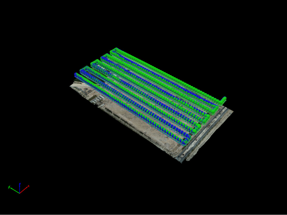
You will get photogrammetry, lidar processing, 3D topography contours
Project details
Survey-Grade Drone Mapping & Geospatial Engineering
Looking for centimeter-level accuracy for your next project? I provide professional reality capture and drone data processing, ensuring your surveys are truly "design-ready."
Expert Services:
Photogrammetry: Interactive mapping from images and GCPs.
GNSS Post-Processing: Static and Kinematic (PPK/RTK) workflows to maximize precision.
LiDAR Processing: Strip alignment and GNSS integration.
3D Modeling: High-detail textured meshes and point cloud generation.
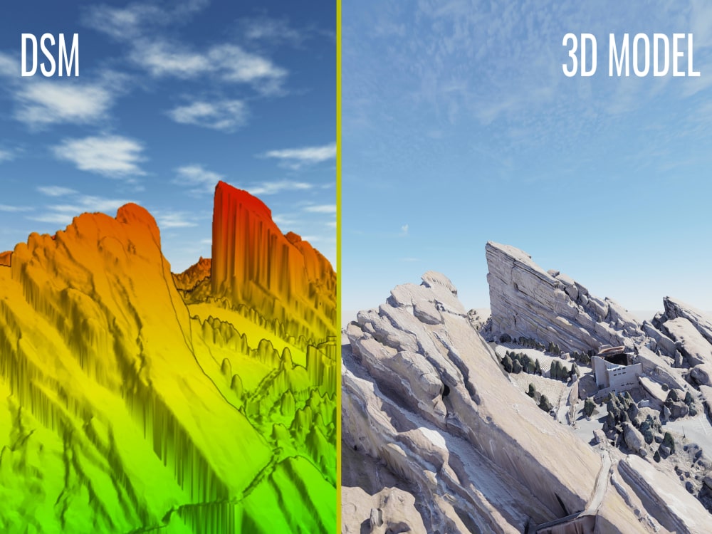
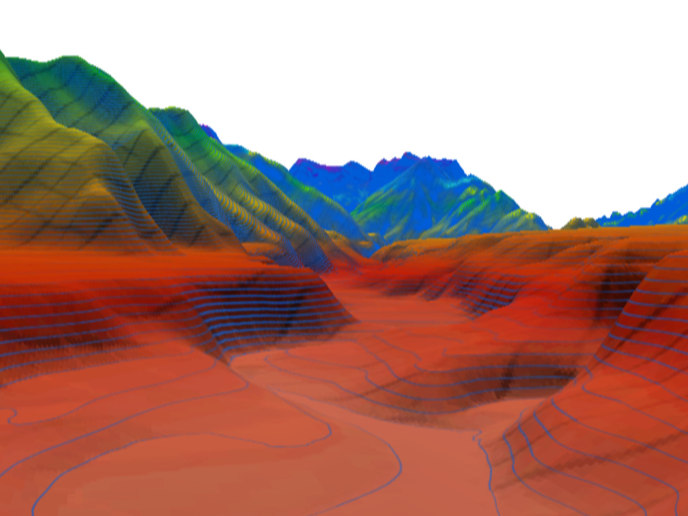
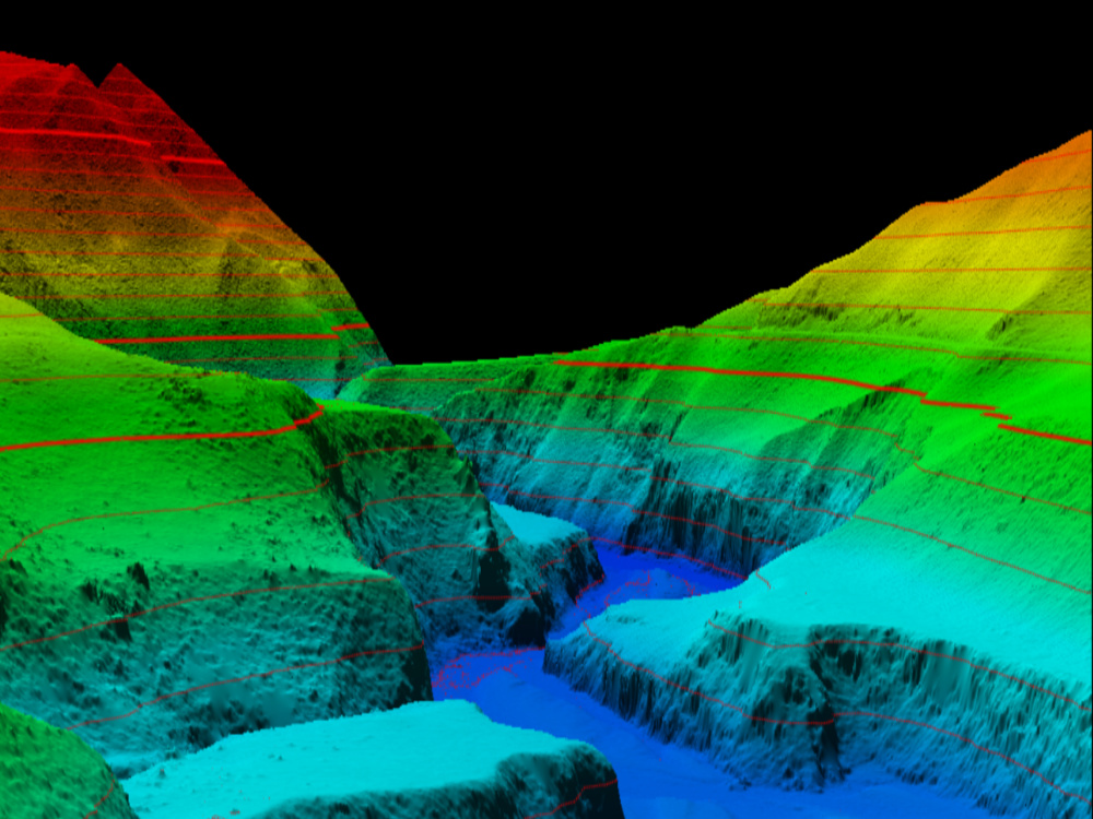
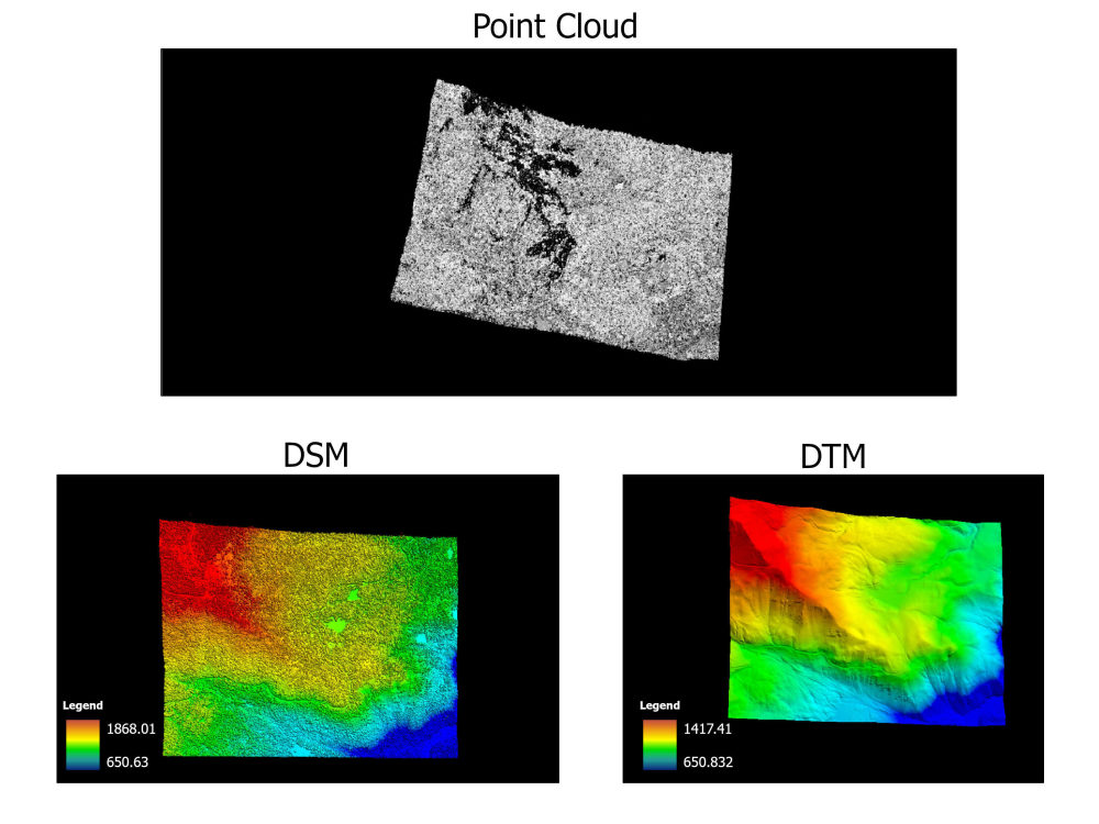
Terrain Analysis: Accurate DSM, DTM, and contour line extraction.
The "Design-Ready" Deliverable:
I provide a specialized CAD file with the surface generated from the point cloud and the orthophoto perfectly draped. No more cleaning data, just open and start your design.
Deliverables Include:
Orthomosaic (Tiff/Jpeg)
DSM, DTM & Contour Lines
Point Clouds (LAS/LAZ) & 3D Meshes (OBJ/FBX)
Why me? I bridge the gap between raw drone data and engineering-grade results.
Do message me to discuss your project requirements
Looking for centimeter-level accuracy for your next project? I provide professional reality capture and drone data processing, ensuring your surveys are truly "design-ready."
Expert Services:
Photogrammetry: Interactive mapping from images and GCPs.
GNSS Post-Processing: Static and Kinematic (PPK/RTK) workflows to maximize precision.
LiDAR Processing: Strip alignment and GNSS integration.
3D Modeling: High-detail textured meshes and point cloud generation.
Terrain Analysis: Accurate DSM, DTM, and contour line extraction.
The "Design-Ready" Deliverable:
I provide a specialized CAD file with the surface generated from the point cloud and the orthophoto perfectly draped. No more cleaning data, just open and start your design.
Deliverables Include:
Orthomosaic (Tiff/Jpeg)
DSM, DTM & Contour Lines
Point Clouds (LAS/LAZ) & 3D Meshes (OBJ/FBX)
Why me? I bridge the gap between raw drone data and engineering-grade results.
Do message me to discuss your project requirements
File Format
DWG, OBJ, FBX, TIFFWhat's included
| Service Tiers |
Starter
$100
|
Standard
$250
|
Advanced
$500
|
|---|---|---|---|
| Delivery Time | 4 days | 4 days | 6 days |
Number of Revisions | 1 | 1 | 1 |
Optional add-ons
You can add these on the next page.
Fast Delivery
+$25 - $50
Additional Revision
+$25
1 review
(0)
(1)
(0)
(0)
(0)
This project doesn't have any reviews.
NU
Nishant U.
Oct 30, 2024
Convert Picture Map to Enhanced 2D Map with Legends
About Rupesh
Drone, LiDAR Survey to CAD | GIS | BIM | 3D Terrain Expert
Pokhara, Nepal - 11:45 am local time
I specialize in processing photogrammetry and LiDAR data to create precise 3D topography and immersive terrain models tailored for engineering, architecture, and real-time visualization.
Whether you are an urban planner needing a real-world site context, a developer requiring realistic environments in Unreal Engine, or a surveyor looking to translate geospatial data into actionable models, I provide end-to-end 3D solutions.
What I Bring to Your Project:
LiDAR & Photogrammetry Processing: Expertly converting raw spatial data, aerial imagery, and point clouds into clean, accurate CAD topography, Digital Elevation Models (DEM/DTM) and detailed 3D meshes.
High-Fidelity 3D Terrain Modeling: Building realistic, optimized terrain and landscape simulations using Unreal Engine, Blender, and Autodesk 3ds Max for seamless integration into your specific workflow.
Geospatial Accuracy: Ensuring all topography is rooted in precise geographic coordinates and spatial logic using industry-standard tools like ArcGIS and QGIS.
BIM & Architectural Context: Integrating generated terrains directly with Building Information Modeling (BIM) workflows (like Revit) to visualize urban planning, architectural and infrastructure projects using Lumion and Twinmotion.
My Software Toolkit:
Data Processing & GIS: ArcGIS, QGIS, Pix4Dmapper
3D Modeling & Rendering: Blender, Autodesk 3ds Max, Autodesk Revit, Lumion, Twinmotion
Real-Time Engines: Unreal Engine
I am dedicated to delivering models that are not only visually striking but technically flawless and geographically precise. Let's transform your raw spatial data into an interactive, high-quality 3D reality.
Steps for completing your project
After purchasing the project, send requirements so Rupesh can start the project.
Delivery time starts when Rupesh receives requirements from you.
Rupesh works on your project following the steps below.
Revisions may occur after the delivery date.
Image Processing + GCP Matching + GNSS post processing together