You will get Professional Point Cloud Cleaning & Terrain Surface Extraction
Project details
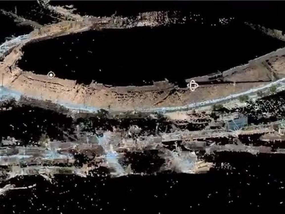
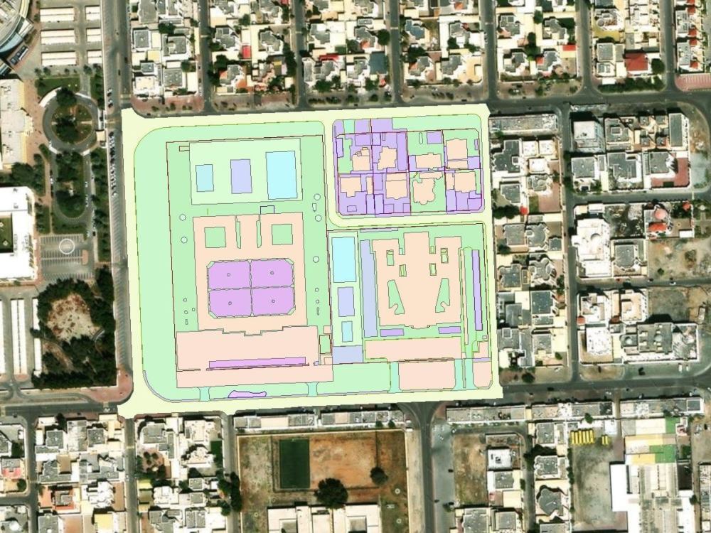
I provide professional point-cloud processing and terrain modeling services for engineering, surveying, and architecture projects. My work focuses on delivering accurate, engineering-ready outputs that support design, grading, and site-planning workflows.
Using industry tools such as Civil 3D / ArcGIS / Recap, Cloud Compare, Leica Cyclone, etc. I clean and classify point-cloud data, generate terrain surfaces, and export final deliverables in the required formats (LAS/LAZ, TIN, DXF, DWG, etc.). Every project includes quality checks to ensure reliable elevations, smooth surfaces, and consistent geometry.
This project is ideal for architects, contractors, surveyors, and land-development professionals who need precise and professionally processed site data.
Project Scale
CityBuilding Type
Commercial, Office & Work Space, ResidentialFile Format
3DS, BLEND, DAE, DWG, JPG, MA, MB, OBJ, PDF, RVT, SKP, SLDPRT, STLWhat's included
| Service Tiers |
Starter
$150
|
Standard
$350
|
Advanced
$800
|
|---|---|---|---|
| Delivery Time | 1 day | 3 days | 6 days |
Number of Revisions | 1 | 2 | 3 |
Number of 2D Drawings | 1 | 2 | 4 |
High Level of Details | - | - | |
Graphic Enhancements | - | ||
Source Files | |||
Layout Sheets |
Optional add-ons
You can add these on the next page.
Fast Delivery
+$50 - $150
High Level of Details
(+ 1 Day)
+$100
Graphic Enhancements
(+ 1 Day)
+$75About Aso
Survey and Geomatics Engineer | Mapping | CAD | GIS | LiDAR | GNSS GPS
Glasgow, United Kingdom - 6:19 am local time
➢ Strongly skilled in:
1- GNSS Static & Kinematic Surveys and Data Processing and Control Adjustment.
2- ArcGIS & QGIS spatial analysis.
3- Topographic Map Creation.
4- CAD & Civil 3D drafting (site plans, grading plans, profiles and x-sections).
5- GIS layer creation (roads, utilities, parcels) with layer cleanup and standardization.
6- Georeferencing, digitizing & map rectification.
7- Contours, surfaces & volume calculations.
8- SHP, KML, GeoJSON, and LAS/LAZ conversions.
9- 3D basemap development & LiDAR integration.
10- Coordinate Transformations.
11- Excel ➟ CAD/GIS Mapping.
12- Satellite and Aerial Images processing.
13- Point Clouds processing.
14- DTM, DSM, DEM, Mesh and Orthophoto generation.
15- Fiber Optic Network Design (FTTx).
16- Project Management and Work Progress Tracking; utilizing managing software (MS-Project, MS-Planner, Primavera, Excel Gant Charts).
17- LULC analysis
18- Hydrological and Geological Analysis; using software (ENVI, ERDAS Imagine).
19- Drone Images processing; utilizing (Pix4D Matic, Agisoft Metashape) software.
➣ I have worked on large residential and infrastructure projects including highways, high-rise towers, basemap integration, telecommunication network design and quality control of government Control Points.
➢ Proven record in delivering accurate geospatial data for infrastructure and urban development projects.
➢ Deliverables I provide:
1- Topographic Maps (DWG, DXF, PDF).
2- Civil 3D surfaces, profiles, alignments.
3- Clean, accurate GIS layers (SHP, KML, GeoJSON, GDB).
4- Coordinate conversion & transformation (UTM and others).
5- GNSS baseline processing & reports.
6- Georeferencing & digitizing.
7- DEM, DTM, DSM.
8- Orthophoto.
9- 3D Basemap.
➢ Why clients hire me:
✔ Fast delivery & professional communication.
✔ High accuracy (Surveying background).
✔ Clear explanation + organized output.
✔ Ability to handle engineering-level details.
If you need clean GIS data, accurate maps, or professional survey/CAD deliverables - I can help you immediately.
Let's work together!
Steps for completing your project
After purchasing the project, send requirements so Aso can start the project.
Delivery time starts when Aso receives requirements from you.
Aso works on your project following the steps below.
Revisions may occur after the delivery date.
Input Data Review
I will review your point cloud / survey files and confirm scope, coordinate system, and deliverables.
Pre-processing & Alignment
I will organize, clean, and prepare the dataset to ensure consistency and accuracy.