You will get a custom interactive WebGIS map dashboard.
Project details
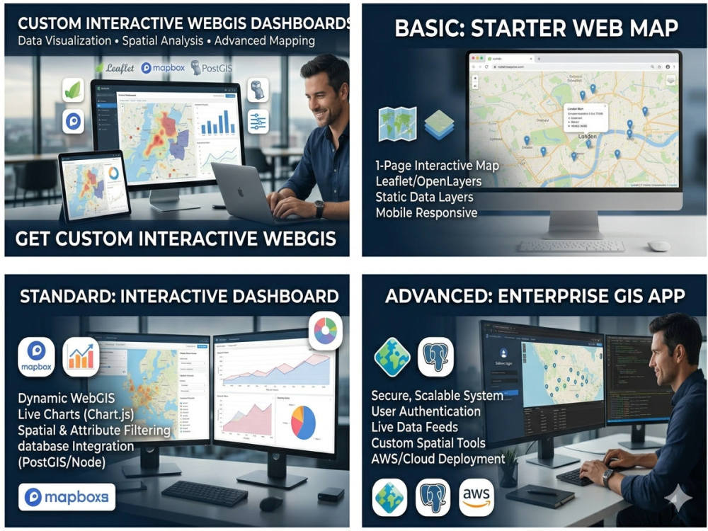
Need a modern, interactive WebGIS portal for your business or project? I will develop custom GIS web applications using cutting-edge tools for data visualization, map interaction, spatial analysis, and reporting.
What I Offer:
Fully responsive GIS web portal
Interactive maps with custom layers (points, polygons, raster, etc.)
Attribute search & filtering
Upload and download spatial data
GeoServer, PostGIS, and database integration
Admin dashboard and map controls
Technologies:
Leaflet | Mapbox | OpenLayers | ArcGIS JS API | React | GeoServer | QGIS2Web
Hosting & security options available
Ideal for urban planning, environment, zoning, utilities, agriculture, and public data sharing
Lets bring your spatial data to life!
Message me with your project idea or a sample, and I'll suggest a perfect solution.
Note: Project price can vary according to your requirements.
What's included
| Service Tiers |
Starter
$850
|
Standard
$1,750
|
Advanced
$2,550
|
|---|---|---|---|
| Delivery Time | 14 days | 21 days | 28 days |
Number of Revisions | 2 | 3 | 5 |
Design Customization | - | - | - |
Content Upload | - | - | - |
Responsive Design | - | - | - |
Source Code | - | - | - |
About Gis
GIS & RS Expert | Zoning Mapping | WebGIS | Spatial Data Analysis
Rawalpindi, Pakistan - 2:51 am local time
My strengths include zoning and land use mapping (USA-focused), cadastral mapping, spatial data processing, and WebGIS development. I am skilled in ArcGIS, QGIS, and geoprocessing workflows, with a strong focus on data accuracy and efficiency.
I have completed projects such as zoning mapping for U.S. datasets, cadastral mapping, urban flood analysis using AHP, and LULC classification using remote sensing techniques and i have also done many projects on WebGIS like creating custom GIS dashboard using Geo-server, Geo-node, PostgreSQL/PostGIS. These projects demonstrate my ability to handle complex spatial data and deliver reliable outputs.
I hold a Bachelor's degree in GIS & Remote Sensing and currently work as a GIS Analyst, gaining hands-on experience in real-world geospatial projects.
I am committed to delivering high-quality GIS solutions that support informed decision-making.
Steps for completing your project
After purchasing the project, send requirements so Gis can start the project.
Delivery time starts when Gis receives requirements from you.
Gis works on your project following the steps below.
Revisions may occur after the delivery date.
Requirements & Data Gathering
Client provides the project goals, raw geographical data files (Shapefiles, KML, GeoJSON, Excel), and any preferred branding colors.
UI/UX Wireframing & Design Approval
I map out the visual interface and placement of filters, legends, and graphs for your review before diving into the code.