You will get A Cutting-Edge WebGIS Portal to Unlock the Power of Geospatial Data






Project details
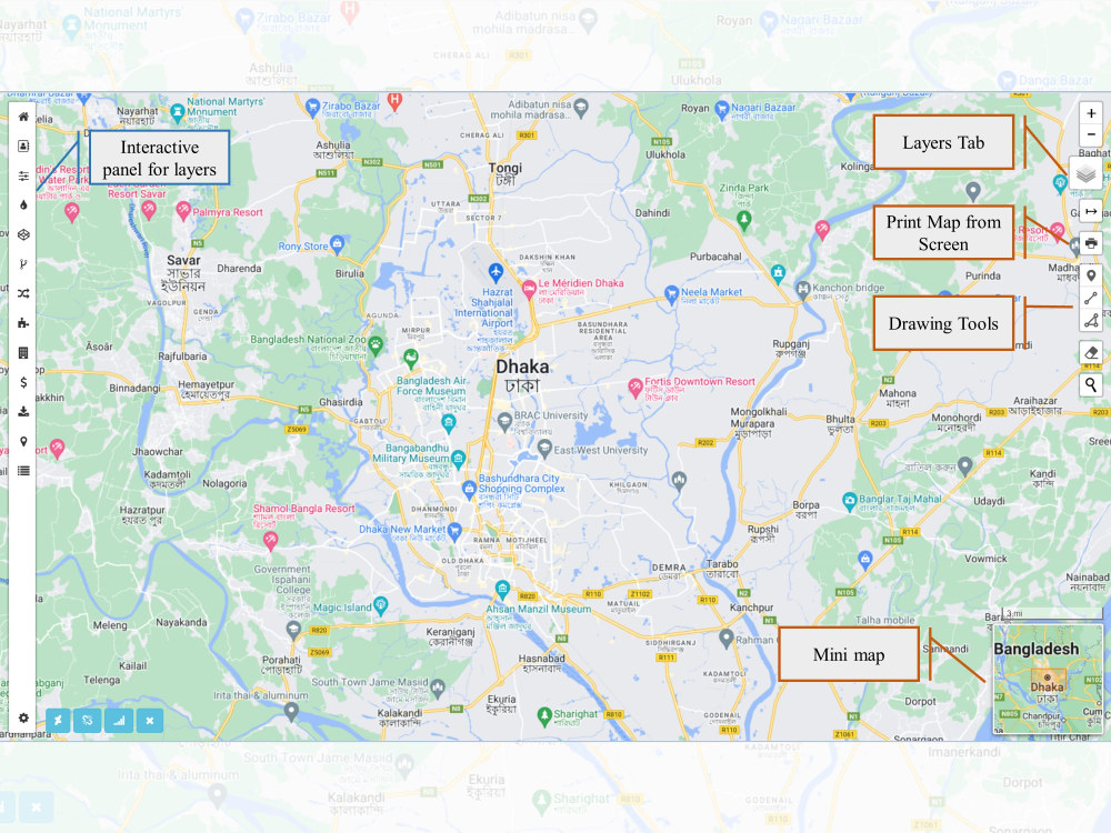
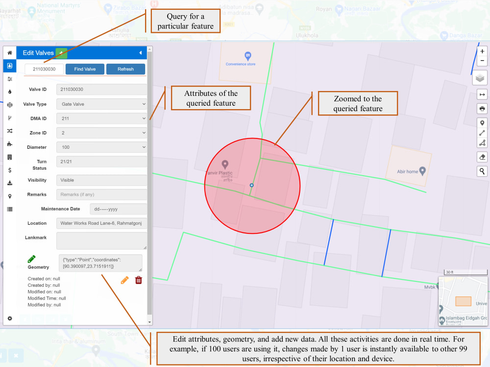
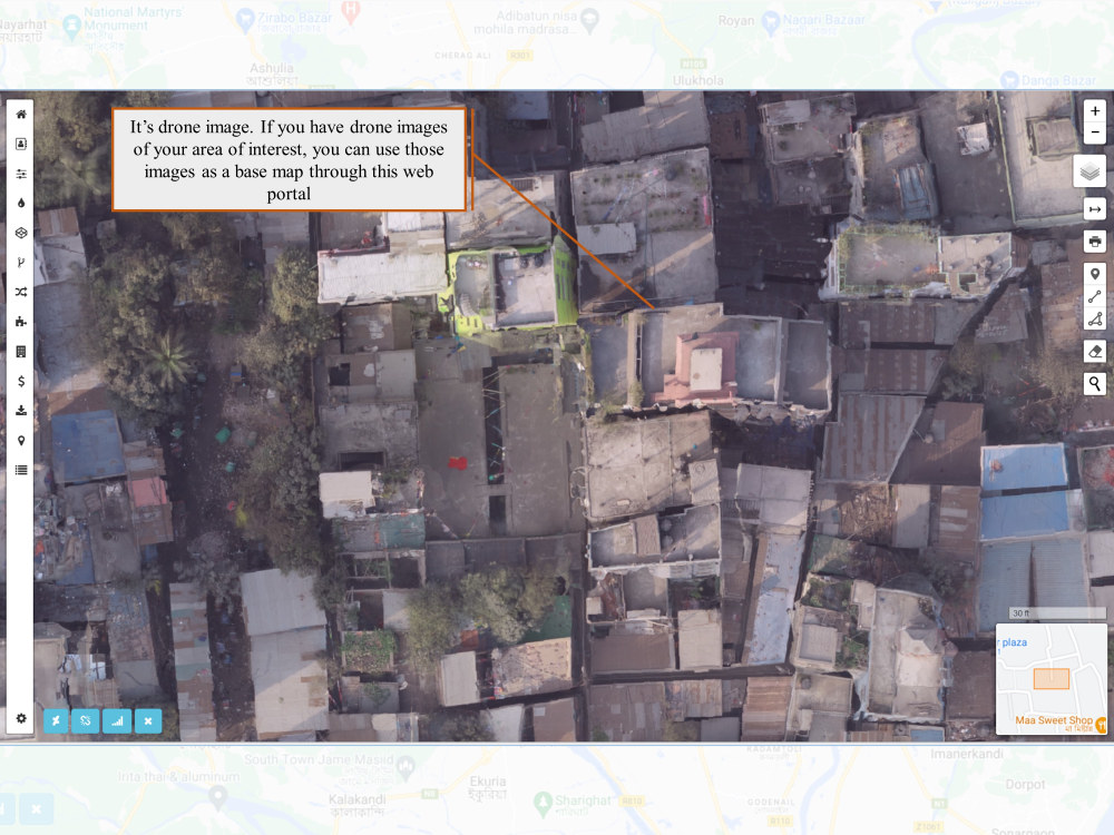
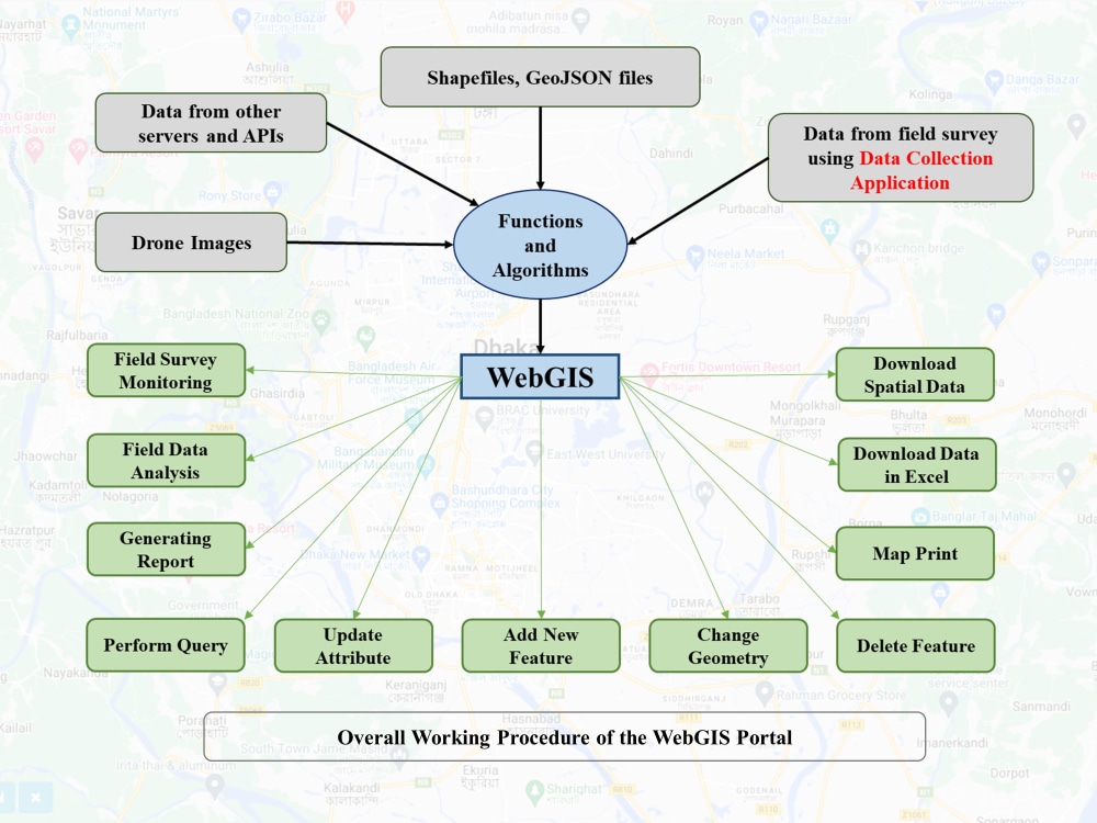
A WebGIS-based software that runs on a server while users connect to it from their computers using an internet browser. Users don’t have to install or download anything. It can be used from anywhere in the world by an unlimited number of users.
Discover the package details in the following:
Starter
1. Displaying data in a WebGIS portal.
2. Query and map print.
3. Up to 4 layers.
4. Hosting (Local or cloud)
Standard Package
1. All facilities of starter.
2. Real-time data update, insert, and delete.
3. Real-time geometry update.
4. Up to 8 layers.
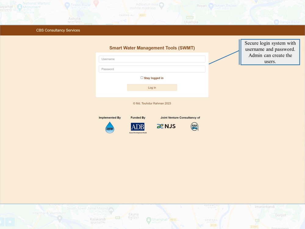
5. Secure login.
6. Admin (create users only)
Advanced Package
1. All facilities of Standard.
2. Up to 12 layers.
3. Cloud server setup and domain hosting.
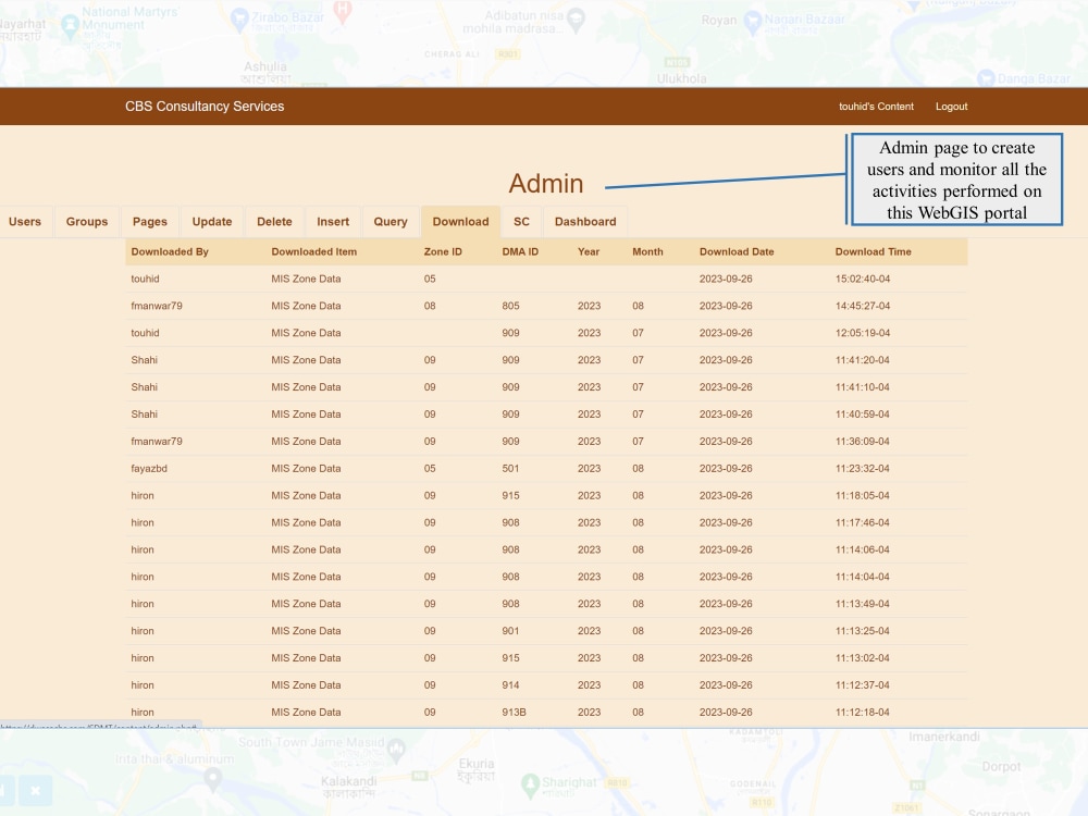
4. Admin (users, activity monitoring, group control, etc.)
5. Content page for each user.
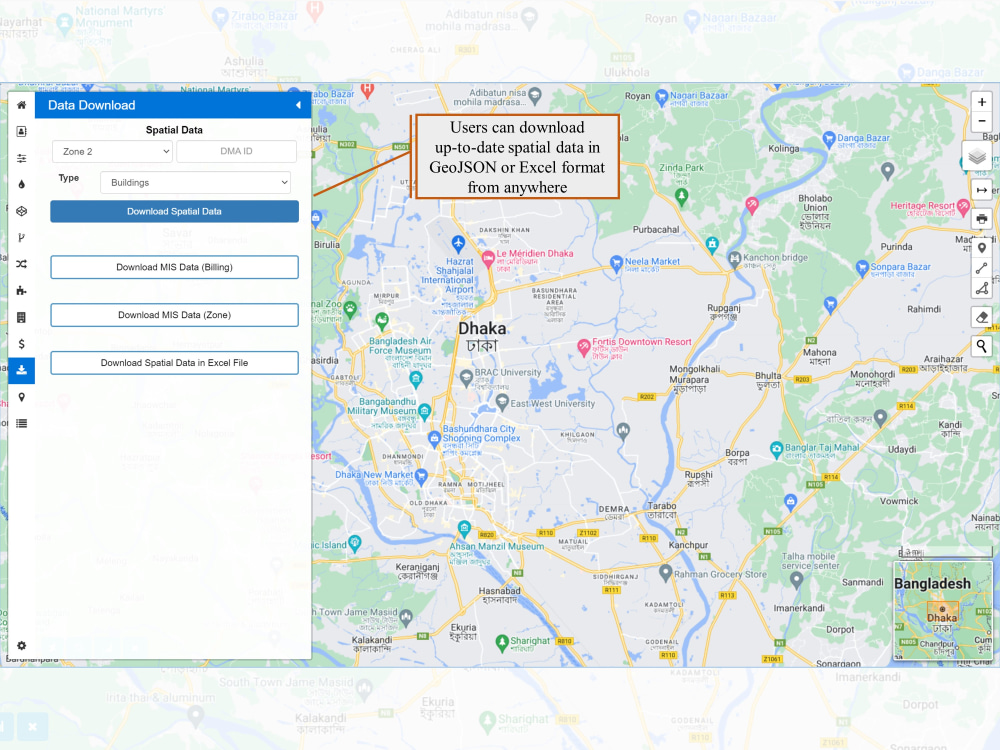
6. Spatial data download.
7. Daily automatic data backup system.
8. Customized mobile data collection application.
9. Custom dashboard to check and edit field data.
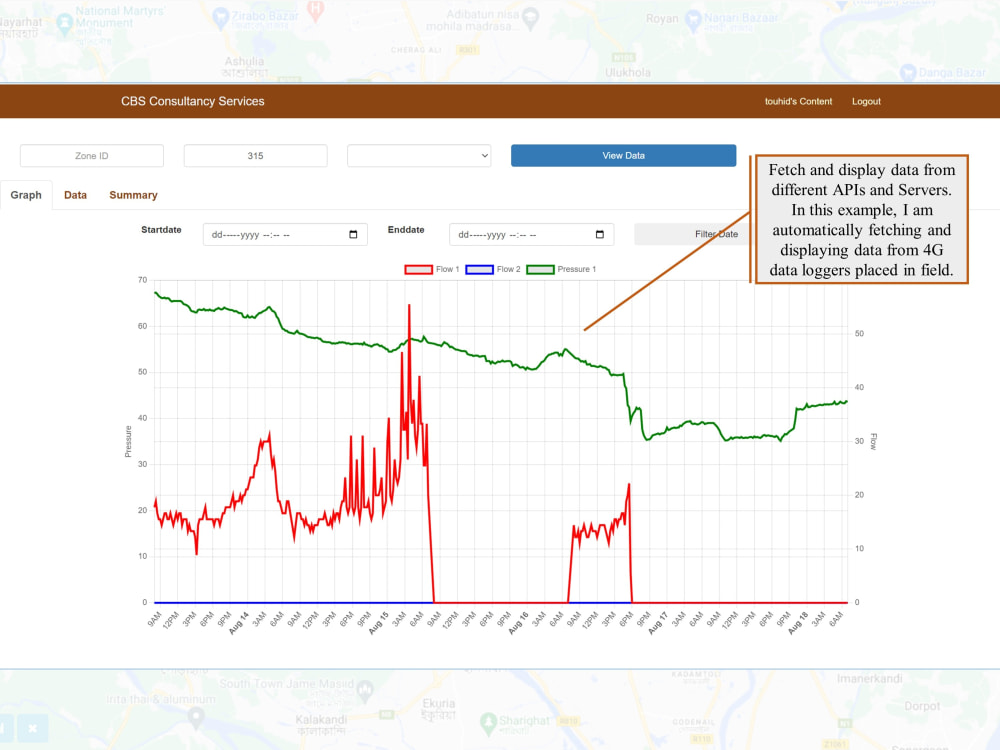
10. Integration of data from APIs (up to 2).
11. Picture uploading option for each feature.
12. Three working days of online training.
13. Free maintenance service for three months (after project handing over).
Discover the package details in the following:
Starter
1. Displaying data in a WebGIS portal.
2. Query and map print.
3. Up to 4 layers.
4. Hosting (Local or cloud)
Standard Package
1. All facilities of starter.
2. Real-time data update, insert, and delete.
3. Real-time geometry update.
4. Up to 8 layers.
5. Secure login.
6. Admin (create users only)
Advanced Package
1. All facilities of Standard.
2. Up to 12 layers.
3. Cloud server setup and domain hosting.
4. Admin (users, activity monitoring, group control, etc.)
5. Content page for each user.
6. Spatial data download.
7. Daily automatic data backup system.
8. Customized mobile data collection application.
9. Custom dashboard to check and edit field data.
10. Integration of data from APIs (up to 2).
11. Picture uploading option for each feature.
12. Three working days of online training.
13. Free maintenance service for three months (after project handing over).
Programming Languages
PHP, HTML & CSS, JavaScriptCoding Expertise
Cross Browser & Device Compatibility, Performance Optimization, SecurityWhat's included
| Service Tiers |
Starter
$200
|
Standard
$500
|
Advanced
$10,000
|
|---|---|---|---|
| Delivery Time | 7 days | 15 days | 70 days |
Number of Revisions | 2 | 3 | 4 |
Number of Pages | 1 | 2 | 3 |
Design Customization | |||
Content Upload | |||
Responsive Design | |||
Source Code |
Optional add-ons
You can add these on the next page.
For each additional layer
(+ 3 Days)
+$100
For each additional API
(+ 10 Days)
+$2,000About Md Touhidur
GIS Programmer & WebGIS Developer
Dhaka, Bangladesh - 8:32 pm local time
# GIS Programming: Leaflet, JavaScript, PHP, SQL, Python, AJAX, HTML & CSS, GDAL, Turf.js, ArcGIS JavaScript API, PyQt5
# GIS Software: ArcGIS Desktop, ArcGIS Pro, ArcGIS Online, ArcGIS Web AppBuilder, ArcGIS Instant App, Survey123, ArcGIS Enterprise, QGIS, QField
# Python for GIS: GeoPandas, Folium, Plotly, Matplotlib, Jupyter Notebooks, ArcPy
# Databases: PostgreSQL, Oracle, MySQL, SQlite, SpatiaLite
# ETL Tools: Feature Manipulation Engine (FME), SQL Server Integration Services (SSIS)
# Raster Processing: Google Earth Engine (GEE), ERDAS Imagine, ArcGIS Raster Calculator
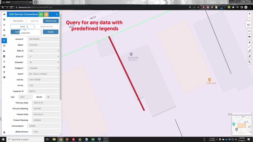
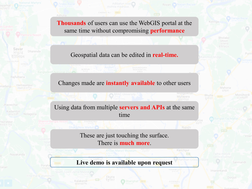
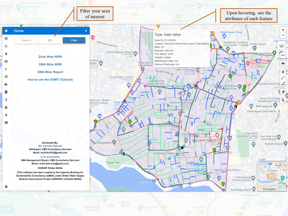
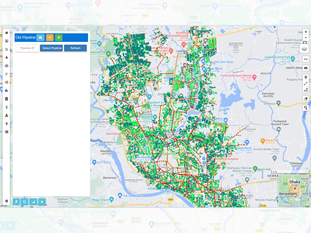
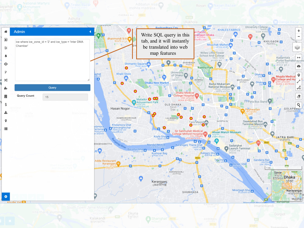
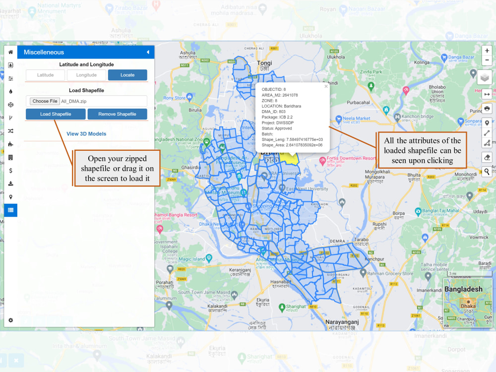
One of my most significant achievements is the development of Smart Water Management Tools (SWMT), a WebGIS-based software designed to revolutionize the District Metered Area (DMA) management system for Dhaka WASA, the largest water and sanitation service provider in Southeast Asia. SWMT is now the official DMA management software of Dhaka WASA and is being regularly used to manage assets which ensure water supply to more than 22 million people of Dhaka City. It seamlessly incorporates live data changes from thousands of users and facilitates real-time integration of field data collected through mobile applications, serving as a central repository for all geospatial data related to the organization.
Steps for completing your project
After purchasing the project, send requirements so Md Touhidur can start the project.
Delivery time starts when Md Touhidur receives requirements from you.
Md Touhidur works on your project following the steps below.
Revisions may occur after the delivery date.
Get Client's Requirement
After receiving all the data, I will have a clear understanding of your expected outcome from the geospatial data.
Design and Development
I will design and develop the WebGIS portal according to the expected outcome.