Hasem isn't taking new orders for this project right now. Here are some similar projects to explore.
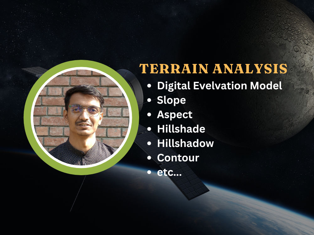
You will get a fantastic Terrain Analysis done using Python or ArcGIS Pro
Project details
You will get a 100% original work done by me. All the objectives will be covered with pin point accuracy. I like to update project progress time to time.
Programming Languages
PythonDesktop App Expertise
Application Setup & Installation, Development, Performance Optimization, Application Review & OptimizationWhat's included
| Service Tiers |
Starter
$150
|
Standard
$250
|
Advanced
$400
|
|---|---|---|---|
| Delivery Time | 1 day | 2 days | 4 days |
Number of Revisions | 1 | 3 | 5 |
Bug Investigation | |||
Source Code | |||
Database Integration | |||
Detailed Code Comments | - | ||
Fix Documentation | - |
Optional add-ons
You can add these on the next page.
Fast Delivery
+$50 - $100
Additional Revision
+$50
Detailed Code Comments
(+ 1 Day)
+$50About Hasem
Geospatial Data Scientist || Full Stack GIS Developer
Kolkata, India - 11:19 am local time
With over 6 years of hands-on experience, I specialize in delivering innovative GIS solutions for complex projects. My expertise spans across GIS analysis, WebGIS development, and Geospatial Data Science, consistently driving results and exceeding expectations.
I have a strong foundation in Python, JavaScript, and SQL, using these technologies to create efficient, scalable geospatial solutions. For front-end development, I use JavaScript and Vue.js or React.js to create seamless, user-friendly interfaces. My database expertise includes PostgreSQL/PostGIS for spatial data management, and I'm also proficient with DuckDB for additional data processing needs.
If you're looking for cutting-edge GIS solutions tailored to your project’s unique needs, I’m here to help you achieve success.
**Services**
1. GIS Analysis
-- Georeferencing and Digitization
-- Geoprocessing & Spatial Modelling
-- Cartography & Map production
-- Data Cleaning, Visualization & Interactive Mapping
-- Custom GIS Application Development
-- GIS Data Conversion
2. Remote Sensing
-- Automatic Satellite Image Collection
-- MOSIC, CLIP, False Color Composite, True Color Composite, etc..
-- Band Rationing (NDVI, NDWI, EVI, etc..) or Indices Calculation & Automation
-- Microwave Remote Sensing Services (ex - preprocessing, flood inundation mapping etc.).
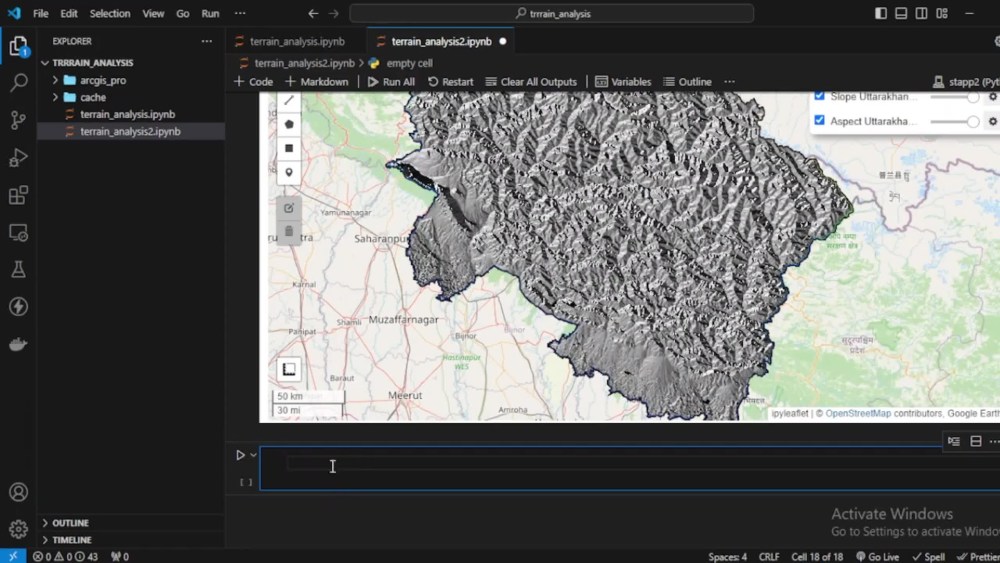
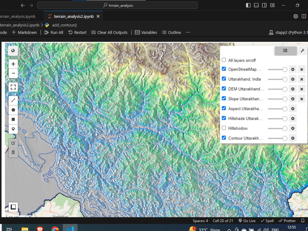
-- DEM, Terrain Analysis & Hydrology Analysis.
-- Lidar Data Analysis Services
3. GeoAI
-- Machine Learning Models for Geospatial Analysis
-- Image Classification & Object Detection using ML and AI
-- Feature Extraction from Satellite Images
-- Supervised Classification
-- Unsupervised Classification
4. Spatial Database Management
-- Spatial Database Design & Implementation
-- Data Modelling & Schema Development
-- Spatial Quarry & Non-Spatial Quarry
-- Performance Optimization & Spatial Indexing
5. .WebGIS
-- Web-based GIS applications using JavaScript and JS Framework.
-- Custom Web-GIS application based on objectives.
-- Map services integration (WMS, WTS etc..)
I look forward to connecting with you on your GIS projects. Feel free to reach out to me anytime!
Steps for completing your project
After purchasing the project, send requirements so Hasem can start the project.
Delivery time starts when Hasem receives requirements from you.
Hasem works on your project following the steps below.
Revisions may occur after the delivery date.
Data Collection
collection of the data that fit the best of the project objectives.
Data Preprocessing
Data cleaning and preprocessing and creation of ROI