You will get Demographic Analysis & Migration Heatmaps (maps)
Top Rated
Project details
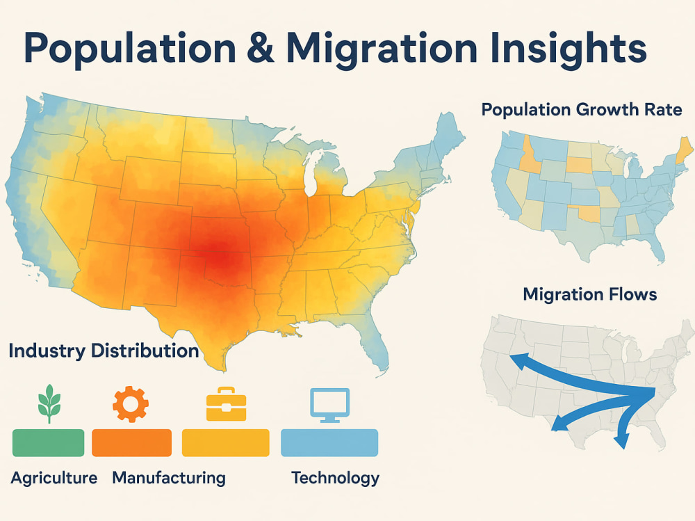
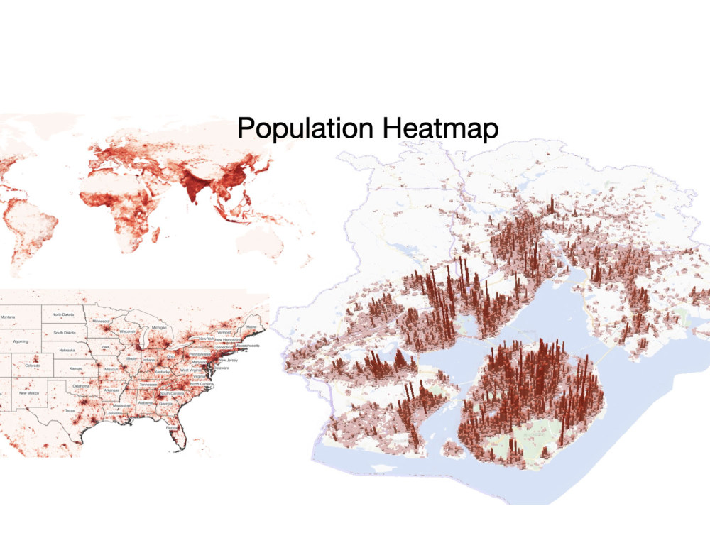
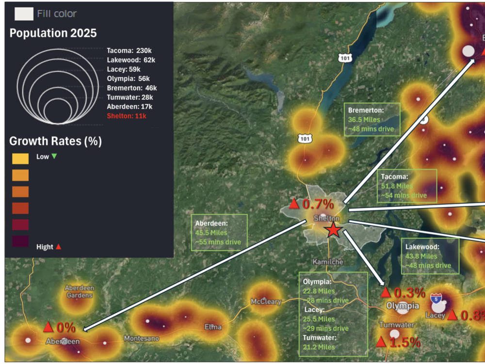
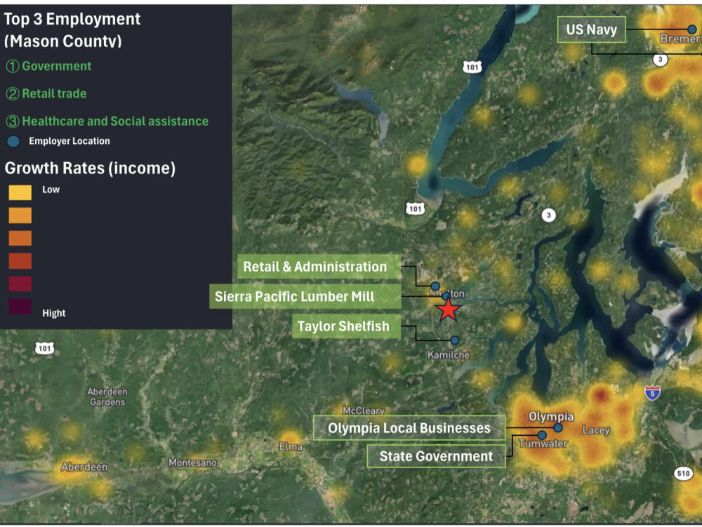
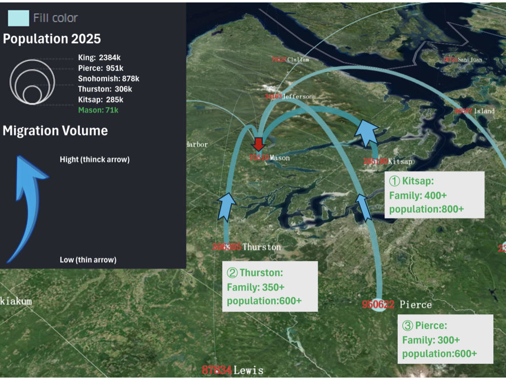
Generate detailed spatial reports on population data (population structure, density, growth rate, migration, etc.) for specific communities/cities/regions.Integrate Geographic Information System (GIS) data with census/open data to provide visual analysis of the region.
Data Tool
ArcGISWhat's included
| Service Tiers |
Starter
$9.90
|
Standard
$19.90
|
Advanced
$39.90
|
|---|---|---|---|
| Delivery Time | 2 days | 3 days | 3 days |
Number of Revisions | 1 | 1 | 1 |
Data Source Connectivity | - | - | - |
Web Embedding | - | - | - |
Interactive/Animated Visuals | - | - | - |
Optional add-ons
You can add these on the next page.
Fast Delivery
+$20
Additional Revision
+$10
4 reviews
(4)
(0)
(0)
(0)
(0)
This project doesn't have any reviews.
DH
Darwin H.
May 12, 2026
GIS data analyst
very resourceful and highly skilled. Quick turnaround and was able to understand our requirements precisely. She has demonstrated she is exceptional on GIS and will definitely collaborate again in future for more related projects.
She also communicates very well and respond punctually.
She also communicates very well and respond punctually.
JW
Jeffrey W.
Dec 17, 2025
Bay Area Demographic + Grocery Store GIS Mapping Project
CÁ
Carlos Á.
Oct 31, 2025
GIS specialist needed to create city GeoJSON files
Excellent communication, fast delivery, strongly recommend!
WZ
Wenjie Z.
Oct 6, 2025
3D City Map in White/Clay Model Style (Interactive)
Chen help me create an interactive map of US. She pays attention to detail and responds quickly. Thanks for your nice work !
About Chen
GIS Visualization & Spatial Data Analyst | Python Automation & GeoAI
100%
Job Success
Guangzhou, China - 2:22 am local time
My work includes:
• Parcel and land analysis
• Spatial relationship modeling
• Drive-time / accessibility analysis
• Interactive maps and dashboards
• GIS workflow automation
• Large-scale geospatial data processing
Recently, I developed a GIS automation tool for large-scale parcel and road relationship analysis in Australia. The system supports identifying frontage roads, parcel orientation, corner lots, and multi-road adjacency through rule-based spatial analysis workflows.
The solution was designed for practical use in real workflows, and packaged as a standalone application with batch processing and configurable parameters for non-technical users.
Core expertise:
* Spatial analysis and GIS data processing
* Map-based analysis and parcel-level studies
* Road-network and accessibility analysis
* Python-based geospatial automation
* Data preparation for mapping and reporting workflows
Tools & technologies:
Python, GeoPandas, QGIS, ArcGIS Pro, PostGIS, Pandas, Shapely, Jupyter Notebook
I also have experience building more advanced spatial rule-based systems that bridge traditional GIS analysis with emerging geospatial intelligence workflows (GeoAI concepts), especially in structured spatial relationship modeling.
Steps for completing your project
After purchasing the project, send requirements so Chen can start the project.
Delivery time starts when Chen receives requirements from you.
Chen works on your project following the steps below.
Revisions may occur after the delivery date.
Communicate
Communicate with customers to understand their needs
Mapping
Make a map as required