You will get a webGIS application seasoned with experience
Project details
I have a focused expertise in:
Developing engaging web-based mapping applications and geo portals.
Automating and tailoring ArcGIS and QGIS solutions to meet specific requirements.
Developing engaging web-based mapping applications and geo portals.
Automating and tailoring ArcGIS and QGIS solutions to meet specific requirements.
Programming Languages
PHP, HTML & CSS, JavaScriptCoding Expertise
Cross Browser & Device Compatibility, Performance Optimization, DesignWhat's included $50
These options are included with the project scope.
$50
- Delivery Time 3 days
- Number of Revisions Unlimited
- Number of Pages 9
- Design Customization
- Content Upload
- Responsive Design
- Source Code
About Sarah
Professional GIS and Remote Sensing expert
Islamabad, Pakistan - 4:33 am local time
Proficiency in software such as ArcMap, ArcGIS Pro, ERDAS Imagine, eCognition, SNAP, QGIS, and ArcGIS Online.
1:Specialization in GIS mapping techniques.
2:Expertise in both object-based and pixel-based image classification.
3:Experience in preprocessing and mapping using Sentinel-1 data.
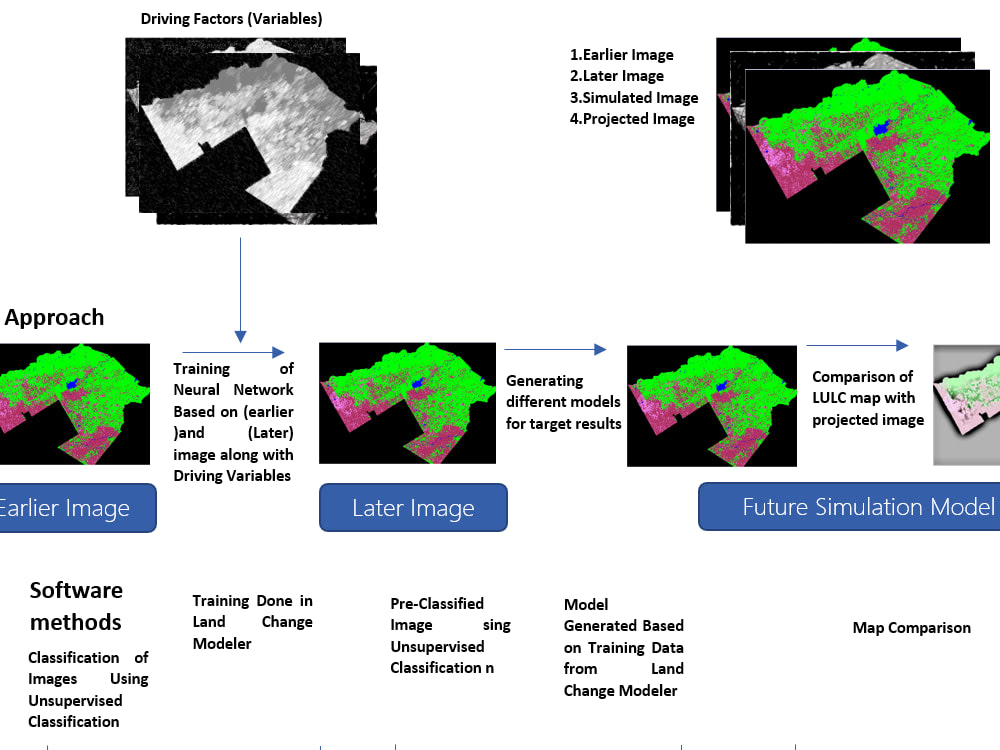
4:Proficient in creating Land Use and Land Cover (LULC) maps.
5:Extensive knowledge of study area selection and analysis.
6:Skilled in geospatial analysis methods.
7:Capability in designing and utilizing Esri StoryMaps.
8:Proficient in developing GIS interactive dashboards using HTML, CSS, Leaflet, and JavaScript.
My background and skills make me a valuable asset for remote sensing and GIS projects, whether involving data analysis, mapping, or interactive data visualization.
My services include:
=>Collecting and analyzing spatial data using a range of GIS and remote sensing tools
Creating maps, charts, and other visual representations of data to help you make informed decisions
Developing custom workflows and processes to ensure accurate and efficient data analysis
Providing detailed reports and presentations that clearly communicate key findings and recommendations
=Whether you're working in environmental science, urban planning, or any other field that requires accurate spatial data analysis, I can provide you with the expertise and skills you need to succeed. With my attention to detail and commitment to quality, you can be sure that you will receive the highest level of service and support.
Contact me today to learn more about how I can help you with your GIS and remote sensing needs!
Steps for completing your project
After purchasing the project, send requirements so Sarah can start the project.
Delivery time starts when Sarah receives requirements from you.
Sarah works on your project following the steps below.
Revisions may occur after the delivery date.
Open to Client