You will get Accessibility Modeling and GIS Website
Project details
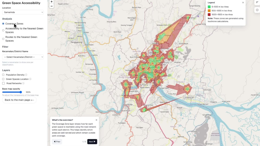
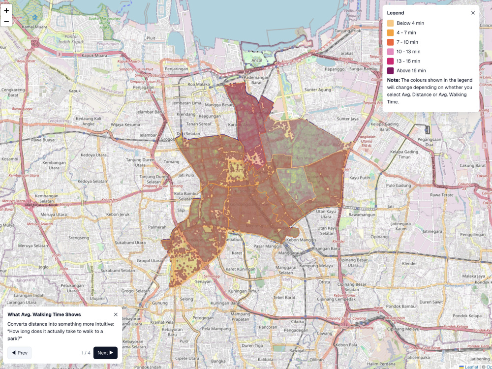
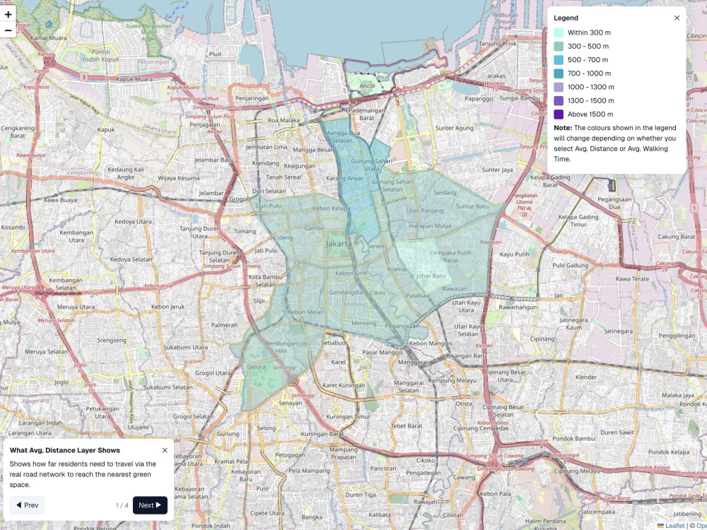
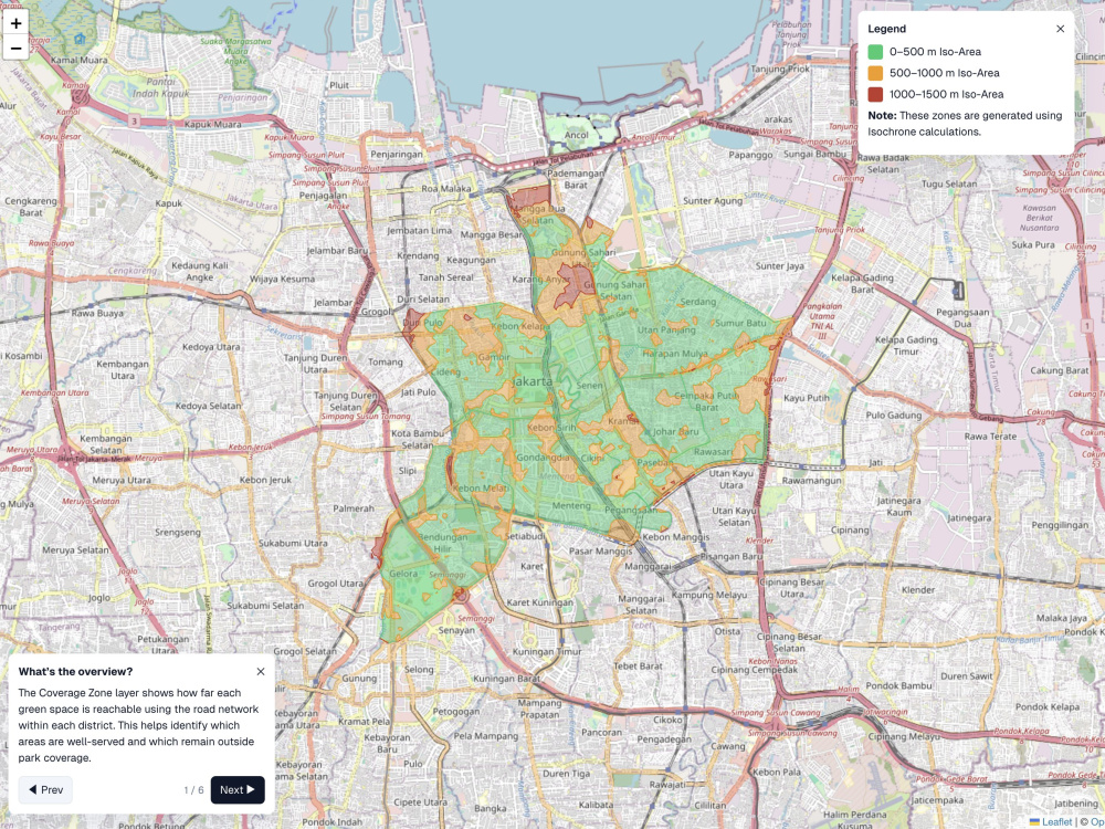
You will get a complete, urban accessibility map built from raw spatial data. I combine GIS data processing, analysis, and modern web mapping to deliver clear, actionable visualisations tailored to your needs.
Programming Languages
HTML & CSS, JavaScript, PythonCoding Expertise
Cross Browser & Device Compatibility, DesignWhat's included
| Service Tiers |
Starter
$300
|
Standard
$700
|
Advanced
$1,500
|
|---|---|---|---|
| Delivery Time | 5 days | 10 days | 20 days |
Number of Revisions | 1 | 2 | 2 |
Design Customization | - | - | |
Content Upload | - | - | - |
Responsive Design | |||
Source Code |
Optional add-ons
You can add these on the next page.
Additional Revision
+$500About Nasywa
Data Engineer
Jakarta, Indonesia - 7:09 pm local time
stakeholders based in Indonesia and Singapore. Most recently, I have been focused on developing a national data-driven policymaking system that integrates socioeconomic, spatial, and fiscal data.
Steps for completing your project
After purchasing the project, send requirements so Nasywa can start the project.
Delivery time starts when Nasywa receives requirements from you.
Nasywa works on your project following the steps below.
Revisions may occur after the delivery date.
User Requirement on the Metrics and Visualization
GIS Data Preprocessing