You will get an automated backend tool built using satellite data, ML and Python.


Project details
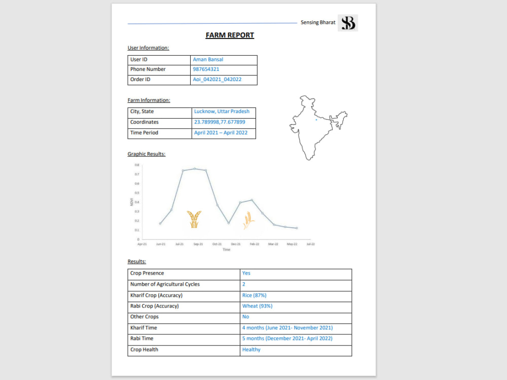
Simple to understand automized code for farm monitoring in any part of the world using open-source satellite data. Produces a report in pdf which has text and graphics describing the status of the crop on the farm. Covers parameters like crop presence, crop type, and number of crop cycles.
Machine Learning Tools
pandas, Python, Python Scikit-Learn, PyTorch, SciPyWhat's included $70
These options are included with the project scope.
$70
- Delivery Time 1 day
- Number of Revisions 1
- Number of Model Variations 2
- Number of Scenarios 0
- Number of Graphs/Charts 2
- Model Validation/Testing
- Model Documentation
- Data Source Connectivity
- Source Code
About Harshit
Remote Sensing scientist | Geospatial expert | Backend tool developer
Delhi, India - 11:51 pm local time
◦ I build robust geospatial layers and automated backend tools using Optical data, SAR data, ML and Python.
◦ I integrate remote sensing technologies to monitor and optimize crop type, crop health, crop cycles fostering sustainable agricultural practices. ML models in Python for crop yield prediction.
◦ Contact if project requires analysis of satellite data.
Steps for completing your project
After purchasing the project, send requirements so Harshit can start the project.
Delivery time starts when Harshit receives requirements from you.
Harshit works on your project following the steps below.
Revisions may occur after the delivery date.
Use the code
The client reviews and approves the code
Purchase
The client purchases the project and sends requirements.