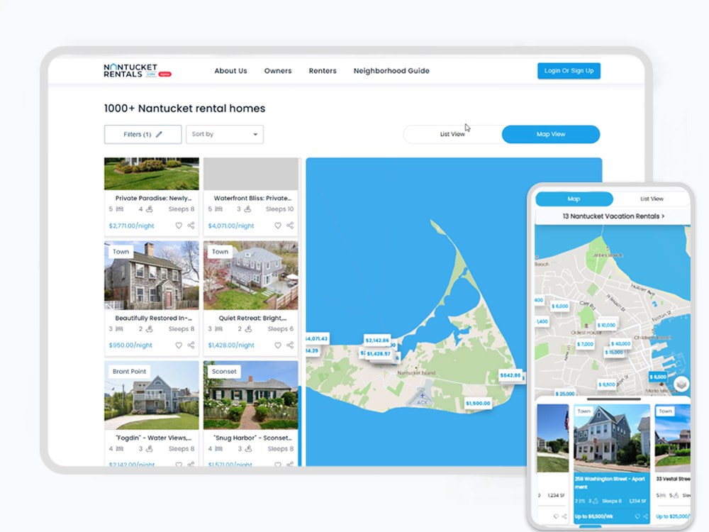
You will get an interactive web map for your website
Top Rated
Project details
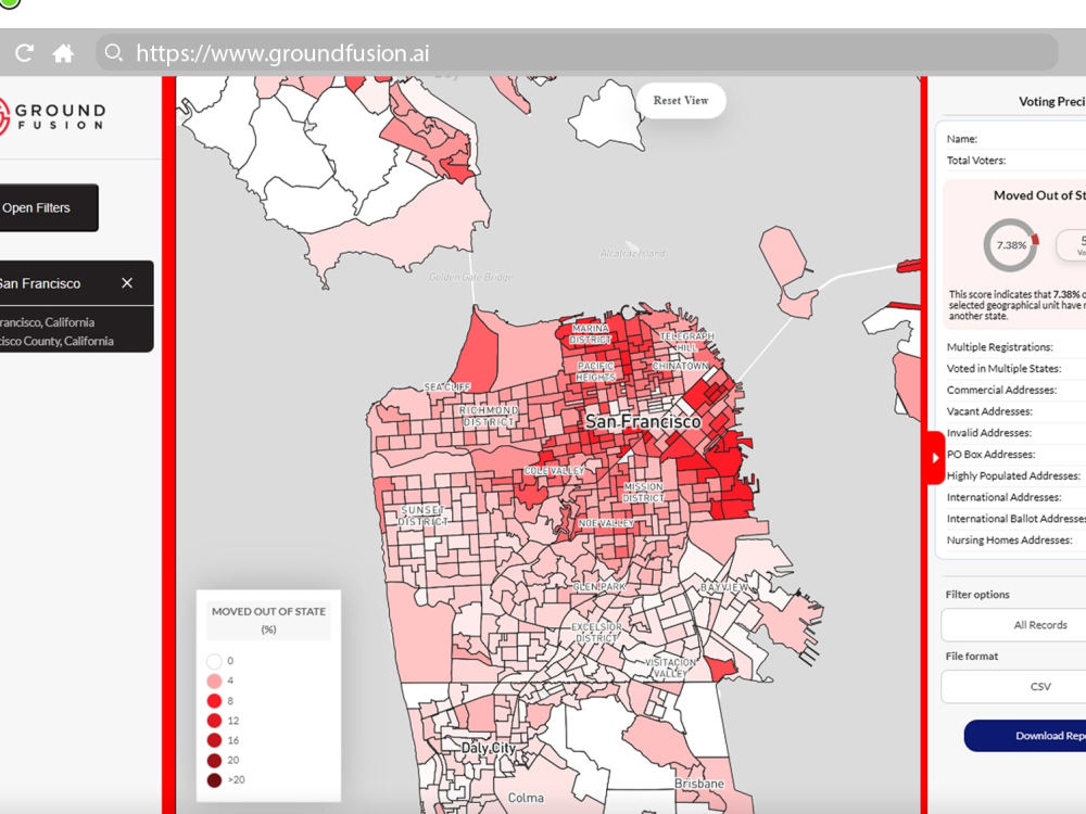
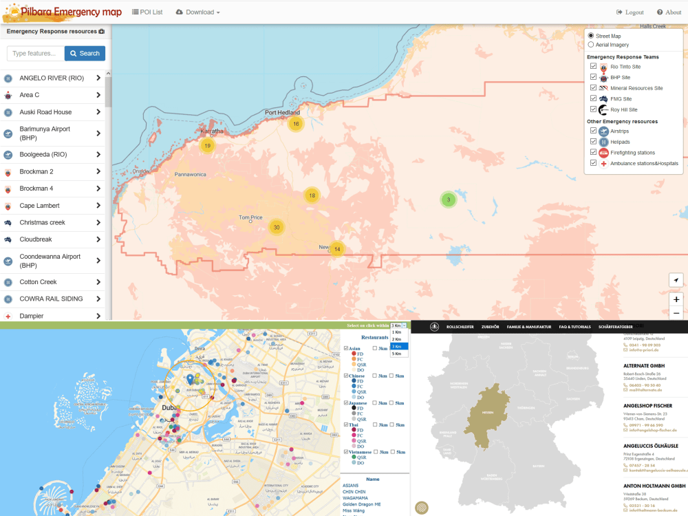
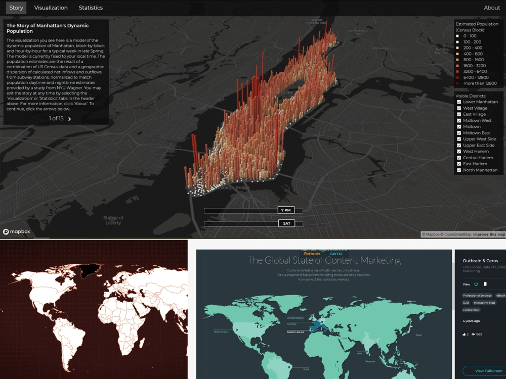
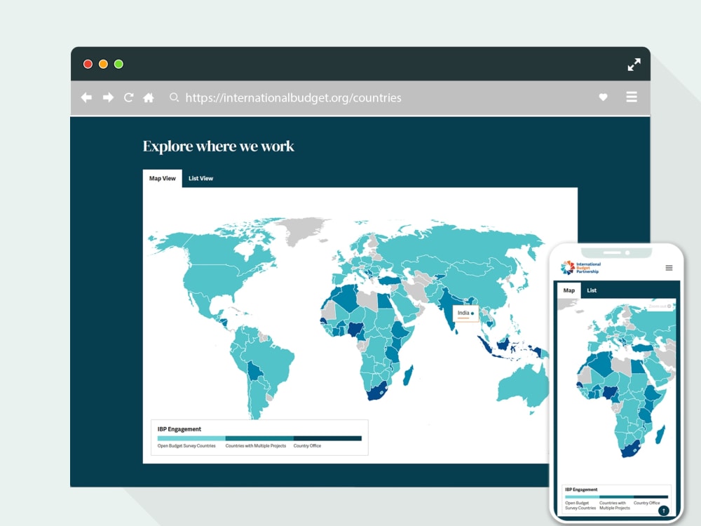
I build interactive web maps and geospatial web applications that help visualize and explore complex datasets.
This can include anything from simple embedded maps to advanced mapping applications with custom layers, filtering, analytics, and data-driven visualizations.
I work with modern web technologies and mapping APIs to create fast, responsive, and scalable solutions that integrate seamlessly into existing websites or standalone platforms.
The solution can be tailored to many use cases such as location-based services, research projects, environmental data, business analytics, public information portals, or custom GIS dashboards.
Programming Languages
HTML & CSS, JavaScript, TypeScriptCoding Expertise
Cross Browser & Device Compatibility, Performance Optimization, DesignWhat's included
| Service Tiers |
Starter
$1,500
|
Standard
$3,000
|
Advanced
$6,000
|
|---|---|---|---|
| Delivery Time | 2 days | 6 days | 12 days |
Number of Revisions | 2 | 3 | 5 |
Number of Pages | 1 | 2 | 6 |
Design Customization | - | ||
Content Upload | |||
Responsive Design | |||
Source Code |
67 reviews
(64)
(2)
(0)
(1)
(0)
This project doesn't have any reviews.
BR
Bernhard R.
May 21, 2026
30 minute consultation
JM
James M.
Apr 20, 2026
Google Maps Integration
Boris recommended and executed an excellent solution for our needs. He far exceeded our expectations.
DP
David P.
Feb 4, 2026
Website development on mapping - religious mapbox
JS
Jim S.
Aug 19, 2025
Continuation of GIS Web App Development
Boris is an extremely talented GIS web developer and an asset to any dev team.
MK
Matti K.
Jun 11, 2024
Mapbox GIS Web App Development
About Boris
Full-Stack GIS Engineer | Maps | React | Mapbox | PostGIS | AWS
100%
Job Success
Tucepi, Croatia - 3:14 am local time
𝐅𝐫𝐨𝐧𝐭𝐞𝐧𝐝 𝐓𝐨𝐨𝐥𝐬
• React, Next.js, TypeScript, Tailwind CSS, Styled Components, Canvas API, Redux, WebSockets, Expo, Jest
𝐌𝐚𝐩𝐩𝐢𝐧𝐠 𝐋𝐢𝐛𝐫𝐚𝐫𝐢𝐞𝐬 𝐚𝐧𝐝 𝐓𝐨𝐨𝐥𝐬
• Mapbox, MapLibre, Turf.js, Leaflet.js, Routing APIs, Google Maps API, ArcGIS SDK, OpenLayers, Cesium, deck.gl, Maputnik, GDAL, TileServer GL, Tippecanoe
𝐁𝐚𝐜𝐤𝐞𝐧𝐝
• Node.js, Express.js, Jest, LLM integration and MCP APIs
• Python/Django (intermediate)
𝐃𝐚𝐭𝐚𝐛𝐚𝐬𝐞
• PostgreSQL(PostGIS), MongoDB, MySQL, Snowflake, Prisma ORM
𝐃𝐞𝐯𝐎𝐩𝐬, 𝐂𝐥𝐨𝐮𝐝 & 𝐈𝐧𝐟𝐫𝐚𝐬𝐭𝐫𝐮𝐜𝐭𝐮𝐫𝐞
• Cloud: AWS (EC2, S3, CDN, SQS), Vercel, Heroku, Netlify, Render
• Infra & CI/CD : Docker, Redis, NGINX, CI/CD Pipelines
𝐕𝐞𝐫𝐬𝐢𝐨𝐧 𝐂𝐨𝐧𝐭𝐫𝐨𝐥
• Git, GitHub, GitLab
𝐃𝐞𝐬𝐤𝐭𝐨𝐩 𝐒𝐭𝐚𝐜𝐤
• QGIS, ArcGIS Pro
• Adobe Photoshop and Illustrator (intermediate)
𝐀𝐫𝐞𝐚𝐬 𝐨𝐟 𝐄𝐱𝐩𝐞𝐫𝐭𝐢𝐬𝐞
• Design systems & component-driven React development with UI/UX, Agile workflows
• End-to-end interactive map & GIS application development
• Self-hosted basemaps, vector & raster tile pipelines
• Navigation & live-tracking & routing map features
• Thematic & topographic map design
• High-accuracy geocoding & spatial analysis
• Geospatial formats: GeoJSON, 3D-Tiles, PMTiles, MBTiles, KML, TopoJSON, Shapefile, GeoTIFF, WKT...
• OSM and Census data integration
• 2D / 3D map animations and storytelling
I believe that quality is the key to a job well done. I always try to work as quickly as possible and efficiently. With that said, I can state I give my best to make my clients happy.🤝
Steps for completing your project
After purchasing the project, send requirements so Boris can start the project.
Delivery time starts when Boris receives requirements from you.
Boris works on your project following the steps below.
Revisions may occur after the delivery date.
Project description
Give me a detailed description of what you want me to create. The more details you give me, the better the final product will be.
Data agreement
You will send me all the data and I will review it. We will discuss the possible need for collecting/creating more data.