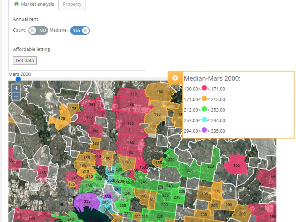
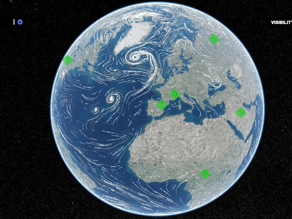
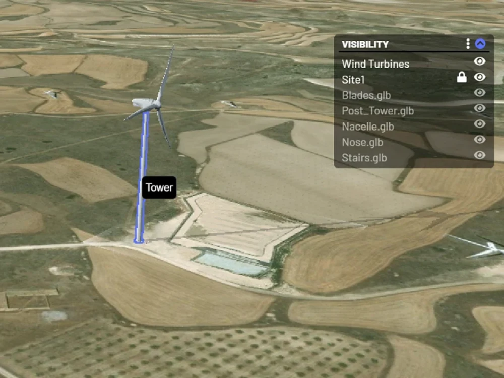
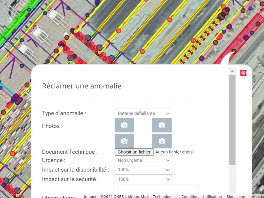
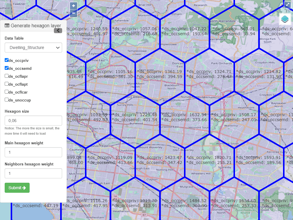
You will get beautiful 2D & 3D interactive maps Of your data
Top Rated

Top Rated
Project details
You will get beautiful maps that will allow you to watch and analyze your data easily. With over 6 years of experience in GIS, I care deeply about details. Your data can be in any format(excel, CSV, text, SHP...) The work I deliver is 100% original and high quality.
Programming Languages
HTML & CSS, JavaScriptCoding Expertise
Performance Optimization, Security, DesignWhat's included
| Service Tiers |
Starter
$200
|
Standard
$600
|
Advanced
$2,500
|
|---|---|---|---|
| Delivery Time | 5 days | 10 days | 20 days |
Number of Revisions | 1 | 1 | 1 |
Number of Pages | 1 | 1 | 1 |
Design Customization | |||
Content Upload | |||
Responsive Design | |||
Source Code |
9 reviews
(8)
(1)
(0)
(0)
(0)
This project doesn't have any reviews.
HF
Harrison F.
Dec 6, 2024
Developer Needed for Custom Web-Based Geospatial Visualization Using Open Source Library
It was a pleasure working with Mohssine! He's professional, communicative, and very capable.
GD
Guillermo D.
Apr 22, 2024
30 minute consultation
Excellent professional.
MB
Mouna B.
Apr 16, 2024
Heatmaps for Gilead
Collaborating with Mohssine was truly delightful. His professionalism, responsiveness, proactive approach, and work quality are commendable. I engaged him to develop heat maps for a client, and despite evolving data, he remained flexible and adept at proposing solutions to meet each client request. I highly recommend him.
MS
Matt S.
Apr 11, 2024
30 minute consultation
Mohssine is brilliant at what he does. Really great conversation and got a good idea of scope of work. I am looking forward to working with and learning from Mohssine.
AK
Andrew K.
Mar 19, 2024
Back-End GIS Software Engineer
Mohssine was a pleasure to work with. He was willing to go beyond his skill set and learn and implement newly learned technologies. It seemed like he really cared about the product and team. Thanks for your hard work Mohssine!
About MOHSSINE
GIS Developer || AI specialist || Map expert || MVP || SAAS
100%
Job Success
Sale, Morocco - 11:29 am local time
I am GIS and AI specialist for more than 10 years, I possess a solid foundation in programming languages such as Python and JavaScript, along with expertise in geospatial analysis, data management, and web mapping technologies. My ability to effectively communicate and collaborate with cross-functional teams, combined with my strong problem-solving and analytical skills, enables me to deliver high-quality results and contribute to the success of GIS projects. I am confident that my skills and passion for GIS make me a valuable asset to your team
⭐My strengths and skills :
✅Full Stack Development: Proficient in both front-end and back-end development, including HTML, CSS, JavaScript, and frameworks like React, Angular, or Vue.js for building user interfaces. They also have experience with server-side technologies like Node.js, Laravel, or Django for building robust APIs and handling data processing.
✅Geospatial Expertise: In-depth knowledge of GIS principles, spatial databases (e.g., PostGIS), and geospatial data formats (e.g., GeoJSON, Shapefile). They understand coordinate systems, map projections, and spatial analysis techniques.
✅Web Mapping Technologies: Familiarity with popular web mapping libraries and frameworks such as Leaflet, OpenLayers, Mapbox GL JS, or Google Maps API. They can create interactive and visually appealing web mapping applications.
✅Database Management: Proficient in working with relational databases (e.g., PostgreSQL, MySQL) and spatial databases (e.g., PostGIS) for efficient storage and retrieval of geospatial data. They can design database schemas, perform spatial queries, and optimize database performance.
✅Data Visualization: Skilled in visualizing geospatial data using charting libraries like D3.js or Plotly. They can create intuitive and informative data visualizations, including maps, charts, and graphs.
✅Spatial Analysis and Modeling: Capable of performing advanced spatial analysis tasks such as buffering, overlaying, network analysis, and geoprocessing. They can develop spatial models using tools like ArcGIS, QGIS, or GeoTools.
geospatial AI
satellite imagery analysis
LiDAR classification
Precision agriculture
Location intelligence
Geospatial Machine Learning
LiDAR Processing
Agricultural Technology
Location Intelligence
✅Problem-Solving and Analytical Skills: Strong analytical thinking and problem-solving abilities, enabling them to address complex spatial challenges and develop innovative solutions using GIS and programming techniques.
✅Communication and Collaboration: Excellent communication skills to effectively collaborate with cross-functional teams, stakeholders, and clients. They can translate technical concepts into understandable terms and work in agile development environments.
⭐Technologies :
✅Geographic Information Systems (GIS) Software: ArcGIS, QGIS, MapInfo.
✅Spatial Databases: PostgreSQL with PostGIS, Oracle Spatial, Microsoft SQL Server.
✅Programming Languages: Python, JavaScript, SQL
✅Web Mapping Libraries: Leaflet, OpenLayers, Mapbox GL JS,CesiumJs, Potree
✅GIS APIs: Google Maps API, ArcGIS API for JavaScript, Mapbox API.
✅Front-end Frameworks: React
✅Back-end Frameworks: Node.js, Django, Laravel, Geoserver
✅Data Visualization: D3.js, Plotly, Tableau.
✅Geospatial Analysis: GDAL PDAL rasterio TurfJs Geopandas
✅Spatial ETL (Extract, Transform, Load): FME
✅Version Control: Git, GitHub, Bitbucket.
✅Cloud Computing: Amazon Web Services (AWS), Google Cloud Platform (GCP), Microsoft Azure.
✅Mobile Development: ionic, ReactJs
✅Containerization: Docker, Kubernetes.
✅Data Formats: GeoJSON, Shapefile, KML,KML, GeoTIFF, vector tiles
Geographic Information Systems (GIS)
Python
JavaScript
SQL
Spatial databases
PostGIS
GeoJSON
Shapefile
Leaflet
OpenLayers
Mapbox
Google Maps API
ArcGIS
QGIS
Remote Sensing
Data Visualization
Data Analysis
Cartography
Geocoding
Geoprocessing
Web Mapping
Spatial Analysis
Spatial Data Management
GIS Programming
API Integration
Database Management
Data Modeling
Data Extraction
Data Transformation
Data Integration
Geospatial Analysis
Network Analysis
Routing Algorithms
Overlay Analysis
Geostatistics
Data Mining
Data Interoperability
Georeferencing
Geodatabase
Geospatial Web Services
Geometric Networks
Spatial Indexing
Satellite Imagery
LiDAR
GPS
Topology
Web Development
Front-end Development
Back-end Development
HTML
CSS
React
Angular
Vue.js
Node.js
RESTful APIs
Data Visualization Libraries (D3.js, Plotly)
Big Data
Cloud Computing
Docker
Image Processing
Spatial Data Infrastructure (SDI)
Metadata Management
Web Services (WMS, WFS, WCS)
Spatial ETL (Extract, Transform, Load)
Mobile Development
iOS
Android
Spatial Decision Support Systems (SDSS)
Geospatial Analytics
Asset Management
Web Scraping
Steps for completing your project
After purchasing the project, send requirements so MOHSSINE can start the project.
Delivery time starts when MOHSSINE receives requirements from you.
MOHSSINE works on your project following the steps below.
Revisions may occur after the delivery date.
1. Exchange the need of the application.
2. Prepare mock ups.