You will get Build Enterprise Agentic AI Solution
Project details
Transform your GIS into an intelligent, AI-powered decision support platform.
I help organizations build Autonomous GIS solutions that combine Geospatial Intelligence, Agentic AI, Large Language Models (LLMs), Enterprise Data Integration, and Spatial Analytics to automate complex workflows and accelerate decision-making.
Unlike traditional GIS systems that require users to navigate layers, tools, and workflows manually, Autonomous GIS enables users to interact using natural language, allowing AI agents to analyze data, generate maps, perform spatial analysis, retrieve information, and recommend actions automatically.
### What I Can Help You Build
✔ Agentic AI-powered GIS Assistants
✔ Natural Language GIS Query Systems
✔ Autonomous GIS Platforms
✔ AI-Driven Spatial Analysis Workflows
✔ ArcGIS Enterprise AI Integration
✔ Groundwater Intelligence Platforms
✔ Remote Sensing & Geospatial AI Solutions
✔ Enterprise Knowledge Assistants (RAG)
✔ AI-Powered Decision Support Systems
✔ Multi-Agent Geospatial Intelligence Systems
I help organizations build Autonomous GIS solutions that combine Geospatial Intelligence, Agentic AI, Large Language Models (LLMs), Enterprise Data Integration, and Spatial Analytics to automate complex workflows and accelerate decision-making.
Unlike traditional GIS systems that require users to navigate layers, tools, and workflows manually, Autonomous GIS enables users to interact using natural language, allowing AI agents to analyze data, generate maps, perform spatial analysis, retrieve information, and recommend actions automatically.
### What I Can Help You Build
✔ Agentic AI-powered GIS Assistants
✔ Natural Language GIS Query Systems
✔ Autonomous GIS Platforms
✔ AI-Driven Spatial Analysis Workflows
✔ ArcGIS Enterprise AI Integration
✔ Groundwater Intelligence Platforms
✔ Remote Sensing & Geospatial AI Solutions
✔ Enterprise Knowledge Assistants (RAG)
✔ AI-Powered Decision Support Systems
✔ Multi-Agent Geospatial Intelligence Systems
AI Algorithms
Large Language ModelAI Applications
AI Chatbot, AI Mobile App Development, AI Text-to-Image, AI Text-to-Speech, AI-Generated Code, Conversational AI, Image Processing, Natural Language Generation, Natural Language Understanding, Object Detection, Text RecognitionAI Development Language
PythonAI Tools
Hugging Face, Microsoft CNTK, PyTorch, Replit, TensorFlow, Word2vecAI Models
ChatGPT, LLaMA, OpenAI CodexWhat's included
| Service Tiers |
Starter
$5,000
|
Standard
$25,000
|
Advanced
$50,000
|
|---|---|---|---|
| Delivery Time | 1 day | 15 days | 30 days |
AI Model Integration | |||
Batch Normalization | - | - | - |
Database Integration | |||
Detailed Code Comments | - | - | - |
Image Upscaling | - | - | - |
MLOps | - | - | - |
Model Deployment | - | - | - |
Model Documentation | - | - | - |
Model Monitoring | - | - | - |
Model Testing & Optimization | - | - | - |
Model Tuning | - | - | - |
Natural Language Processing | |||
NLP Tokenization | - | - | - |
Pre-Training | - | - | - |
Prompt Engineering | |||
Setup File | - | - | - |
Source Code | - | - | - |
About Qaiser
Principal AI & Geospatial Architect | Agentic AI | ArcGIS | GeoAI
Khobar, Saudi Arabia - 2:29 pm local time
I bring 20+ years of experience delivering enterprise-scale solutions for some of the world's largest organizations, including Saudi Aramco, ADNOC, and Schlumberger.
My expertise combines Artificial Intelligence, Large Language Models (LLMs), Retrieval-Augmented Generation (RAG), AI Agents, ArcGIS Enterprise, Remote Sensing, Groundwater Intelligence, and Enterprise Architecture to solve high-value business challenges.
What makes me different is my ability to bridge business strategy, domain expertise, enterprise architecture, and hands-on implementation.
I don't just build AI systems.
I design intelligent platforms that automate analysis, accelerate decision-making, and generate measurable business value.
Core Areas of Expertise:
✔ Agentic AI & Multi-Agent Systems
✔ Autonomous GIS Platforms
✔ Enterprise RAG Solutions
✔ AI Assistants & Knowledge Systems
✔ Geospatial AI & Spatial Intelligence
✔ ArcGIS Enterprise Architecture
✔ Groundwater Intelligence Platforms
✔ Oil & Gas Digital Transformation
✔ Mining Intelligence Solutions
✔ Remote Sensing & Computer Vision
✔ Data Science & Machine Learning
✔ Enterprise System Architecture
Representative Projects:
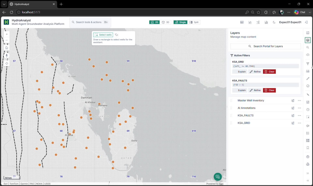
• Designed and developed an Autonomous GIS platform that converts natural-language instructions into geospatial analysis workflows and map generation.
• Developed enterprise geological knowledge assistants using Large Language Models and Multimodal Retrieval-Augmented Generation.
• Led digital transformation initiatives involving geospatial governance, enterprise data platforms, analytics, and AI-driven decision support.
• Delivered national-scale groundwater information systems and decision-support platforms across the Middle East, Africa, and Asia.
• Developed AI-powered remote sensing solutions for environmental monitoring, water resources management, land-cover classification, and offshore seep detection.
If you are looking for a consultant who understands both AI and complex industry domains such as Energy, Groundwater, Mining, Oil & Gas, and Geospatial Systems, I can help.
Steps for completing your project
After purchasing the project, send requirements so Qaiser can start the project.
Delivery time starts when Qaiser receives requirements from you.
Qaiser works on your project following the steps below.
Revisions may occur after the delivery date.
Discovery & Requirement Review
I will review your objectives, data, existing systems, workflows, and technical constraints.
Solution Architecture
I will design the recommended AI/GIS architecture, including tools, data flow, integrations, and implementation roadmap.