You will get Convert Blueprints and Floor Plans into GIS Indoor Maps
Rising Talent
Project details
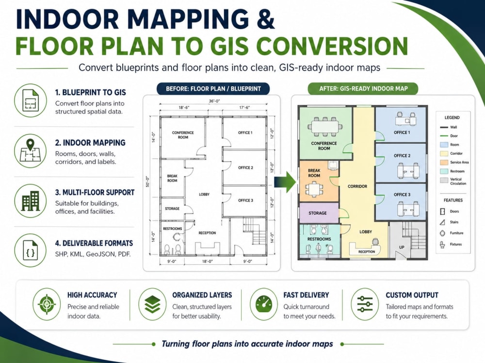
I will convert your blueprints, floor plans, or building layouts into clean, organized, and GIS-ready indoor maps. I can digitize rooms, walls, corridors, doors, stairs, elevators, labels, and other indoor features, then deliver the final output in formats such as SHP, KML, GeoJSON, PDF, PNG, or QGIS/ArcGIS project files. My focus is on accuracy, clean layers, and professional indoor mapping outputs that are easy to use for planning, facility management, navigation, or documentation.
Data Tool
ArcGISWhat's included
| Service Tiers |
Starter
$20
|
Standard
$45
|
Advanced
$80
|
|---|---|---|---|
| Delivery Time | 2 days | 3 days | 6 days |
Number of Revisions | 1 | 2 | 3 |
Number of Pages Mined/Scraped | 1 | 3 | 5 |
Number of Sources Mined/Scraped | 1 | 2 | 3 |
Optional add-ons
You can add these on the next page.
Additional Page Mined/Scraped
(+ 2 Days)
+$15Frequently asked questions
About Zohra
GIS Specialist | ArcGIS, QGIS, Remote Sensing & Spatial Data Analysis
Gilgit, Pakistan - 12:29 am local time
My work focuses on precision, consistency, and efficiency. I have contributed to national-level GIS projects, including Indonesia’s One Map Policy and national statistical mapping, where data accuracy, topology correction, and standardized spatial outputs were critical.
One of my key strengths is handling high-volume GIS production tasks without compromising quality. For example, I successfully resolved 20,000+ building topology errors in a single week, ensuring clean and usable building datasets for further analysis and mapping.
🔹 Major Projects I Have Worked On
✅ High-accuracy building digitization from satellite imagery and aerial data
✅ Spatial data cleaning and topology correction for large-scale building datasets
✅ Indonesia One Map Policy-related GIS data preparation and standardization
✅ National statistical mapping and boundary data validation
✅ Indoor mapping from blueprints and floor plans
✅ Urban mapping and land-use data digitization
✅ Conversion of raw imagery and scanned maps into SHP, KML, and GeoJSON formats
✅ Geospatial database preparation for analysis, visualization, and reporting
🛠️ Tools & Formats
I have hands-on experience working with QGIS, ArcGIS, Google Earth, SHP, KML, GeoJSON, and spatial databases. I also bring data science knowledge to GIS workflows, allowing me to support projects involving spatial analysis, data validation, automation, and structured reporting.
📌 I Can Help You With
✅ GIS digitization and mapping
✅ Spatial data cleaning and quality control
✅ Topology error correction
✅ Satellite imagery interpretation
✅ Blueprint/floor plan to GIS conversion
✅ SHP, KML, GeoJSON creation and conversion
✅ Urban and indoor mapping
✅ Large-scale geospatial data processing
✅ GIS data validation and standardization
If you need accurate, clean, and well-structured GIS data delivered efficiently, I can help turn your raw spatial information into reliable mapping outputs.
Steps for completing your project
After purchasing the project, send requirements so Zohra can start the project.
Delivery time starts when Zohra receives requirements from you.
Zohra works on your project following the steps below.
Revisions may occur after the delivery date.
Review floor plans and requirements
Digitize indoor map features