You will get Custom Web GIS Applications | Mapbox, Leaflet, Spatial Data & Analytics
Project details
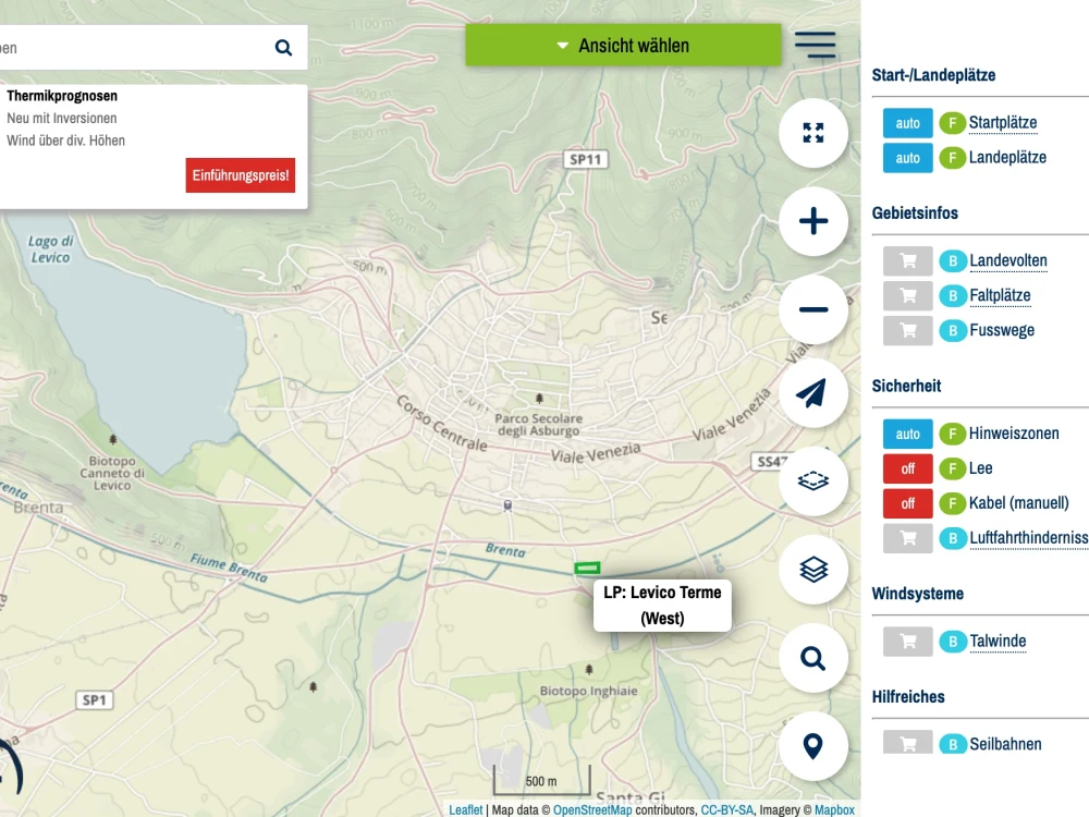
I will deliver a custom, production-ready Web GIS application built with modern technologies such as React, Node.js, NestJS, PostGIS, Mapbox, Leaflet, and GeoServer. With 14+ years of experience developing high-performance geospatial systems for global clients, I specialize in building fast, scalable, and visually intuitive GIS platforms.
Your solution will include interactive maps, custom data layers, spatial analytics, responsive UI, clean system architecture, and secure backend APIs. I follow a structured development process with clear communication, regular updates, and on-time delivery—backed by excellent client feedback and proven results.
Whether you need a GIS dashboard, location-based platform, real-time tracking system, spatial analysis tool, or enterprise-grade GIS solution, I will build a robust system tailored precisely to your requirements.
Programming Languages
HTML & CSS, JavaScriptCoding Expertise
Cross Browser & Device Compatibility, Performance Optimization, SecurityWhat's included
| Service Tiers |
Starter
$1,000
|
Standard
$5,000
|
Advanced
$10,000
|
|---|---|---|---|
| Delivery Time | 7 days | 15 days | 30 days |
Number of Revisions | 2 | 3 | 4 |
Number of Pages | 3 | 8 | 12 |
Design Customization | - | ||
Content Upload | - | ||
Responsive Design | |||
Source Code |
Optional add-ons
You can add these on the next page.
Custom Map Design & Styling
(+ 5 Days)
+$500
API Development (REST / GeoServer)
(+ 10 Days)
+$800
Mobile App Version (Flutter / React Native)
(+ 10 Days)
+$1,500Frequently asked questions
38 reviews
(37)
(0)
(1)
(0)
(0)
This project doesn't have any reviews.
VM
Victor M.
Mar 13, 2026
Skewset Infrastructure GIS Web Application
Abid Nawaz was engaged during a critical period to build a complex custom application. He exhibited tolerance, going beyond expectation and provided flexibility that helped us satisfy the end goal. His communication skills are great and availability despite being outside my timezone was remarkable. Totally happy to recommend him to someone needing GIS expertise.
AR
Adnan R.
Aug 23, 2019
iOS Native Developer
Easy to work with, very cooperative, excellent coding skills.
NB
Nancy B.
Mar 4, 2019
Google Map or Mapbox specialist
Abid is the professional that will restore your faith in all freelancers. Abid showed me how to easily prepare the project I needed, myself. He spent his time going over my project with a fine toothed comb and found the perfect solution I could implement easily. His honesty caused him not to have a project to build! And he lost an agreed upon $200 contract we had established! This kind of integrity needs to be commended. So I insisted he take the contract so I could give him a small bonus, but more importantly - leave this review. Abid. I can NOT thank you enough for your very kind professionalism. I look forward to working with you on future projects.
BH
Bernie H.
Feb 25, 2019
Create Web-Map from QGIS Data
Abid did the second project for me already.
It was a pleasure to work with him again.
It was a pleasure to work with him again.
BH
Bernie H.
Oct 4, 2018
Speed Increase of Meteo Site
I worked with Abid the second time now. It was just flawless! I can recommend him any time.
About Abid
Enterprise GIS Systems Architect |Web GIS, Mapbox, Spatial Data & SaaS
Islamabad, Pakistan - 8:25 am local time
I specialize in building Web GIS SaaS platforms, operational mapping systems, and location, intelligence dashboards used for asset tracking, logistics, compliance-driven workflows, and high-volume spatial data visualization. These are not demo maps or one-off tools, they are core operational systems that must scale, remain auditable, and perform reliably under real-world data loads.
I typically work on mid-to-large GIS projects ($2,000–$30,000+), partnering with startups, agencies, and enterprises that need a clean architecture, predictable delivery, and long-term scalability.
What I Do
— Build Web GIS applications and interactive map platforms
— Develop Mapbox, Leaflet, OpenLayers based mapping systems
— Create scalable Node.js / NestJS APIs for spatial data
— Optimize GeoJSON & large GIS datasets for performance
— Modernize legacy GIS & SaaS systems into clean, modular architectures
— Solve complex problems involving maps, data visualization, UI/UX, and performance
Core Technical Skills
• GIS, Web GIS, Spatial Data
• Mapbox, Leaflet.js, OpenLayers
• Google Maps API, GeoJSON
• React 18+, Next.js, TypeScript
• Node.js, NestJS, Express
• PostgreSQL, MongoDB
• REST APIs, GraphQL APIs
• Tailwind, Material UI, Styled Components
• CI/CD, deployments (Vercel, AWS, DigitalOcean)
Problems I Solve for Clients
– Slow, laggy maps → High-performance GIS rendering & optimization
– Large GeoJSON files → Efficient spatial data handling
– Complex map layers → Clean UX, filtering & interactions
– Scaling GIS systems → Backend & cloud optimization
– MVP needed → Production-ready Web GIS delivery
Industries I Work With
✓ GIS & mapping platforms
✓ Real estate & land visualization systems
✓ Logistics, delivery & tracking apps
✓ Aviation & flight mapping
✓ Smart dashboards & data visualization
✓ SaaS platforms with location intelligence
Tech Stack
– GIS: Mapbox, Leaflet, OpenLayers, Google Maps API
– Frontend: React, Next.js, TypeScript
– Backend: Node.js, NestJS
– Database: PostgreSQL, MongoDB
– Cloud: AWS, DigitalOcean, Vercel
– Other: Redis, WebSockets, Stripe
Why Clients Choose Me
• Proven GIS + Full-Stack expertise
• Clean, scalable, future-proof architecture
• Strong communication & ownership
• Enterprise-level performance optimization
• Fast delivery without compromising quality
• Long-term partnership mindset
Let’s Build Something Great
Send me your project details — I’ll respond within 2 hours with a clear GIS or system architecture plan, recommendations, and timeline.
Steps for completing your project
After purchasing the project, send requirements so Abid can start the project.
Delivery time starts when Abid receives requirements from you.
Abid works on your project following the steps below.
Revisions may occur after the delivery date.
Requirements & GIS Data Collection
We review your use case, gather spatial data, define map layers, features, and finalize the technical roadmap.
UI/UX & System Architecture Design
I design the application structure, map layout, backend architecture, database schema, and integration plan.