You will get expert GIS Dashboard & Custom Data Visualisation Service
Project details
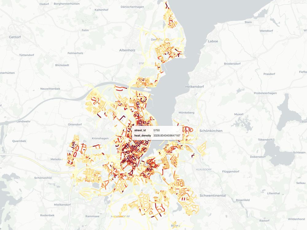
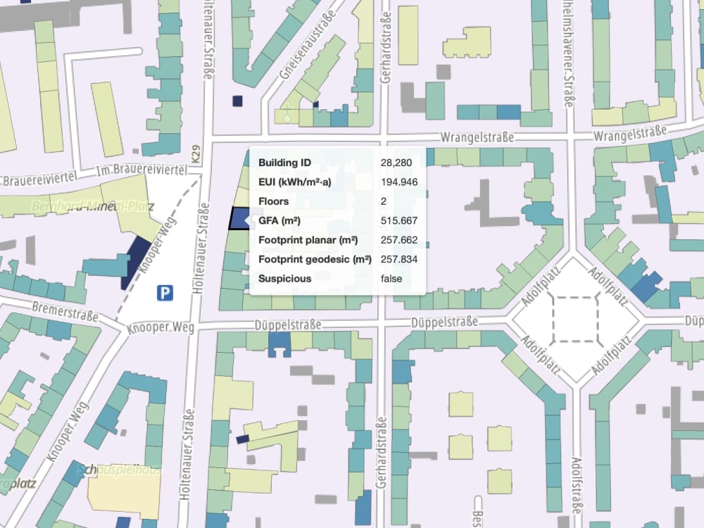
Do you need to visualise complex urban or public data? I build expert, high-performance React GIS Dashboards and Data Visualisation solutions as an M.Sc. Cartographer, I convert your raw geographic information (census, health, urban models) into clear, interactive web maps using Mapbox GL JS or Leaflet. My service is a comprehensive data-to-map solution, encompassing professional data cleansing (ETL/Python) and custom filtering tools. This ensures the final application is responsive, fast, and easy for non-technical users to interpret. Ideal for non-profits, government, and urban planning clients seeking reliable, specialised map applications.
Programming Languages
HTML & CSS, JavaScript, PythonCoding Expertise
Cross Browser & Device Compatibility, Performance Optimization, DesignWhat's included
| Service Tiers |
Starter
$100
|
Standard
$300
|
Advanced
$550
|
|---|---|---|---|
| Delivery Time | 2 days | 3 days | 5 days |
Number of Revisions | 1 | 2 | 3 |
Number of Pages | 1 | 2 | 5 |
Design Customization | |||
Content Upload | - | - | |
Responsive Design | - | - | |
Source Code |
About Maryam
Geospatial Web Dev (React) & Python Automation | MSc Cartography, TUM
Munich, Germany - 10:34 pm local time
I focus on two high-demand service niches for clients globally:
1. Geospatial Web Development & Interactive Mapping
• I build dynamic, user-centric Geospatial Web Applications and dashboards to visualise complex location data.
• Front-End Stack: Professional experience with React.js and Angular for building robust, modern web apps.
• Mapping Libraries: Expert in creating custom interactive maps and spatial dashboards using Leaflet and Mapbox.
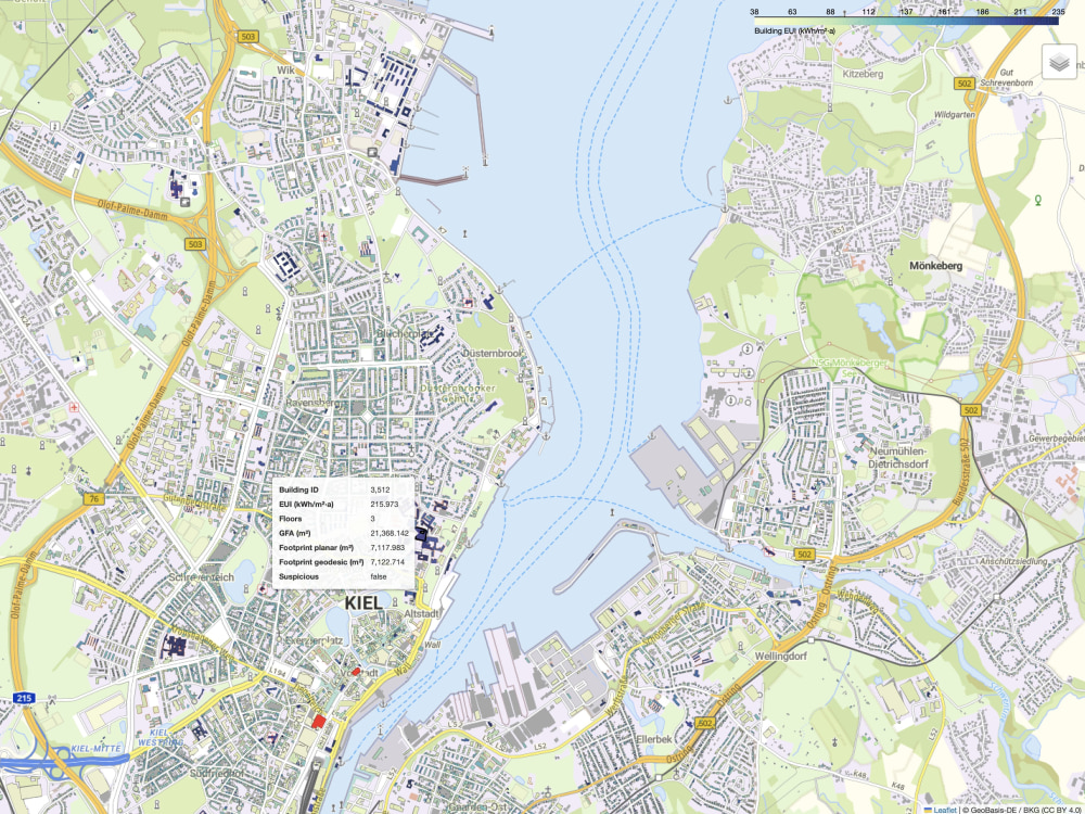
Proof Point: Developed the interactive web interface for the Urban Building Energy Model (UBEM) for the city of Kiel, Germany, to enhance sustainable city planning.
2. Python Automation & Specialized GIS Analysis
I create efficient, automated data pipelines to transform raw spatial data into actionable Geospatial Insights, saving time and reducing errors.
• Python Automation: Proficient in Python scripting (Pandas, NumPy) for large-scale data processing, workflow automation, and ETL.
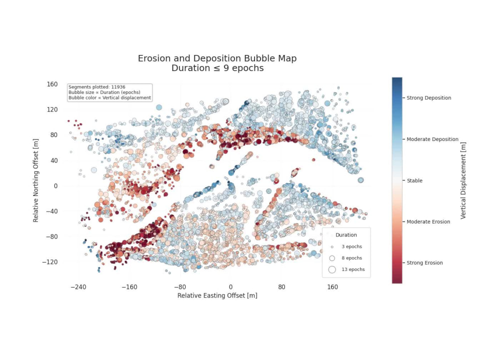
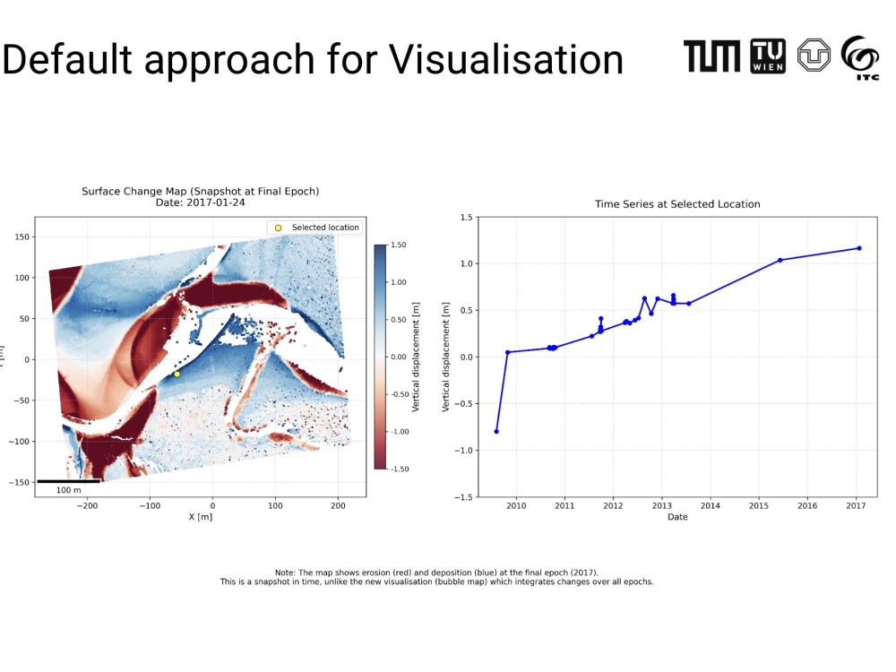
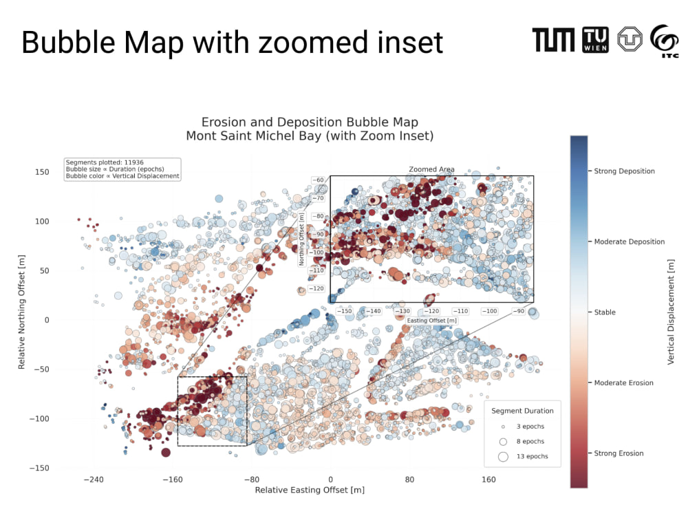
• Advanced Analysis: Expertise in LiDAR data analysis for 3D cartography and change detection.
GIS Tools: Extensive experience with professional GIS tools like QGIS and ArcGIS Pro.
I ensure full project management, clear version control (Git), and transparent communication from scoping through final delivery. Let's connect if you need an expert Geospatial Web Developer or Python Automation specialist.
Steps for completing your project
After purchasing the project, send requirements so Maryam can start the project.
Delivery time starts when Maryam receives requirements from you.
Maryam works on your project following the steps below.
Revisions may occur after the delivery date.
Dashboard Build
I develop interactive React applications, integrating custom map layers, charts, and filtering tools, while ensuring a fully responsive design.
Review & Launch Prep
You test the dashboard on a private link. I make any needed revisions (based on your tier) and finalise the code.