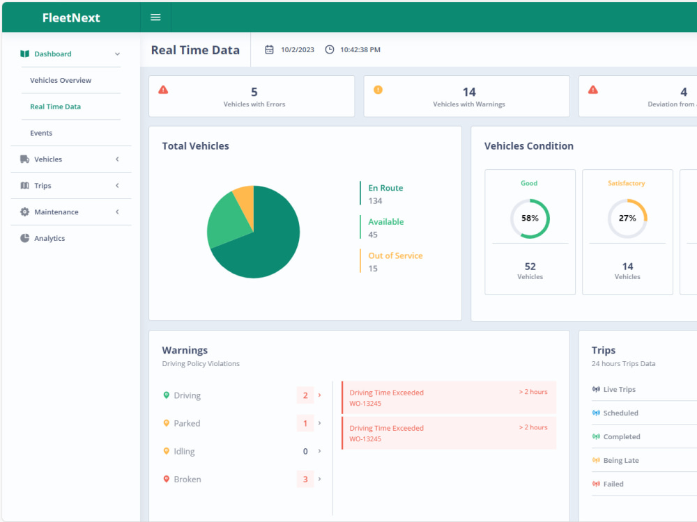
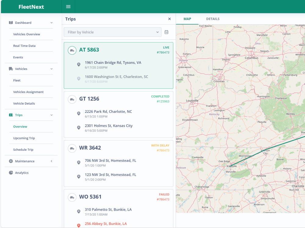
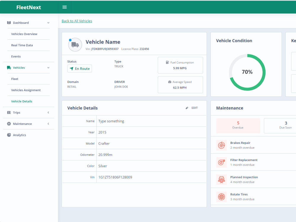
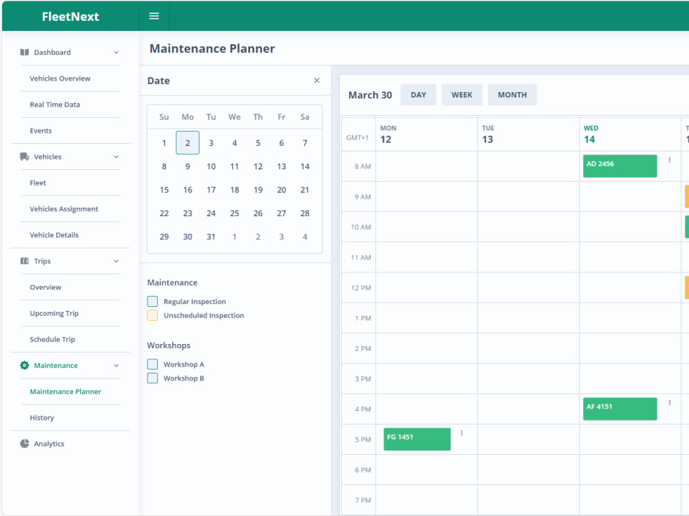
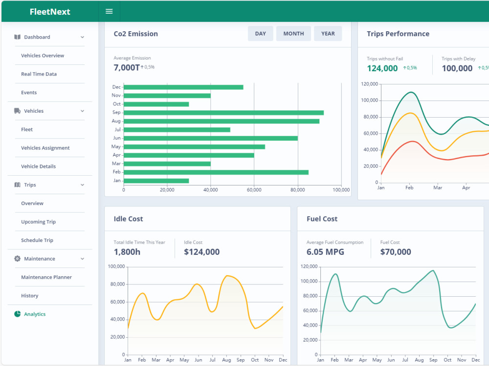
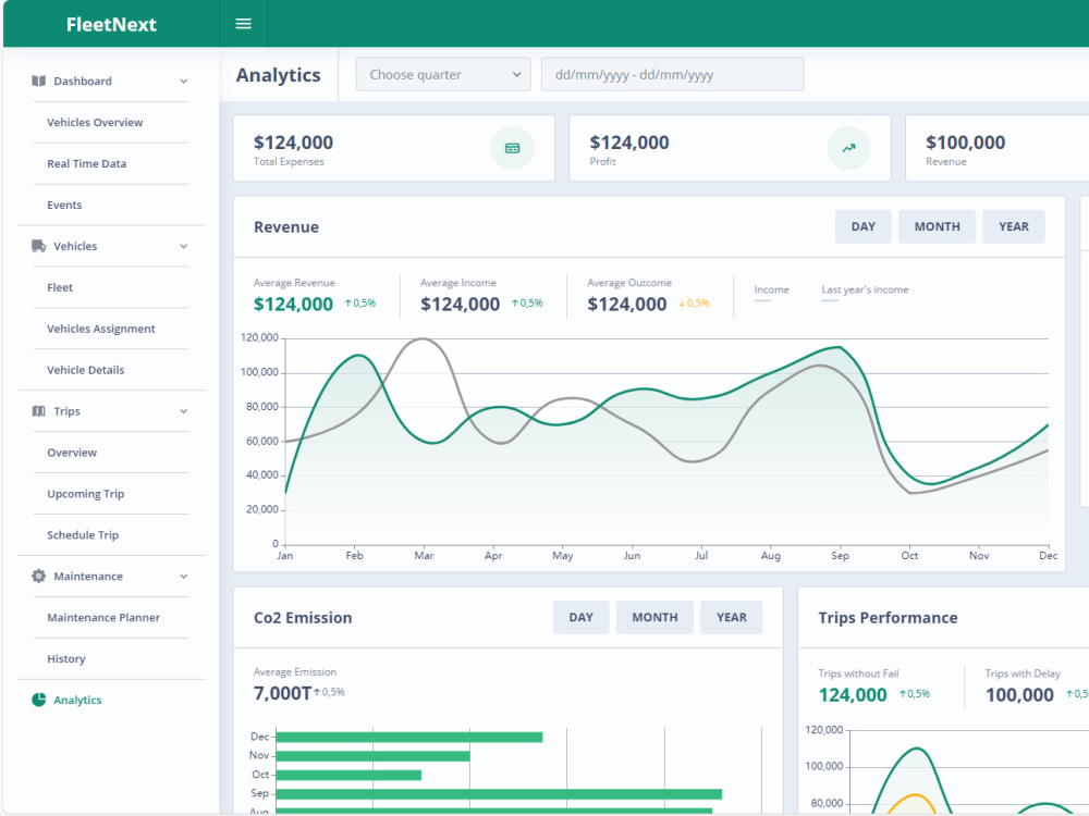
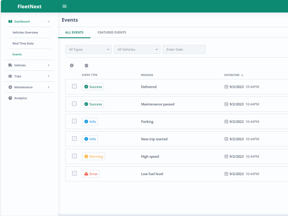
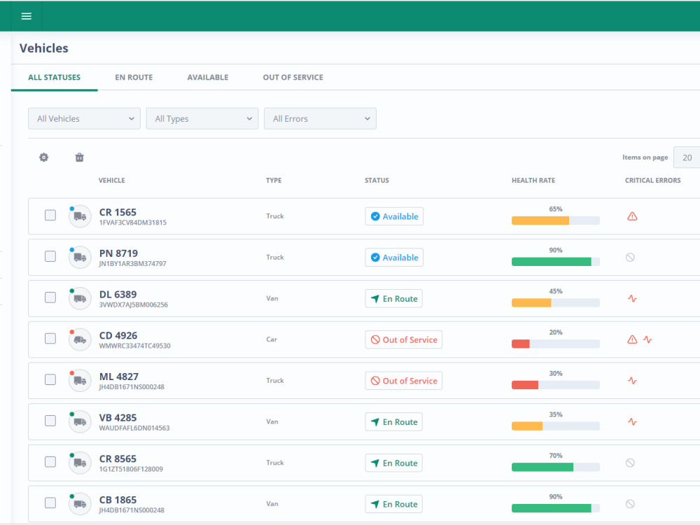
You will get Fleet System which includes, Live Tracking, Trips, Maintenance, Events & BI

Project details
Revolutionize Your Fleet Management with Our Cutting-Edge System!
Are you tired of the hassles and inefficiencies that come with managing a fleet of vehicles? Say goodbye to the old way of doing things and embrace the future of fleet management with our state-of-the-art system!
Optimize Operations: Maximize the efficiency of your fleet with real-time monitoring, route optimization, and smart analytics. Reduce fuel costs, minimize idle time, and increase productivity.
Programming Languages
HTML & CSS, JavaScript, PythonCoding Expertise
Performance Optimization, Security, DesignWhat's included
| Service Tiers |
Starter
$150
|
Standard
$750
|
Advanced
$1,500
|
|---|---|---|---|
| Delivery Time | 7 days | 7 days | 7 days |
Number of Revisions | 2 | 2 | 2 |
Number of Pages | 12 | 12 | 12 |
Design Customization | |||
Content Upload | |||
Responsive Design | |||
Source Code | - | - | - |
1 review
(0)
(0)
(1)
(0)
(0)
This project doesn't have any reviews.
RB
Remi B.
May 23, 2023
Low Code Developer NIFI
Initially satisfied with freelancer performance, but the contract ended in a sour note.
About Shahbaz
GIS & Data Engineer | Prompt Engineer | AI-Accelerated
Lahore Cantt, Pakistan - 8:39 am local time
Currently GIS Data Architect at First City AI. Previously AVP – Data Analytics at Systems Limited and Big Data Architect at Mi-C3 International. IEEE-published in spatial big data (PerCom 2016, IEEE Big Data 2016).
What I deliver:
✅ GIS / Geospatial — PostGIS, pgRouting, GeoServer, OpenLayers, Mapbox, Graphhopper, ArcGIS, CartoDB. Routing, geofencing, map tiling, real-time location pipelines.
✅ Big Data & Streaming — Apache Spark, Flink, Kafka, RabbitMQ, NiFi, Databricks, Delta Lake, Snowflake, Druid, Superset, Elasticsearch.
✅ Backend & APIs — Java/Spring, Python, Scala, Angular. REST microservices on Postgres, MongoDB, Redis.
✅ Cloud & DevOps — GCP, AWS (Lambda, S3, Glue, Athena, Kinesis, EMR), Docker, Kubernetes.
How I work:
1. 30-minute scoping call to understand the real problem.
2. A written architecture plan before any code is written — no surprises.
3. Daily updates and small reviewable increments.
4. You own the code, docs, and deployment runbook on day one.
I work AI-accelerated (Cursor + Claude Code + Copilot + Antigravity), which is how I quote shorter timelines without compromising architect-grade quality. There are 20 years of Java, Spark, and PostGIS work behind every line.
Platforms I've designed end-to-end:
• Mi-Stream — real-time IoT data platform (Mi-C3 International)
• Geo-Where, Masar IoT, Traffixity — pilgrimage crowd & traffic management (Makkah)
• Predictive insurance claims pipeline — Databricks + Snowflake (Systems Limited)
• Currently scaling a real-estate GIS platform at First City AI
Send a brief — data sources, what "done" looks like, and your deadline. You'll get a real reply within hours.
Steps for completing your project
After purchasing the project, send requirements so Shahbaz can start the project.
Delivery time starts when Shahbaz receives requirements from you.
Shahbaz works on your project following the steps below.
Revisions may occur after the delivery date.
Current Fleet Infrastructure
We need to understand the current fleet infrastructure