You will get FME workflow to manipulate and data conversion.
Project details
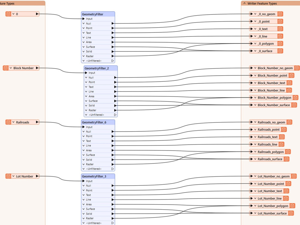
i had a good experience in data manipulation using FME workflow. can export data in several formats and shapes. can run CAD conversion to get GIS from DWG files. also, can re run workflow once you get an updates inputs.
Machine Learning Tools
ArcGISWhat's included
| Service Tiers |
Starter
$20
|
Standard
$50
|
Advanced
$100
|
|---|---|---|---|
| Delivery Time | 1 day | 1 day | 2 days |
Number of Revisions | 1 | 1 | 2 |
Model Validation/Testing | |||
Model Documentation | - | - | |
Data Source Connectivity | |||
Source Code |
Optional add-ons
You can add these on the next page.
Additional Revision
+$20
Additional Graph/Chart
(+ 1 Day)
+$50
Model Documentation
(+ 1 Day)
+$100About Badr
GIS Expert | Geospatial Analyst | Cartographer
Cairo, Egypt - 1:07 am local time
Skills:
• GIS (ArcGIS Pro, ArcGIS Online, FME, GeoCalc, AutoCAD & Google Earth)
• Cartographic methods , Spatial data analysis, digital mapping, data visualization & illustration.
• Digitizing and vectorization ( converting scanned maps to a GIS data )
• Convert non-geographical data to a spatial data.
• Publish maps over GIS portal and dashboard.
• Prepare Posters , Reports and Presentation with required maps.
• Convert CAD files to a GIS Data.
Software:
-ArcGIS Pro
-FME
-AutoCAD Map
-Power BI
-SQL
-VS code
Let’s connect!
Steps for completing your project
After purchasing the project, send requirements so Badr can start the project.
Delivery time starts when Badr receives requirements from you.
Badr works on your project following the steps below.
Revisions may occur after the delivery date.
descript your targets and what data source you have.
descript your targets and what data source you have.