You will get Spatial Analysis, GIS Mapping, ArcMap, ArcGIS Pro and Qgis associated tasks
Top Rated


Top Rated
Project details
Are you in search of a highly skilled GIS Analyst with over 1 years of comprehensive experience? Your search ends here! I specialize in crafting precise and visually captivating GIS maps utilizing top-tier software like ArcGIS, QGIS, Global Mapper, Erdas Imagine and more. As a seasoned GIS expert, I offer a diverse range of services tailored to meet the unique needs of your projects:
1. Custom Map Creation
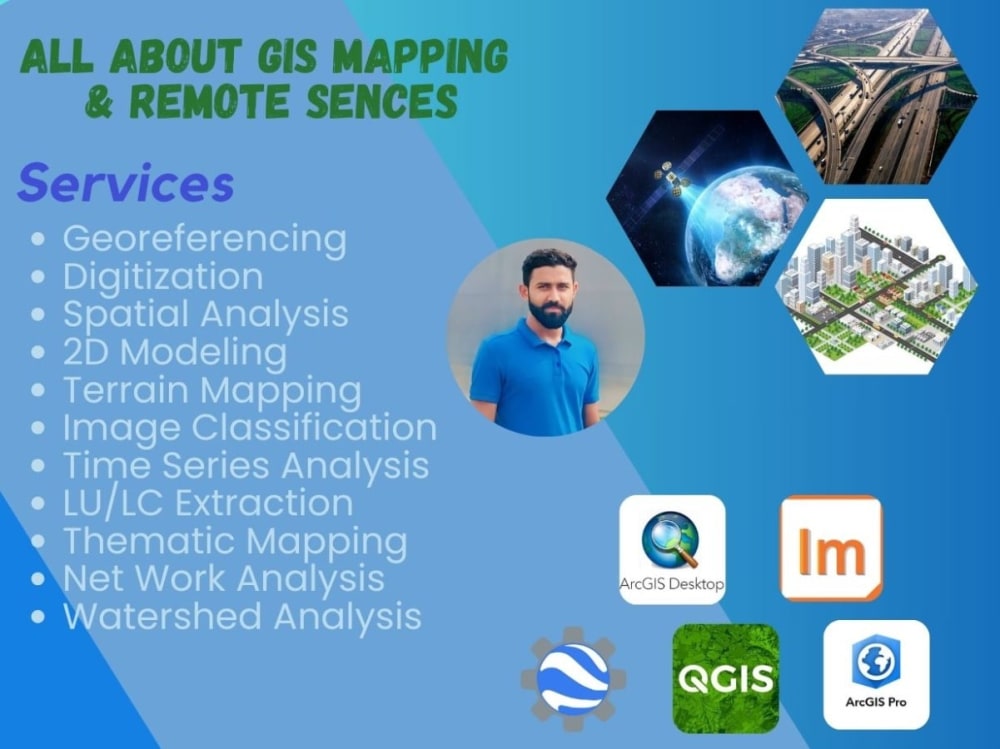
2. Digitization and Georeferencing
3. Spatial Analysis
4. Geospatial Database Management
5. Network Analysis and Routing
6. Hydrology and Watershed Mapping
7. Satellite Image Processing
8. Urban Growth Trends Mapping
I take pride in my keen attention to detail, adept problem-solving skills, and a commitment to delivering projects on time. My primary objective is to provide you with professional GIS services that not only meet but exceed your expectations.
Let's embark on a collaboration for your next geospatial project! Reach out to me today, and we can discuss how I can add significant value to your endeavours through my extensive expertise in the GIS field. Together, we'll unlock the full potential of your spatial data.
Eagerly anticipate the opportunity to work with you!
1. Custom Map Creation
2. Digitization and Georeferencing
3. Spatial Analysis
4. Geospatial Database Management
5. Network Analysis and Routing
6. Hydrology and Watershed Mapping
7. Satellite Image Processing
8. Urban Growth Trends Mapping
I take pride in my keen attention to detail, adept problem-solving skills, and a commitment to delivering projects on time. My primary objective is to provide you with professional GIS services that not only meet but exceed your expectations.
Let's embark on a collaboration for your next geospatial project! Reach out to me today, and we can discuss how I can add significant value to your endeavours through my extensive expertise in the GIS field. Together, we'll unlock the full potential of your spatial data.
Eagerly anticipate the opportunity to work with you!
Data Tool
ArcGISWhat's included
| Service Tiers |
Starter
$20
|
Standard
$30
|
Advanced
$40
|
|---|---|---|---|
| Delivery Time | 4 days | 6 days | 8 days |
Number of Revisions | Unlimited | Unlimited | Unlimited |
Number of Graphs/Charts | 1 | 2 | 3 |
Number of Variations | 1 | 1 | 1 |
Data Source Connectivity | |||
Web Embedding | |||
Interactive/Animated Visuals |
Optional add-ons
You can add these on the next page.
Fast Delivery
+$5 - $10
Additional Graph/Chart
(+ 2 Days)
+$10
Additional Variation
(+ 2 Days)
+$10
14 reviews
(12)
(2)
(0)
(0)
(0)
This project doesn't have any reviews.
BH
Ben H.
Mar 23, 2026
GIS Task: Clip 1-ft Contours to Defined Bounding Box & Export to CAD (.dwg + .shp)
Abdul delivered exactly what we needed with a complex GIS to CAD conversion.
MC
Michael C.
Mar 20, 2026
Mapping Assistant – QGIS and Road Submissions to Maps Platforms
JA
Jean A.
Mar 6, 2026
Vectorize Contours From Scanned Maps and Create KMZ Polygons With Attributes
CK
Clara K.
Aug 1, 2025
GIS Environmental Project Assistance
DB
Dana B.
Jan 30, 2025
QGIS Mapping Specialist Needed for Polygon and Point Digitization
Thanks for fast assistance on an urgent task related to Polygon and Point Digitization!
About Abdul Haleem
GIS Analyst | Mapping & Geospatial Specialist | Remote Sensing Expert
94%
Job Success
Lahore, Pakistan - 5:31 pm local time
Hello,
If you need help with GIS Mapping expert, Remote Sensing and Geospatial specialist, you’ve come to the right place.I bring expertise in spatial data analysis, mapping, and remote sensing with a Bachelor's degree in GIS and professional experience at SheherSaaz, NESPAK and Municipality Uyun Al Jawa. My passion for GIS and technical expertise ensure results that meet your specific needs.
𝗘𝘅𝗽𝗲𝗿𝘁𝗶𝘀𝗲 𝗮𝗻𝗱 𝗞𝗲𝘆 𝗦𝗸𝗶𝗹𝗹𝘀
✓ Advanced Spatial Data Analysis
✓ High-Quality Cartography and Mapping
✓ Expert Remote Sensing
✓ Geographic Information Systems (GIS)
✓ Comprehensive Data Visualization
✓ Digital Mapping
✓ Data Extraction
✓ Map Digitizing
✓ Data Mining
✓ Erda Imagine
✓ Image Classification
✓ Lidar Data Processing
✓ Automation of Geoprocessing Tasks
✓ Environmental Impact Analysis
✓ Urban Planning
✓ Geoinformatics Engineering
✓ Geodatabase Management
✓ Proficiency in GIS Software (ArcMap, ArcGIS Pro, ArcGIS Online, QGIS)
✓ Google Earth Pro, Google My Maps
✓ Google Earth Engine
✓ Open Street Map
✓ Global Mapper
✓ Mapbox
✓ AutoCAD
✓ Basic Skills in Python for GIS Applications
✓ Database Management (SQL, PostgreSQL)
𝗪𝗵𝘆 𝗖𝗵𝗼𝗼𝘀𝗲 𝗠𝗲:
Top-rated with a proven track record of delivering superior GIS solutions.
Exceptional analytical and problem-solving abilities.
Clear and effective communication of complex spatial information.
Dedication to meeting deadlines and exceeding client expectations.
𝗟𝗲𝘁’𝘀 𝗪𝗼𝗿𝗸 𝗧𝗼𝗴𝗲𝘁𝗵𝗲𝗿:
Ready to take your project to the next level with expert GIS analysis and mapping? Contact me to discuss how I can contribute to your success.
Steps for completing your project
After purchasing the project, send requirements so Abdul Haleem can start the project.
Delivery time starts when Abdul Haleem receives requirements from you.
Abdul Haleem works on your project following the steps below.
Revisions may occur after the delivery date.
The client send me requirements in written format
It will be better for us if we have requirements in written format.