You will get Geospatial Analysis & Mapping with Python and Machine Learning
Project details
Looking to unlock the full potential of your geospatial data? I provide expert-level geospatial analysis and machine learning solutions using Python to help you gain actionable insights. Whether its processing satellite imagery, automating GIS workflows, or building machine learning models for spatial data, I can transform complex geospatial challenges into simple, effective solutions.
With years of experience in GIS, Remote Sensing, and Geospatial Machine Learning, I offer services that will help you efficiently manage and analyze your spatial data.
Services I Offer:
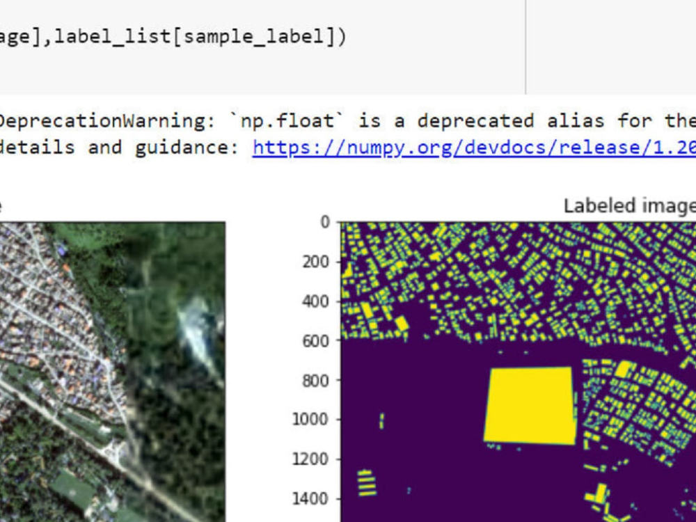
Geospatial Machine Learning: Develop custom machine learning models to analyze and predict spatial data trends, such as land cover classification and geospatial clustering.
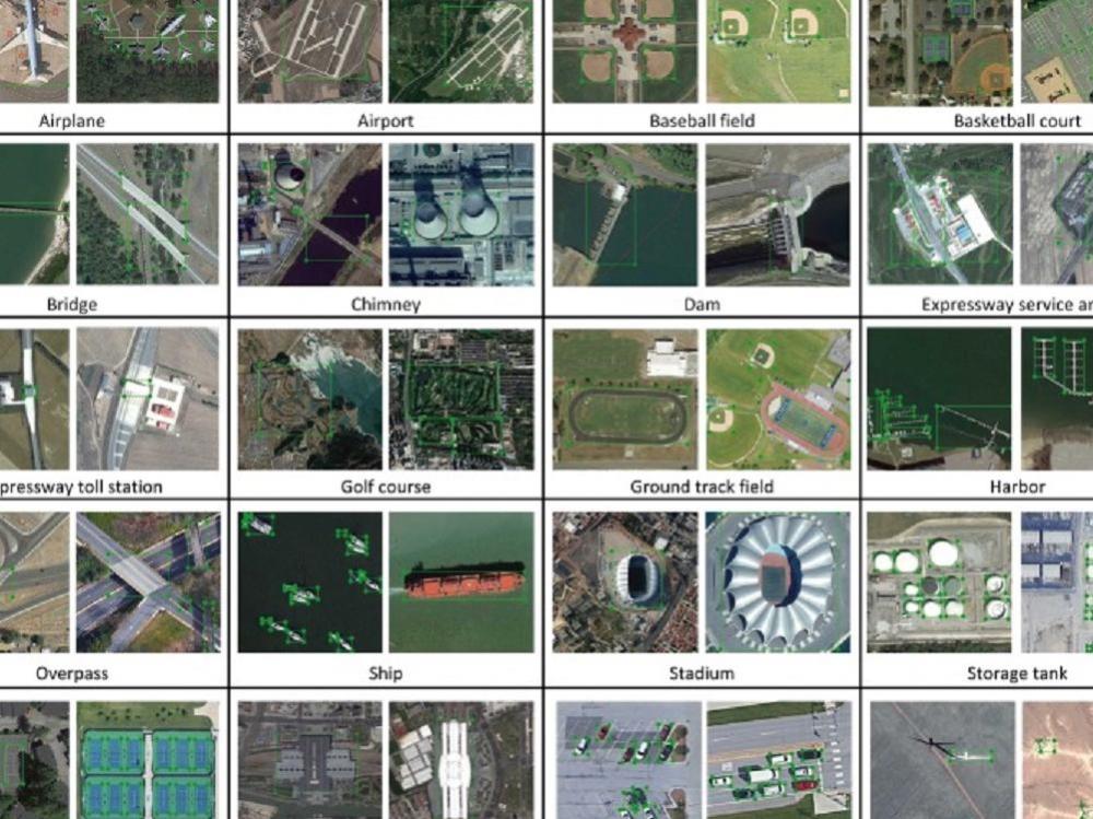
Remote Sensing Data Analysis: Extract detailed insights from satellite imagery using techniques like NDVI, NDWI, and change detection.
Python GIS Automation: Automate your GIS tasks and workflows using Python libraries like GeoPandas, Shapely, and Rasterio for faster and more accurate data processing.
Geospatial Data Processing and Visualization: Clean, analyze, and visualize spatial data to create compelling maps and interactive dashboards
With years of experience in GIS, Remote Sensing, and Geospatial Machine Learning, I offer services that will help you efficiently manage and analyze your spatial data.
Services I Offer:
Geospatial Machine Learning: Develop custom machine learning models to analyze and predict spatial data trends, such as land cover classification and geospatial clustering.
Remote Sensing Data Analysis: Extract detailed insights from satellite imagery using techniques like NDVI, NDWI, and change detection.
Python GIS Automation: Automate your GIS tasks and workflows using Python libraries like GeoPandas, Shapely, and Rasterio for faster and more accurate data processing.
Geospatial Data Processing and Visualization: Clean, analyze, and visualize spatial data to create compelling maps and interactive dashboards
Machine Learning Tools
Keras, NumPy, pandas, Python, Python Scikit-Learn, PyTorch, scikit-learn, TensorFlowWhat's included
| Service Tiers |
Starter
$100
|
Standard
$150
|
Advanced
$200
|
|---|---|---|---|
| Delivery Time | 2 days | 3 days | 4 days |
Number of Revisions | 1 | 2 | 3 |
Number of Model Variations | 1 | 1 | 1 |
Number of Scenarios | 1 | 1 | 1 |
Number of Graphs/Charts | 1 | 1 | 1 |
Model Validation/Testing | |||
Model Documentation | |||
Data Source Connectivity | - | - | - |
Source Code |
About Gaurav
GIS, Remote Sensing & GeoAI Specialist | Python & Deep Learning
Butwal, Nepal - 6:45 pm local time
I specialize in GIS, Remote Sensing, and GeoAI, helping businesses and researchers leverage geospatial data for decision-making. With over 4 years of experience, I provide accurate mapping, deep learning-based image analysis, and automation solutions using Python.
🔹 What I Do:
✅ Geospatial Data Analysis – Advanced spatial data processing, mapping, and visualization
✅ Remote Sensing & Image Processing – Land cover classification, change detection, and satellite image analysis
✅ GeoAI & Deep Learning – Image segmentation, object detection, and automated feature extraction
✅ Python for GIS – Automating geospatial workflows using GeoPandas, Rasterio, OpenCV, TensorFlow, and PyTorch
✅ Cartography & Mapping – Professional map design for reports, research, and web applications
💡 Why Work With Me?
✔ Precision & Accuracy – Delivering high-quality geospatial insights tailored to your needs
✔ Automation & AI Integration – Saving time with AI-driven geospatial solutions
✔ Custom Solutions – No one-size-fits-all! I tailor each project for maximum efficiency
🌍 Whether you need land use analysis, disaster risk mapping, automated image classification, or geospatial AI solutions, I’m here to help. Let's discuss how we can bring your project to life!
📩 Ready to get started? Send me a message!
Steps for completing your project
After purchasing the project, send requirements so Gaurav can start the project.
Delivery time starts when Gaurav receives requirements from you.
Gaurav works on your project following the steps below.
Revisions may occur after the delivery date.
Look after the requirements
See the feasibility