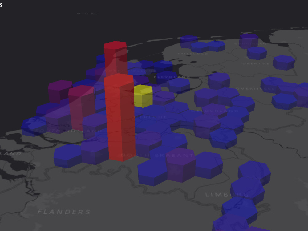
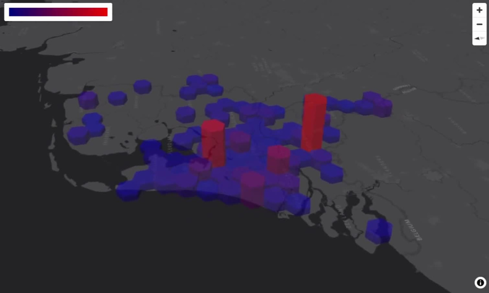
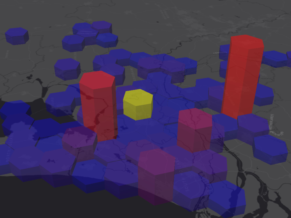
You will get geospatial data visualized on Uber h3 hexagonal grid 3d interactive web map
Project details
You will get engaging futuristic aesthetic perfect dynamic H3 Uber Style Hexagonal Sectional Hierarchical hexagonal grid 3D custom interactive Heatmap with a third dimension – built with modern WebGL technology that work seamlessly across desktop, tablet, and mobile devices with interactive controls – where users can pan, zoom, rotate, and click on points of interest.
Programming Languages
PHP, HTML & CSS, JavaScriptCoding Expertise
Cross Browser & Device Compatibility, Performance Optimization, DesignWhat's included $105
These options are included with the project scope.
$105
- Delivery Time 3 days
- Number of Revisions 2
- Number of Pages 1
- Design Customization
- Content Upload
- Responsive Design
- Source Code
Optional add-ons
You can add these on the next page.
Fast 1 Day Delivery
+$35
41 reviews
(40)
(1)
(0)
(0)
(0)
This project doesn't have any reviews.
DA
Dominic A.
Oct 26, 2025
Switch Ferry Route from Google Maps to OpenStreetMap
Arsen is a very talented freelancer. He was very thorough throughout and made sure that the scripts were performing exactly as intended. Thank you.
DP
Dmytro P.
Aug 11, 2025
Ongoing Development & Support
Arsen is one of the best developers i ever seen, job completed successfully, highly recommend for hire
AR
Alex R.
Jul 20, 2025
Recreate Leaflet project in MapLibre
Thanks Arsen for the attention to detail on this project.
All requirements met and perfected.
All requirements met and perfected.
SJ
Sam J.
Aug 12, 2024
Create interactive map users can edit using Mapbox
great
RT
Ramin T.
Sep 28, 2023
Make our existing PDF generator JavaScript function match a defined one-page template
About Arsen
Custom Interactive Web Map GIS App Developer
100%
Job Success
Yerevan, Armenia - 12:46 am local time
• Mapbox GL JS
• Offline maps, tiles download etc
• D3.js, C3.js,, Highcharts, amCharts
• Google Maps API, Streetview API, places Api etc.
• OpenStreetMap (OSM), Overpass, Nominatim
• Leaflet.js
• deck.gl / kepler.gl
• Turf.js
• GeoJSON / KML / Shapefile
• Uber H3.js
• MapLibre GL JS
FE / BE:
• JavaScript
• jQuery
• Bootstrap
• jsPDF
• PDF-LIB JS
• PHP
• mPDF
• JSON / XML / CSV
DataBase:
• SQLite
• MySQL
• Google Sheet API
Other:
• Google Chrome Extension Development
• FireFox / Opera / Microsoft Edge Add-ons Development
• Email Template & Newsletter Development
• Export / Generate PDF
Steps for completing your project
After purchasing the project, send requirements so Arsen can start the project.
Delivery time starts when Arsen receives requirements from you.
Arsen works on your project following the steps below.
Revisions may occur after the delivery date.
send a list of geospatial data