You will get your projects done in ArcGIS, QGIS
Top Rated
Project details
You will get the digitized vector files in your GIS file format. The export format include but not limited to either GeoJson or shapefiles or geopackage or KML etc.
Data Tool
ArcGISWhat's included
| Service Tiers |
Starter
$25
|
Standard
$50
|
Advanced
$100
|
|---|---|---|---|
| Delivery Time | 1 day | 2 days | 5 days |
Number of Revisions | 1 | 1 | 2 |
Source Code | - | - | - |
Optional add-ons
You can add these on the next page.
Fast Delivery
+$10
Additional Revision
+$10
37 reviews
(34)
(3)
(0)
(0)
(0)
This project doesn't have any reviews.
CR
Chaim R.
Jan 30, 2026
MedWaste Map
Sanjay did a great job for us and very quickly. I highly recommend!
MO
Melanie O.
Jan 10, 2026
🔥 Commercial Land Researcher – $2/Submission + Bonuses ($100, $250, $2,000!) – AI Tools Welcome 🔥
BM
Brian M.
May 18, 2025
clean up map and provide table of route miles in GIS by CBG
will work with again.
DC
Dan C.
Mar 19, 2025
Cartographer Needed for Mapping Australia’s Electrical Transmission Network
DW
David W.
Jan 25, 2025
Animate a simple 5 second 2D or 3D map of an intersection
Great work!
About Sanjay
GIS, Cartography, Maps, Spatial Analysis and Google Earth Specialist
100%
Job Success
Bhaktapur, Nepal - 11:12 pm local time
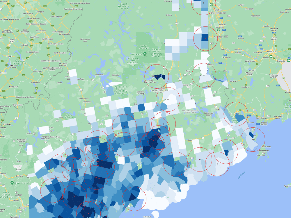
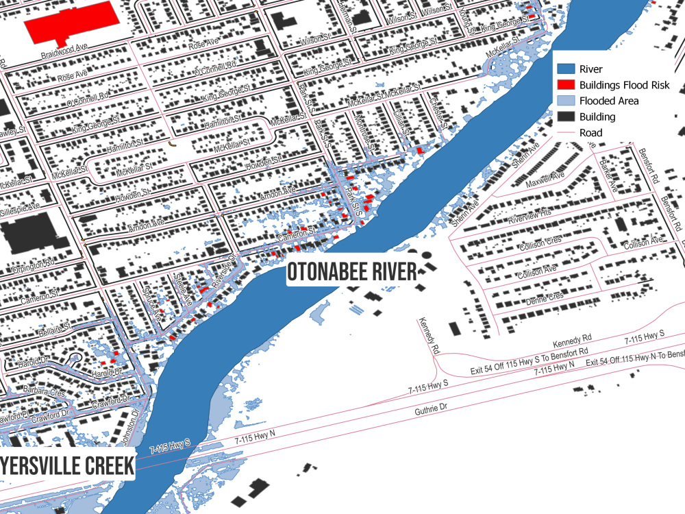
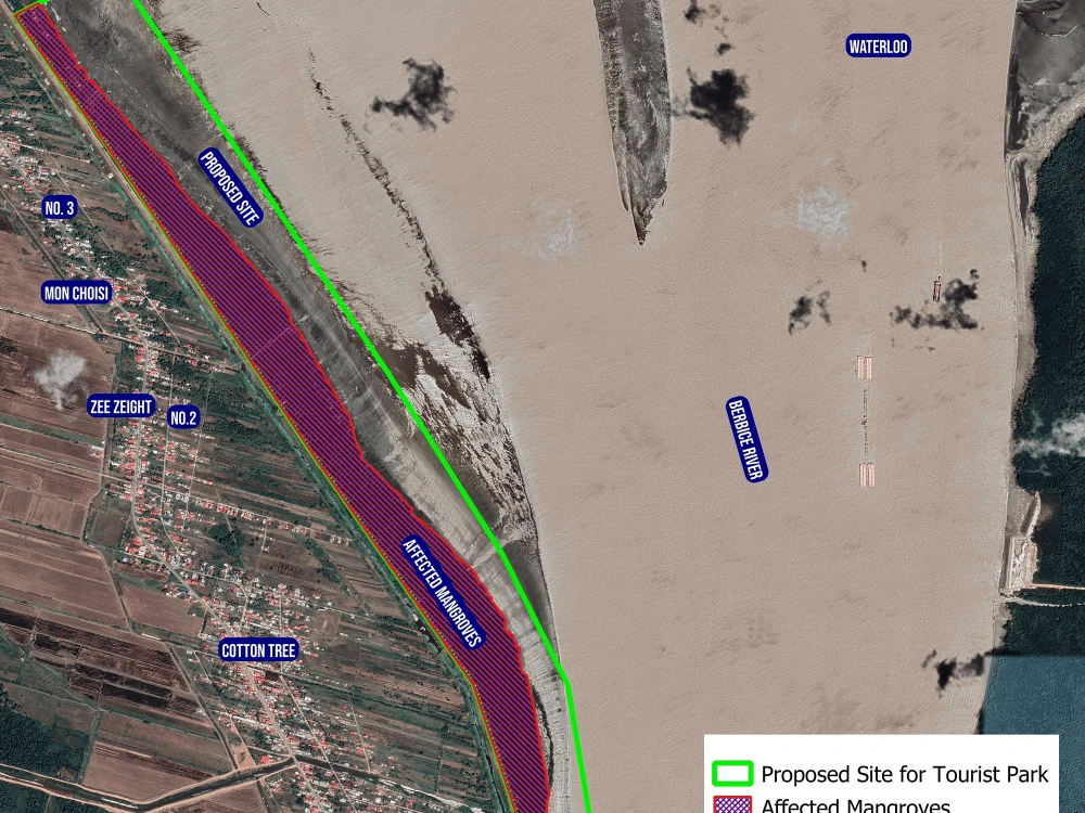
✅ Digitization of raster maps✅ Google maps in KML✅Satellite image processing mapping✅ Multi-criteria decision analysis✅Spatial analysis Mapping✅Digital Terrain Analysis✅Creating Geospatial databases and datasets✅Data conversion, .gdb .shp .dwg .kml..and coordinates to features✅ Network Analysis Mapping: Finding best route, Location Allocations, Vehicle Routing Problem.✅Suitability Analysis Mapping✅ Cost Path Analysis✅ Hydrology Analysis Mapping: Watershed delineation, Hydrology 3D Modeling✅Geology and Topology mapping✅ 3D Modeling, Flood Animation, 3D Path Tracking Animation✅Web Mapping using with leaflet and map box
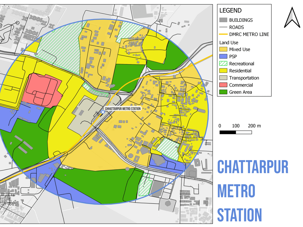
I will provide a whole variety of GIS mapping services that include:
• Georeferencing, address Geocoding and reverse Geocoding.
• Digitization of raster maps, scanned maps and Google Earth maps to Vector format (Point, Lines, and Polygon)
• Satellite image processing mapping
• Multi-criteria decision analysis
• Spatial analysis Mapping
• Digital Terrain Analysis
• Creating Geospatial databases and datasets
• Data conversion, .gdb .shp .dwg .kml..and coordinates to features
• Network Analysis Mapping: Finding best route, Location Allocations, Vehicle Routing Problem..
• Suitability Analysis Mapping
• Cost Path Analysis
• Hydrology Analysis Mapping: Watershed delineation, Hydrology 3D Modeling
• Geology and Topology mapping
• 3D Modeling, Flood Animation, 3D Path Tracking Animation
• Web Mapping using with leaflet and map box
Steps for completing your project
After purchasing the project, send requirements so Sanjay can start the project.
Delivery time starts when Sanjay receives requirements from you.
Sanjay works on your project following the steps below.
Revisions may occur after the delivery date.
Recieve image to be georeferenced and digitized