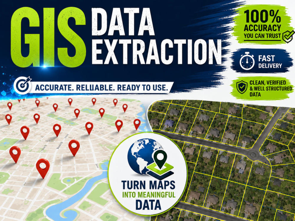
You will get Professional GIS Data Extraction Services
Top Rated
Top Rated
Project details
I provide accurate, high-quality data extraction and spatial data solutions for real estate firms. I specialize in GIS mapping, parcel and address extraction, and automated data processing to improve efficiency and support smarter business decisions.
Data Tool
ArcGISWhat's included
| Service Tiers |
Starter
$25
|
Standard
$100
|
Advanced
$1,000
|
|---|---|---|---|
| Delivery Time | 3 days | 7 days | 15 days |
Number of Pages Mined/Scraped | 100 | 1000 | 100000 |
Number of Revisions | 2 | 2 | 3 |
Optional add-ons
You can add these on the next page.
Fast Delivery
+$30 - $500
Additional Page Mined/Scraped
(+ 1 Day)
+$20
29 reviews
(26)
(3)
(0)
(0)
(0)
This project doesn't have any reviews.
QK
Quintin K.
May 27, 2026
Use Google Map and rapidsketch to draw flat diagrams of buildings
One of the best, multi talented freelancers on Upwork. A hard working, conscientious contractors I have ever worked with. He is a great team player, very sharp, and made valuable contributions. Absolutely work with him if given the chance.
DJ
David J.
May 22, 2026
Digital Mapping GIS Mapping Needed
Mohabat is a rare find as a Digital Map Expert and Freelancer. He built from scratch a Digital Map for an entire 5-Mile Radius community that also incorporated pulling detailed Parcel Info directly from the County Assessors Map and being able to View all properties from Street Level. Then, to help us train our community leaders and staff on how to navigate all aspects of the Digital Map, he also created a great Library of Video Tutorials.
Even more, given this was a very complex project, Mohabat was great at meeting deadlines and completing the project within our requested timeline. I definitely look forward to working with him again.
Even more, given this was a very complex project, Mohabat was great at meeting deadlines and completing the project within our requested timeline. I definitely look forward to working with him again.
MC
Mary C.
May 21, 2026
Information needed from County Records
Mohabat understood the work we needed, and responded with accuracy in a timely manner. Our contract ended, and we hope to work with him again in the future.
BD
Benjamin D.
May 19, 2026
Extract GPS Coordinates & Location from ~1,400 Photos (Excel Output)
Mohabat understood my project quickly and executed it efficiently. I would definitely hire again.
MH
Matt H.
Oct 14, 2025
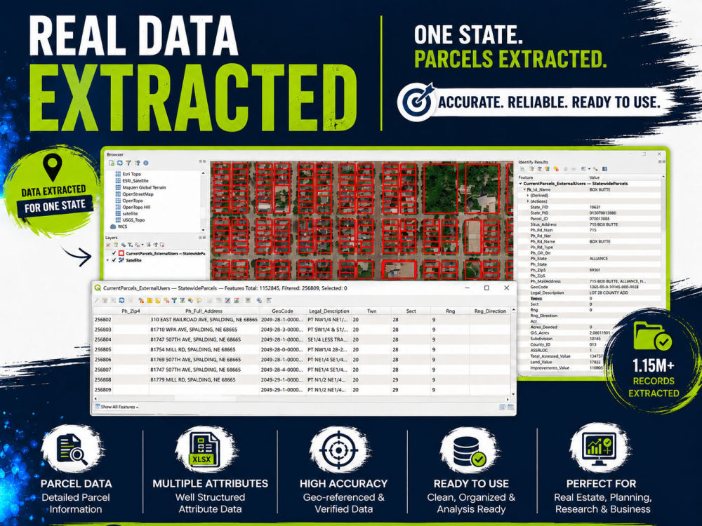
Data extraction - pull all industrial parcels for the city of Phoenix, AZ
About Mohabat
Full-Stack GIS Developer | Web GIS Portals & Spatial Data Engineering
100%
Job Success
Karachi, Pakistan - 9:40 pm local time
With 7+ years of experience across utilities, real estate, telecom, and infrastructure, I don’t just write code—I solve spatial challenges. Whether you need a custom asset management portal, a complex parcel data extraction pipeline, or a streamlined GIS dashboard, I deliver production-ready tools tailored to your specific operational needs.
🌐What I Bring to Your Project:
-Web GIS Development: I specialize in building interactive, user-friendly portals—from cemetery management and utility mapping to real estate platforms—that allow your team to visualize and interact with data in real-time.
-Spatial Data Engineering: I handle large-scale data tasks, including spatial ETL workflows, parcel record joins (handling 50M+ records), and converting raw data into clean, validated formats.
-Automation: I save you time by automating repetitive GIS tasks, whether it’s custom Python scripts, Chrome extensions for workflow efficiency, or building robust API endpoints for geocoding.
🧰Technical Stack:
-Programming Languages: Python (Automation, ETL, backend), JavaScript (Front-end interactivity), SQL (Spatial database management).
-Web GIS Frameworks: Django, Leaflet, Mapbox, OpenLayers, GeoServer.
-Spatial Engineering: GeoPandas, Shapely, GDAL, DuckDB (High-performance, out-of-core processing for massive datasets).
-Databases: PostgreSQL, PostGIS, SQLite/GeoPackage.
Why Partner With Me?
Beyond my technical stack, I pride myself on being a reliable communicator and a collaborative partner. I have a proven track record of managing end-to-end projects—from initial architectural planning and database design to the final deployment of custom UI/UX for spatial tools.
Let’s turn your geospatial requirements into a scalable, production-ready solution. Send me a message to discuss your project needs.
Steps for completing your project
After purchasing the project, send requirements so Mohabat can start the project.
Delivery time starts when Mohabat receives requirements from you.
Mohabat works on your project following the steps below.
Revisions may occur after the delivery date.
Receive Requirement from Client
Extract Data