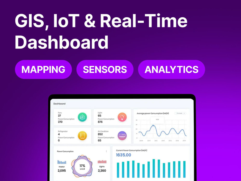
You will get GIS, IoT & Real-Time Dashboard – Mapping, Sensors, Alerts & Analytics
Project details
I design and develop real-time GIS and IoT dashboards that integrate sensor data, mapping layers, and alerts for actionable insights. Using modern technologies, I deliver interactive, scalable, and secure solutions that help you monitor, analyze, and respond to data in real time.
𝐖𝐡𝐲 𝐜𝐡𝐨𝐨𝐬𝐞 𝐦𝐞: Expert in GIS integration, IoT data pipelines, and real-time dashboard development for efficient, data-driven decision-making.
𝐖𝐡𝐲 𝐜𝐡𝐨𝐨𝐬𝐞 𝐦𝐞: Expert in GIS integration, IoT data pipelines, and real-time dashboard development for efficient, data-driven decision-making.
Programming Languages
PHP, JavaScript, ASP.NETCoding Expertise
Cross Browser & Device Compatibility, Performance Optimization, DesignWhat's included
| Service Tiers |
Starter
$350
|
Standard
$650
|
Advanced
$950
|
|---|---|---|---|
| Delivery Time | 5 days | 10 days | 15 days |
Number of Revisions | 2 | 5 | Unlimited |
Number of Pages | 3 | 7 | 15 |
Design Customization | |||
Content Upload | - | ||
Responsive Design | |||
Source Code | - | - |
Frequently asked questions
About Muhammad Nauman
Software Architect & Full-Stack Lead | MERN, IoT, GIS & Real-Time Data
Islamabad, Pakistan - 7:47 pm local time
Over 8+ years I've architected platforms processing 6 billion+ data readings a year, integrated 300+ IoT sensors into live systems, and built telecom-grade services that onboarded 10M+ subscribers.
I led the technology behind Pakistan's leading private weather service from day one and have delivered government and GSMA/GIZ/ECHO-funded platforms in climate, GIS, and disaster-tech.
If you need someone who can own a system end-to-end architecture, backend, frontend, cloud, and the messy real-time/integration parts most developers avoid that's my core strength.
What I do:
• Full-stack development on the MERN stack (React, Node.js, MongoDB, Express) web and mobile
• Real-time data pipelines and event-driven systems (Kafka, MQTT, streaming)
• IoT and sensor integration, including satellite/radar data processing
• GIS / geospatial engineering, mapping, and visualisation
• Cloud architecture and cost optimisation (AWS, Azure, GCP), I once cut a platform's infra cost ~96%
• API engineering (REST & GraphQL) and third-party/telecom integrations
• AI/automation features and predictive analytics
Why clients work with me:
I don't just write code to spec, I architect for scale and reliability, flag the trade-offs early, and deliver systems that hold up in production. I've worked with government bodies, telecom giants, and funded climate programs, so I'm comfortable with complex requirements, multiple stakeholders, and high-stakes deadlines.
Whether it's a greenfield build, scaling an existing platform, a tricky real-time/IoT/GIS integration, or rescuing a stalled project. Let's talk about what you're trying to ship.
Steps for completing your project
After purchasing the project, send requirements so Muhammad Nauman can start the project.
Delivery time starts when Muhammad Nauman receives requirements from you.
Muhammad Nauman works on your project following the steps below.
Revisions may occur after the delivery date.
Requirement Gathering
Understand your goals, sensor data sources, GIS mapping needs, and dashboard features.
Planning & Design
Define architecture, data flows, and create wireframes or mockups for the dashboard.