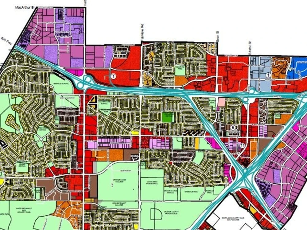
You will get GIS Maps, shape files and vector data with attributes

Project details
GIS analysis:
I can do GIS data creation, analysis, and interpretation and create GIS maps. I can create GIS-based maps of municipal from pdf or image map to shapefiles. Network analysis through PG routing in Postgres/PGAdmin.
Remote sensing analysis:
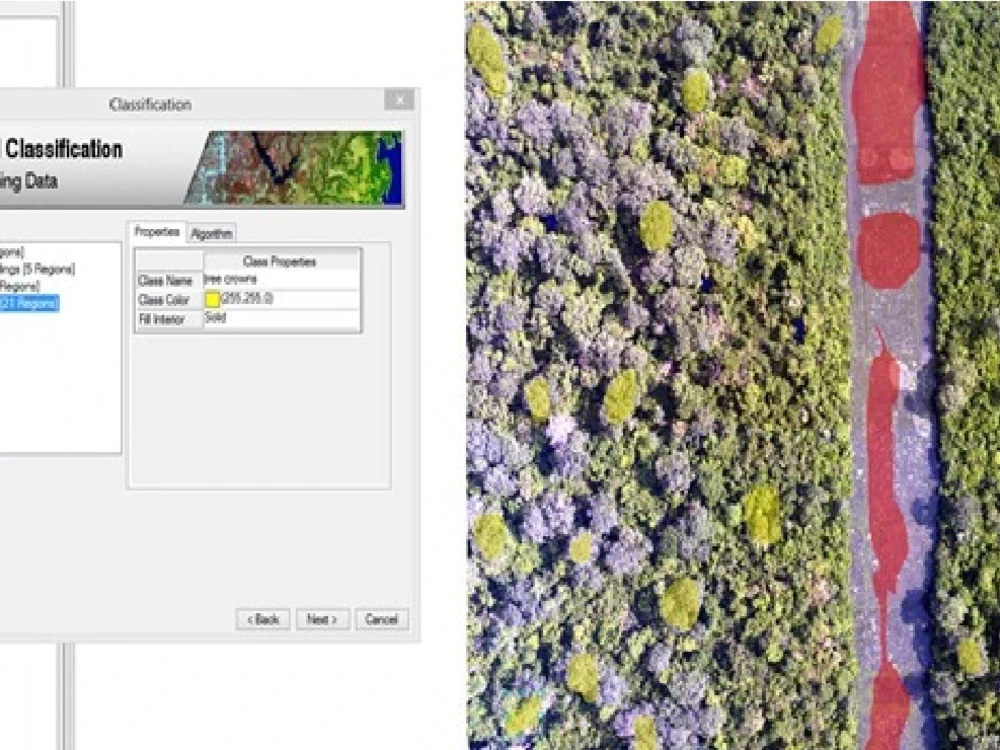
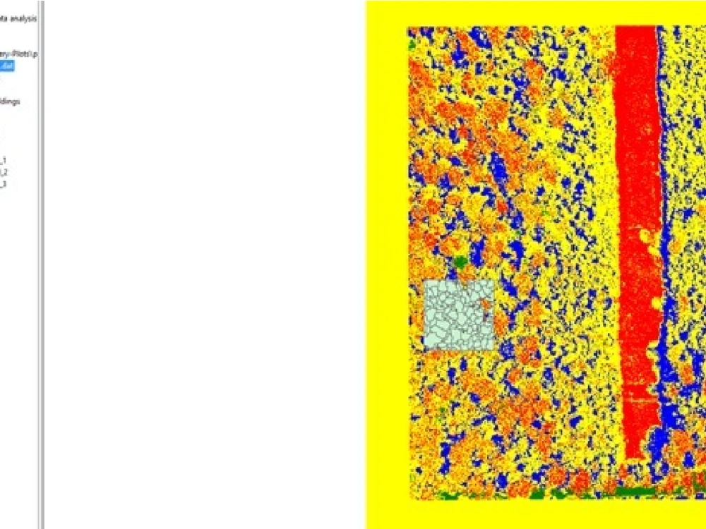
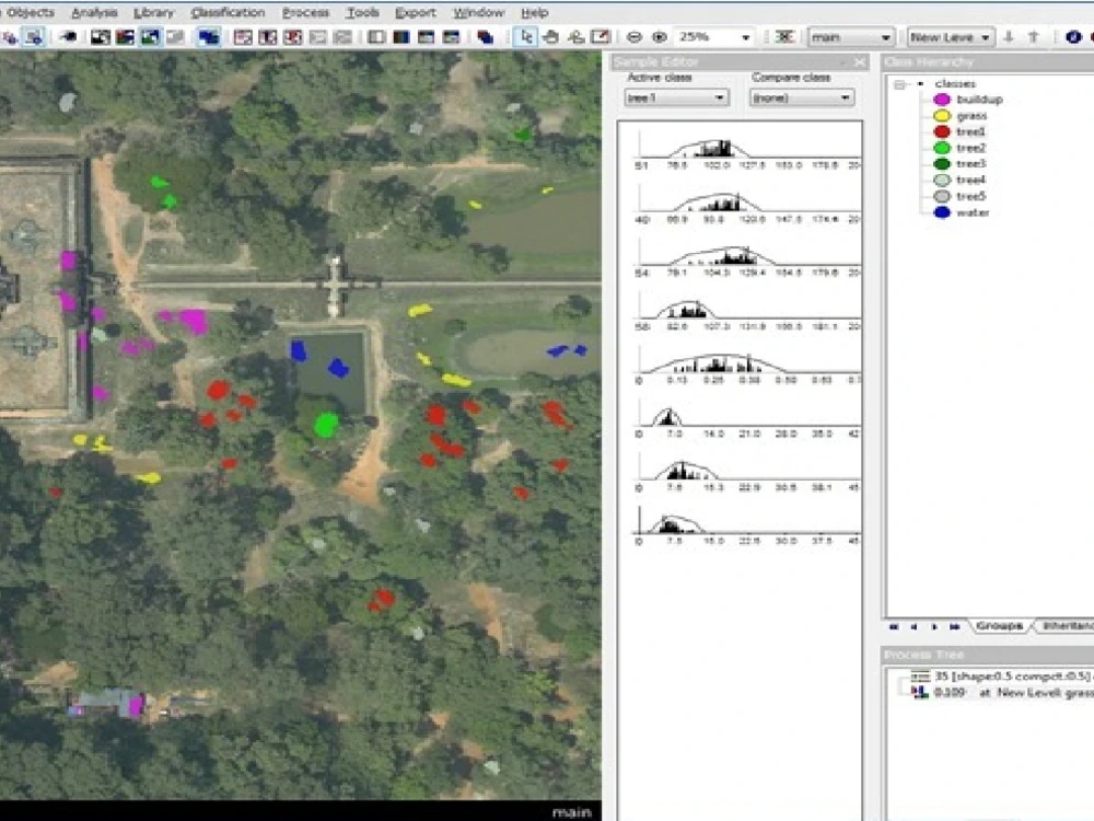
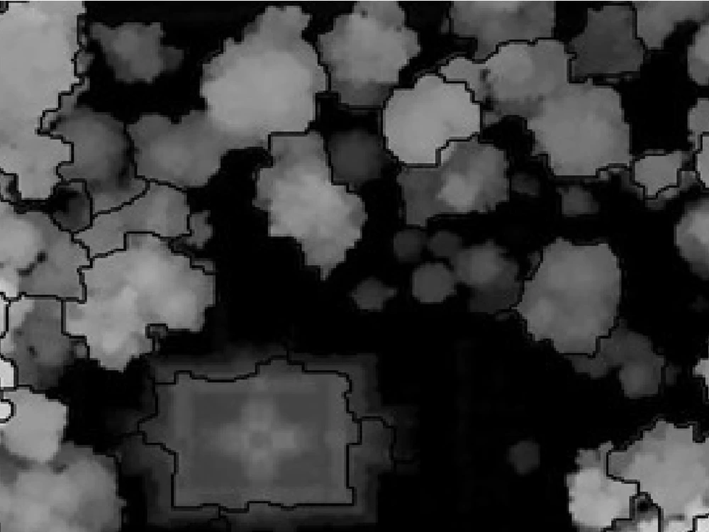
Supervise, un supervise, and object base classification of satellite/aerial imagery. Tree crown mapping of satellite imagery and lidar data for biomass calculation.
Specific GIS skills:
* Spatial Analysis
* ArcGIS
* Geocoding, Georeferencing
* Geoprocessing
* ModelBuilder
* QGIS
* inteactive zoomable web maps
* ArcGIS online
* Google Earth
* Carto CSS
I can do GIS data creation, analysis, and interpretation and create GIS maps. I can create GIS-based maps of municipal from pdf or image map to shapefiles. Network analysis through PG routing in Postgres/PGAdmin.
Remote sensing analysis:
Supervise, un supervise, and object base classification of satellite/aerial imagery. Tree crown mapping of satellite imagery and lidar data for biomass calculation.
Specific GIS skills:
* Spatial Analysis
* ArcGIS
* Geocoding, Georeferencing
* Geoprocessing
* ModelBuilder
* QGIS
* inteactive zoomable web maps
* ArcGIS online
* Google Earth
* Carto CSS
Data Tool
ArcGISWhat's included
| Service Tiers |
Starter
$10
|
Standard
$15
|
Advanced
$25
|
|---|---|---|---|
| Delivery Time | 3 days | 3 days | 3 days |
Number of Revisions | 1 | 2 | 3 |
Frequently asked questions
About Majid
GIS Program Coordinator
Islamabad, Pakistan - 8:00 am local time
- Geospatial Diseases Database in postgres/postGIS
- Create Search, Routing and Mapping services in ArcGIS server
- Create vector maps and styling in CatroCSS in tilemill and publish maps using open source Mapnik library
- Create open source Routing service in Postgres/PGAdmin using pgRouting
- On and off street parking places data and maps preparation for TFL
- Object based classification for tree crown mapping using trees canopy extraction from LIDAR data using object based features extraction techniques
- Topojson and Geojson files conversions and attribute updates using FWTOOL Shell in mapshaper
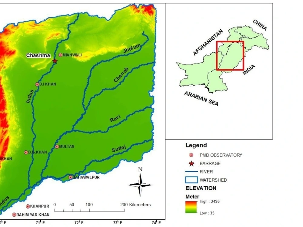
- Data digitization, data cleaning, database preparation and hydrographs preparation of discharges gauges at Indus River
Steps for completing your project
After purchasing the project, send requirements so Majid can start the project.
Delivery time starts when Majid receives requirements from you.
Majid works on your project following the steps below.
Revisions may occur after the delivery date.
Data/Map requirment
Open-source data Google map Open street map Bing map etc
Imagery
Satellite imagery Aerial imagery Google imagery etc