You will get GIS, WebGIS, Dashboard, Frontend, Backend, Database & API Development Done.
Project details
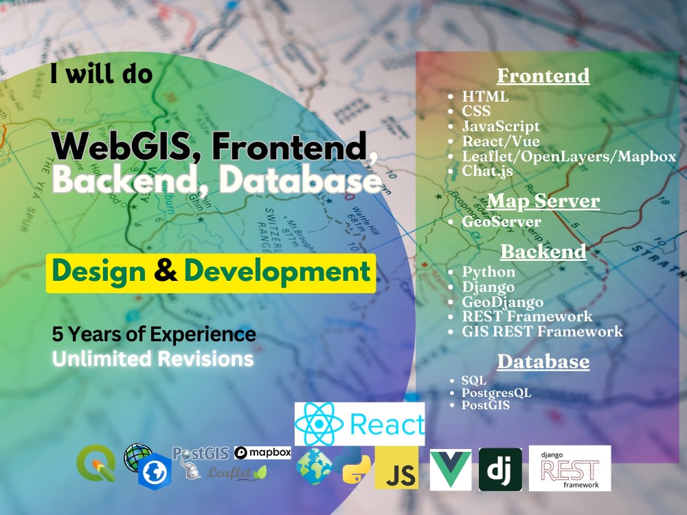
With expertise in GIS and WebGIS development, I deliver fully integrated solutions that combine advanced mapping, interactive dashboards, and seamless API functionalities.
Whether it's building a custom GIS system, crafting a powerful WebGIS platform, or developing full-stack applications with complex backend integrations, my focus is on precision and scalability. I ensure user-friendly interfaces, robust data management, and reliable performance tailored to your unique needs, setting your project apart with high-quality, scalable GIS technology.
Whether it's building a custom GIS system, crafting a powerful WebGIS platform, or developing full-stack applications with complex backend integrations, my focus is on precision and scalability. I ensure user-friendly interfaces, robust data management, and reliable performance tailored to your unique needs, setting your project apart with high-quality, scalable GIS technology.
Web Programming Project
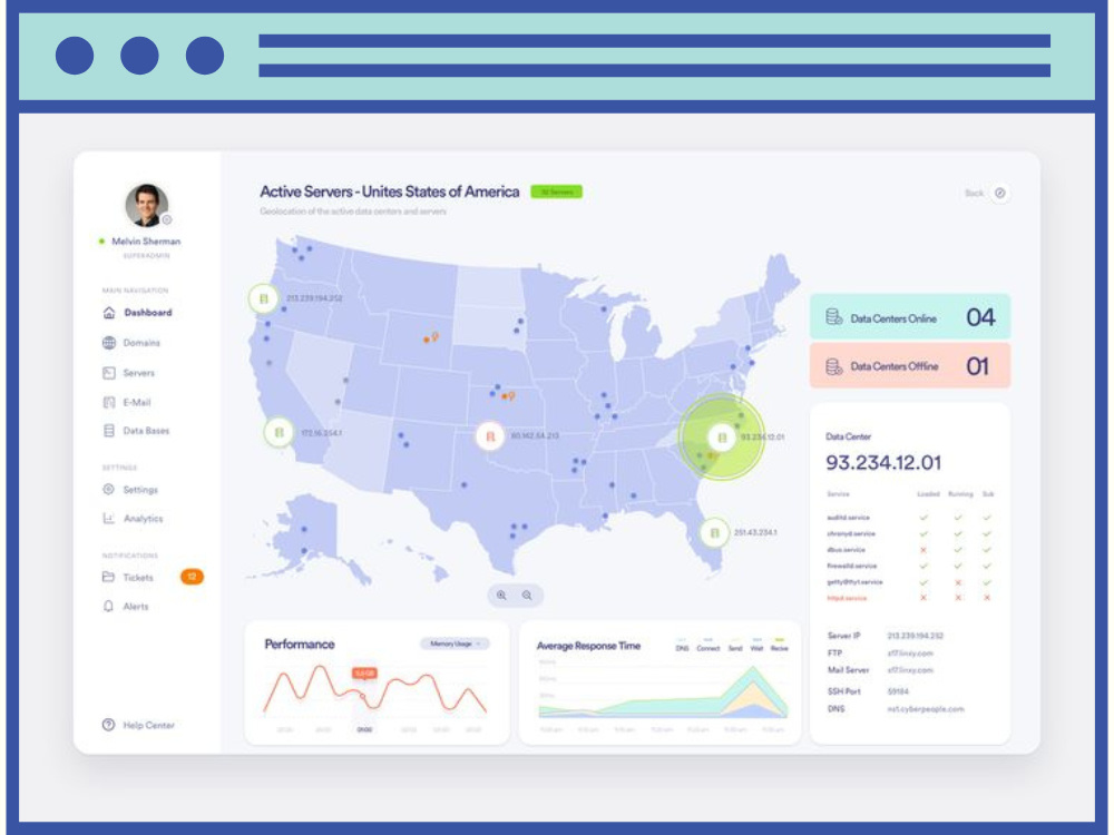
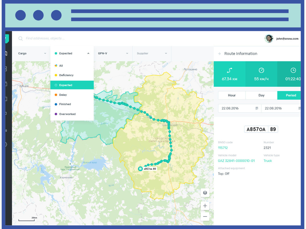
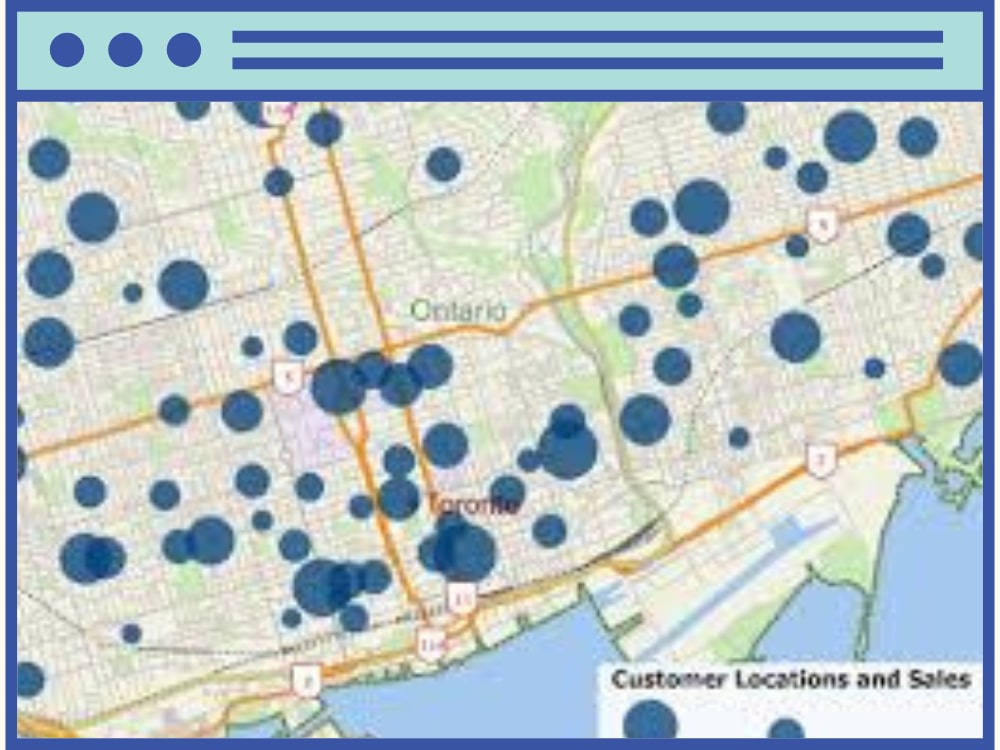
API Development, API Integration, Data DashboardProgramming Languages
HTML & CSS, JavaScript, PythonCoding Expertise
Cross Browser & Device Compatibility, Performance Optimization, DesignWhat's included
| Service Tiers |
Starter
$200
|
Standard
$500
|
Advanced
$1,000
|
|---|---|---|---|
| Delivery Time | 4 days | 8 days | 15 days |
Number of Revisions | Unlimited | Unlimited | Unlimited |
Source Code |
About Hasem
Geospatial Data Scientist || Full Stack GIS Developer
Kolkata, India - 2:09 pm local time
With over 6 years of hands-on experience, I specialize in delivering innovative GIS solutions for complex projects. My expertise spans across GIS analysis, WebGIS development, and Geospatial Data Science, consistently driving results and exceeding expectations.
I have a strong foundation in Python, JavaScript, and SQL, using these technologies to create efficient, scalable geospatial solutions. For front-end development, I use JavaScript and Vue.js or React.js to create seamless, user-friendly interfaces. My database expertise includes PostgreSQL/PostGIS for spatial data management, and I'm also proficient with DuckDB for additional data processing needs.
If you're looking for cutting-edge GIS solutions tailored to your project’s unique needs, I’m here to help you achieve success.
**Services**
1. GIS Analysis
-- Georeferencing and Digitization
-- Geoprocessing & Spatial Modelling
-- Cartography & Map production
-- Data Cleaning, Visualization & Interactive Mapping
-- Custom GIS Application Development
-- GIS Data Conversion
2. Remote Sensing
-- Automatic Satellite Image Collection
-- MOSIC, CLIP, False Color Composite, True Color Composite, etc..
-- Band Rationing (NDVI, NDWI, EVI, etc..) or Indices Calculation & Automation
-- Microwave Remote Sensing Services (ex - preprocessing, flood inundation mapping etc.).
-- DEM, Terrain Analysis & Hydrology Analysis.
-- Lidar Data Analysis Services
3. GeoAI
-- Machine Learning Models for Geospatial Analysis
-- Image Classification & Object Detection using ML and AI
-- Feature Extraction from Satellite Images
-- Supervised Classification
-- Unsupervised Classification
4. Spatial Database Management
-- Spatial Database Design & Implementation
-- Data Modelling & Schema Development
-- Spatial Quarry & Non-Spatial Quarry
-- Performance Optimization & Spatial Indexing
5. .WebGIS
-- Web-based GIS applications using JavaScript and JS Framework.
-- Custom Web-GIS application based on objectives.
-- Map services integration (WMS, WTS etc..)
I look forward to connecting with you on your GIS projects. Feel free to reach out to me anytime!
Steps for completing your project
After purchasing the project, send requirements so Hasem can start the project.
Delivery time starts when Hasem receives requirements from you.
Hasem works on your project following the steps below.
Revisions may occur after the delivery date.
Project Kick-off & Requirement Gathering
After the client purchases the project, we will discuss the requirements in detail. This includes understanding your needs for GIS, WebGIS, dashboard features, API, and database functionality to ensure a clear roadmap.
Design & Planning
I will design the system architecture, plan the database structure, and outline the WebGIS and dashboard functionalities. A project timeline will be created, ensuring all aspects are covered.