You will get High-Precision GIS Digitization, Georeferencing, and Topology Cleanup.
Project details
Stop wasting time with messy, inaccurate GIS data. Most freelancers provide simple tracing that leads to overlaps, gaps, and spatial errors. I offer High-Precision Digitization & Topology Cleanup designed for professional engineering, urban planning, and spatial analysis
With over 5 years of expertise in ArcGIS Pro and QGIS, I transform your scanned maps, old PDFs, and satellite imagery into industry-standard vector datasets (Shapefile, GeoJSON, KML, or File Geodatabase).
What sets this project apart?
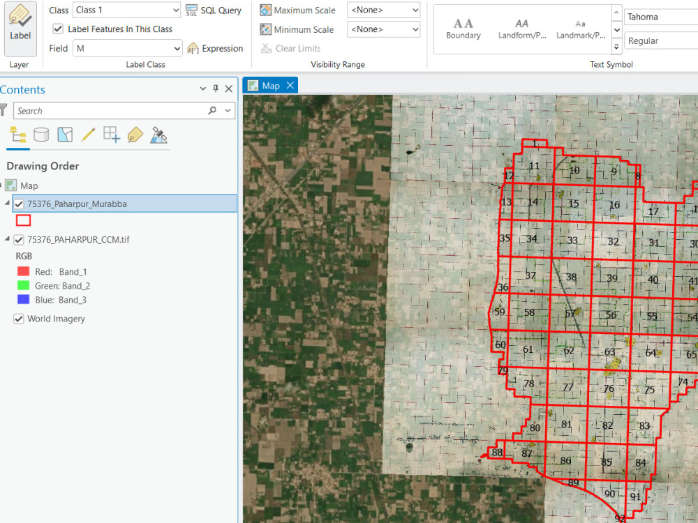
Topology-First Approach: I guarantee Zero Topological Errors. No overlaps, no dangles, and no silver polygons. Your data will be ready for immediate spatial analysis.
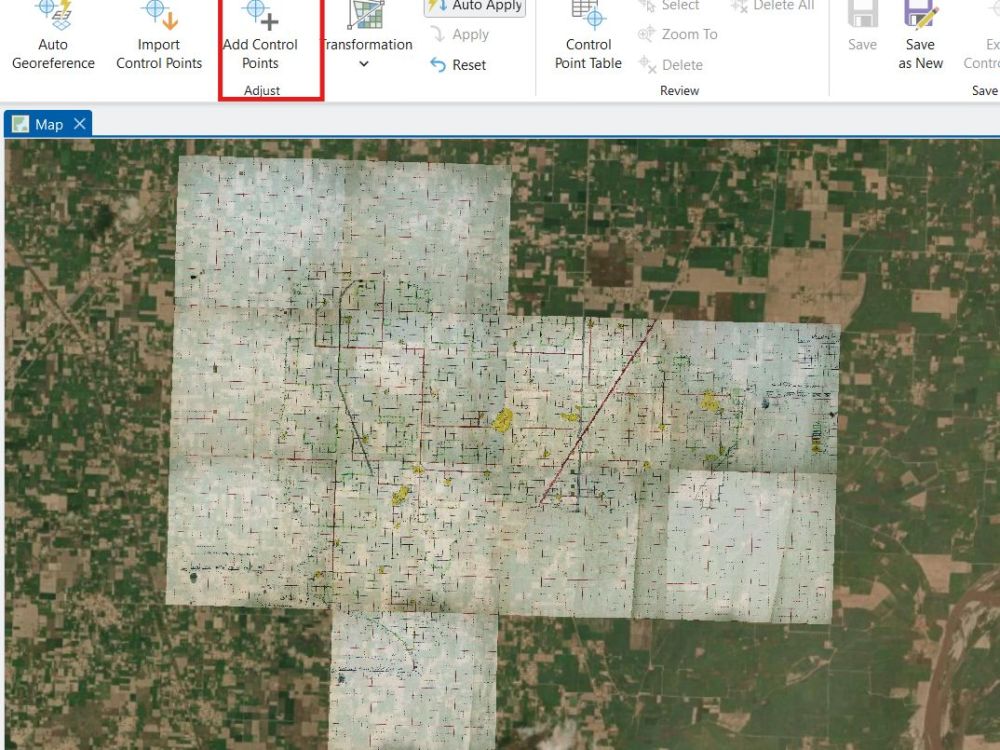
Precision Georeferencing: Using advanced control points to ensure your maps align perfectly with real-world coordinates (WGS84, UTM, or custom CRS).
Structured Attribute Tables: I don’t just draw lines; I build databases. Your attribute tables will be clean, categorized, and easy to query.
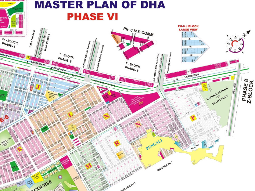
Ideal For: Cadastral Mapping, Utility Networks, Land Use Study, and Urban Zoning.
Let’s turn your static maps into intelligent spatial assets today!
With over 5 years of expertise in ArcGIS Pro and QGIS, I transform your scanned maps, old PDFs, and satellite imagery into industry-standard vector datasets (Shapefile, GeoJSON, KML, or File Geodatabase).
What sets this project apart?
Topology-First Approach: I guarantee Zero Topological Errors. No overlaps, no dangles, and no silver polygons. Your data will be ready for immediate spatial analysis.
Precision Georeferencing: Using advanced control points to ensure your maps align perfectly with real-world coordinates (WGS84, UTM, or custom CRS).
Structured Attribute Tables: I don’t just draw lines; I build databases. Your attribute tables will be clean, categorized, and easy to query.
Ideal For: Cadastral Mapping, Utility Networks, Land Use Study, and Urban Zoning.
Let’s turn your static maps into intelligent spatial assets today!
Data Tool
ArcGISWhat's included
| Service Tiers |
Starter
$50
|
Standard
$100
|
Advanced
$160
|
|---|---|---|---|
| Delivery Time | 2 days | 4 days | 7 days |
Number of Revisions | 2 | 3 | Unlimited |
Number of Pages Mined/Scraped | 3 | 10 | 15 |
Number of Sources Mined/Scraped | 1 | 3 | 8 |
Optional add-ons
You can add these on the next page.
Fast Delivery
+$20 - $50
2 reviews
(2)
(0)
(0)
(0)
(0)
This project doesn't have any reviews.
VS
Victoria S.
Feb 9, 2026
QGIS Projects Specialist Needed
Aurang was very helpful, super responsive and completed the work I needed on time. I recommend him for any QGIS mapping projects!
DD
Darren D.
May 8, 2023
Quick job for geography (GIS) problems
About Aurang
Spatial Data Scientist | GIS Developer | GEE Dashboards & Python
New Garden Town, Pakistan - 12:41 pm local time
Let’s be honest: In today’s market, location data geocoding and reverse geocoding is often the most underutilized asset in a company's toolkit. Whether you’re a Real Estate developer, a Commercial Farmer, or managing Logistics, ignoring spatial intelligence isn't just a missed opportunity. It’s a financial risk.
I don't just "make maps." I build Spatial Intelligence Systems.
With over 5 years of hands-on experience and a 100% Job Success Score, I help clients turn massive, messy datasets into clean, automated, and interactive dashboards that actually make sense for their bottom line. From calculating 21 sq km of glacier recession to building real-time crop phenology monitors for rice production, I’ve seen how the right spatial data can save millions.
✅ How I can help your business grow:
Risk Mitigation (Real Estate & Insurance): I don’t just show you a map; I analyze flood zones, terrain stability, and site suitability. I help you see the "red flags" before you commit capital.
Precision Agriculture (Ag-Tech):
I automate the boring stuff. Using Google Earth Engine (GEE), I build pipelines for NDVI and multispectral analysis so you can monitor crop health and yield without manual checking.
Operational Efficiency (Logistics & Utilities):
I optimize routes and manage assets (like FTTH or Power Plants) with sub-meter precision, cutting down fuel waste and operational lag.
Interactive Insights:
I transform decades of satellite archives into GEE Dashboards that your team can actually use to monitor changes in real-time.
🛡️ My Tech Arsenal (What I use to get results):
Cloud Power: Google Earth Engine (GEE) for large-scale time-series and LULC analysis.
Automation: Python (ArcPy, GeoPandas, Rasterio) My goal is always to turn a week’s worth of manual work into a 10-minute automated script.
Desktop GIS: ArcGIS Pro & QGIS (Expert level).
Specialized Sensing: LiDAR point cloud classification and RADAR (SAR) for flood and terrain monitoring.
Industries I’ve Empowered:
Real Estate | Precision Agriculture | NGOs & Sustainability | Urban Planning | Logistics & Safari Tourism | Mining & Energy.
I’ve delivered $12,000+ worth of complex projects by focusing on one thing: Accuracy. If your data isn't precise, it’s useless.
"If you haven't audited your spatial data yet, you're likely operating in the dark. Let’s have a quick chat and turn your location data into your biggest competitive advantage."
Steps for completing your project
After purchasing the project, send requirements so Aurang can start the project.
Delivery time starts when Aurang receives requirements from you.
Aurang works on your project following the steps below.
Revisions may occur after the delivery date.
Data Acquisition & Assessment
I review your uploaded source files (PDF, JPG, TIFF) and verify the required Coordinate Reference System (CRS). This ensures we start with the correct spatial alignment.
Precision Georeferencing
Using ArcGIS Pro or QGIS, I align your raster maps with real-world satellite imagery or known control points to ensure sub-meter horizontal accuracy