You will get i created a COVID 19 Dashboard
Project details
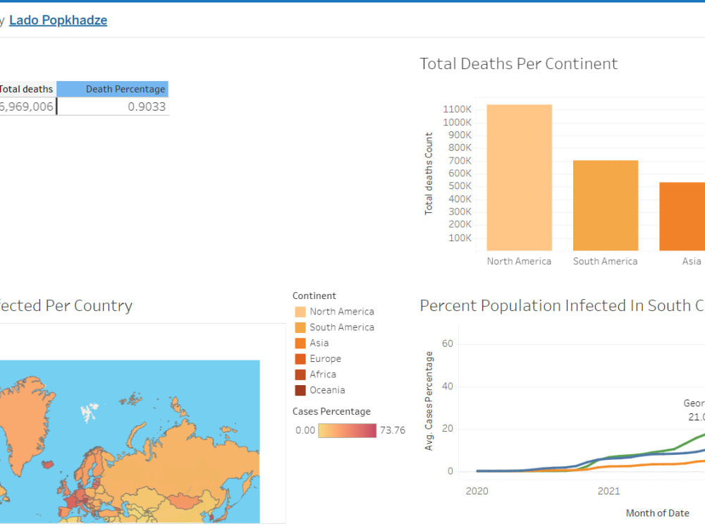
As part of my professional portfolio, I successfully designed and implemented a comprehensive COVID-19 dashboard spanning from 2020 to 2023. The dashboard offers insightful visualizations depicting the percentage of COVID-19 cases by country and regions. Leveraging my data analysis and visualization skills, I employed [specific tools or technologies] to create dynamic representations such as geographic maps, bar charts, and time series graphs. This project showcases my ability to transform complex datasets into user-friendly, informative visuals, providing valuable insights into the global and regional trends of the pandemic.
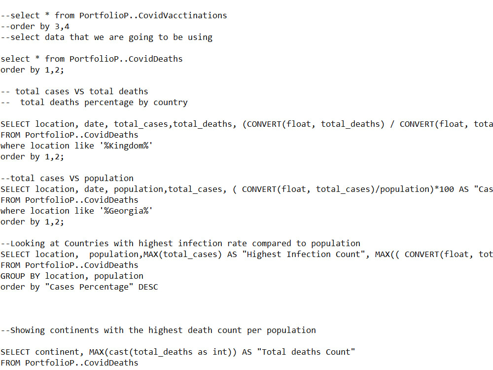
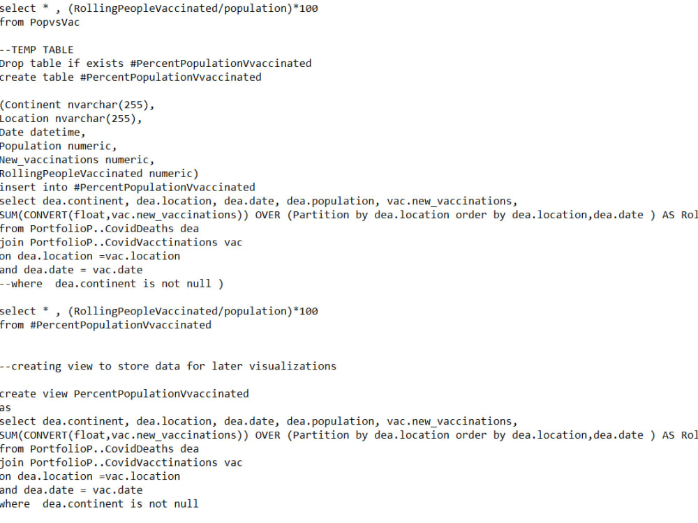
Data Tool
SQLWhat's included $15
These options are included with the project scope.
$15
- Delivery Time 2 days
- Number of Revisions 0
1 review
(1)
(0)
(0)
(0)
(0)
This project doesn't have any reviews.
KS
Konrad S.
May 18, 2025
PLN/DWG File Creation for Hillslide Parcels
About Lado
GIS & Construction Surveying Specialist | AutoCAD, Civil 3D, UAV Data
Tbilisi, Georgia - 7:52 am local time
Professional GIS & Construction Surveying Specialist | AutoCAD, Civil 3D, UAV Data Processing
Hello and welcome!
I’m a GIS and land surveying professional experienced in geospatial analysis, mapping, and construction surveying. I specialize in using industry-standard software such as ArcGIS, QGIS, Global Mapper, AutoCAD, and Civil 3D to deliver high-quality geospatial and engineering outputs.
My core competencies include:
Thematic and topographic map creation
Vectorization and spatial data analysis
Photogrammetry and aerial imagery processing (UAV/Drone)
3D terrain modeling and surface analysis
Construction layout, site planning, and as-built surveys
Preparing civil drawings and grading plans in AutoCAD/Civil 3D
Having transitioned from land surveying to construction surveying, I bring both field expertise and technical skills to ensure your project’s success—from data capture to final deliverables.
Let’s collaborate to bring precision and clarity to your next project!
Steps for completing your project
After purchasing the project, send requirements so Lado can start the project.
Delivery time starts when Lado receives requirements from you.
Lado works on your project following the steps below.
Revisions may occur after the delivery date.
data cleaning
preparation of data for visualization