You will get custom WebGIS dashboard and interactive GIS map
Project details
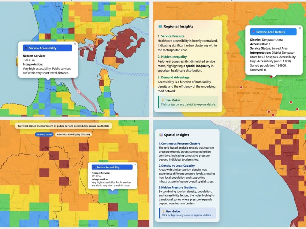
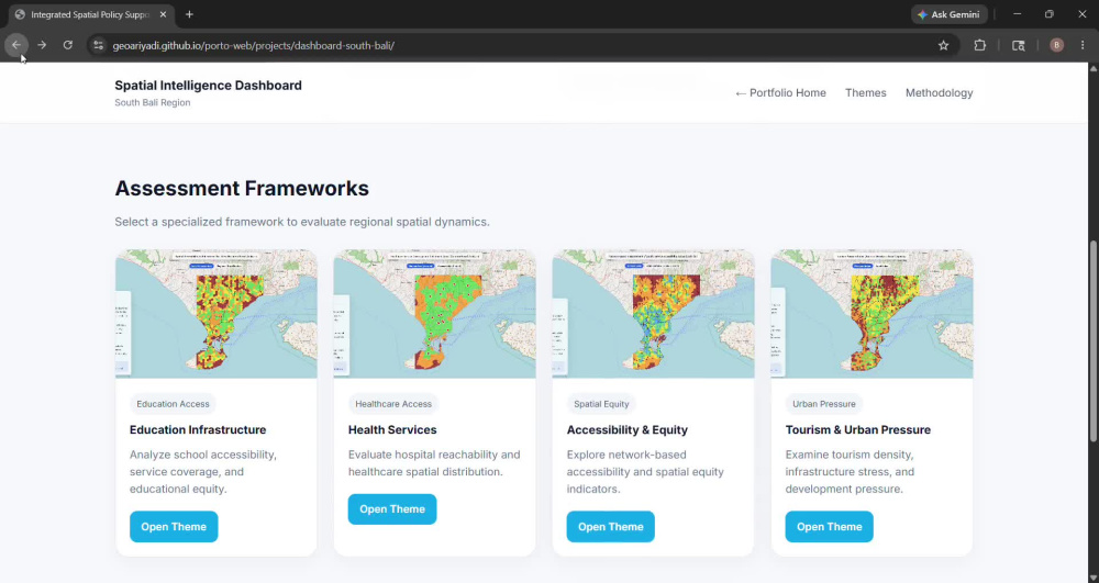
You will get a custom interactive WebGIS dashboard tailored to your spatial data and project goals.
I specialize in GIS and WebGIS development, combining spatial analysis with interactive web mapping to turn complex geographic data into clear, usable insights.
This service can include data preparation, spatial analysis, interactive map development, and dashboard deployment using tools such as QGIS, PostgreSQL/PostGIS, and JavaScript mapping libraries (Leaflet or Mapbox).
Whether you need a business intelligence map, urban analysis dashboard, environmental mapping tool, or custom geospatial visualization, I can help build a clean and reliable solution.
What sets my work apart is a strong GIS foundation—not just web development. I focus on building dashboards that are both technically sound and easy to explore, helping you visualize, analyze, and communicate spatial information effectively.
All deliverables include clean source files, responsive design, and clear communication throughout the project.
Programming Languages
HTML & CSS, JavaScript, JavaCoding Expertise
Cross Browser & Device Compatibility, Performance Optimization, DesignWhat's included
| Service Tiers |
Starter
$175
|
Standard
$399
|
Advanced
$750
|
|---|---|---|---|
| Delivery Time | 5 days | 10 days | 14 days |
Number of Revisions | 2 | 3 | 4 |
Number of Pages | 1 | 2 | 3 |
Design Customization | |||
Content Upload | - | ||
Responsive Design | |||
Source Code |
Optional add-ons
You can add these on the next page.
Additional Page
+$50Frequently asked questions
About Bayu
GIS & Remote Sensing Analyst | WebGIS Developer | Spatial Data Analyst
Bogor, Indonesia - 3:47 pm local time
I help businesses and organizations transform complex spatial data into accurate, production-ready maps, dynamic dashboards, and live WebGIS solutions.
My expertise covers end-to-end geospatial workflows, specializing in processing large datasets, automated spatial databases, and deploying clean web map applications that deliver clear analysis results.
Core Skills:
• GIS Analysis & High-Scale Spatial Data Processing
• WebGIS Architecture & Dashboard Development
• Remote Sensing & Automated Raster Analysis
• Spatial Database Management (PostGIS / PostgreSQL)
• Georeferencing, Digitizing & Topology Cleaning
• Drone Photogrammetry & Orthomosaic 3D Mapping
• Advanced Cartography & National Standard Mapping
I focus on building reliable, clean, and practical geospatial solutions—from raw data preparation to fully deployed web map applications. If you need clean spatial data, advanced mapping, or a custom WebGIS setup, I’m ready to deploy it for you.
Tools & Technologies:
QGIS | ArcGIS | PostGIS | PostgreSQL | Leaflet | JavaScript | GeoJSON | ERDAS Imagine | ENVI | Global Mapper | Visual Studio
Steps for completing your project
After purchasing the project, send requirements so Bayu can start the project.
Delivery time starts when Bayu receives requirements from you.
Bayu works on your project following the steps below.
Revisions may occur after the delivery date.
Review project requirements
I will review your data, goals, and project requirements, then confirm the scope and technical approach.
Data preparation and analysis
I will clean, organize, and analyze your spatial data to prepare it for dashboard integration.