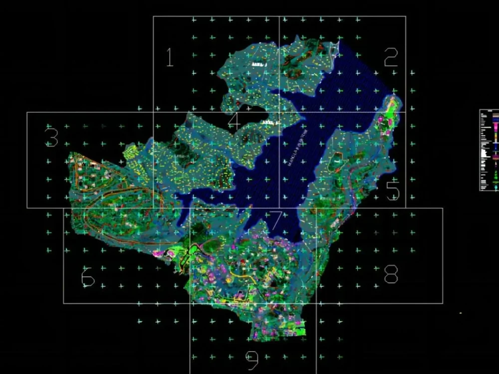
You will get a topographic map using survey data.
Project details
I am a geologist, cartographer and GIS analyst with over 10 years of experience in the GIS field. I have completed many projects creating GIS maps in Arcgis and Envi 5.3. If you are looking for a remote sensing and GIS mapping expert, then this is the job for you. Services: Cartography and Symbology Data analysis, data export and data production Create maps from Google Earth, digitize points, lines, polygons to vector format. Thematic map creation Shapefie, element classes, geodatabases, kml, etc. Modeling Multi-criteria decision analysis Territorial maps Web mapping Spatial Analyst Coordinate systems
Database Type
Realm DatabaseWhat's included $650
These options are included with the project scope.
$650
- Delivery Time 4 days
- Number of Revisions 2
- Number of Queries 3
- Query Debugging
- Query Optimization
- Query Scheduling
- Query Analysis
- Source Code
About Teri
I will create topographic map using surveys data
Amelia, United States - 6:49 pm local time
Steps for completing your project
After purchasing the project, send requirements so Teri can start the project.
Delivery time starts when Teri receives requirements from you.
Teri works on your project following the steps below.
Revisions may occur after the delivery date.
Get requirements
Buyer send the requirements to get started with