You will get Interactive map using Mapbox / Cesium / Leaflet including marker clustering
Top Rated

Top Rated
Project details
We will create an interactive and responsive web application with a map based on your custom data! Here’s how we can tailor the project to your needs:
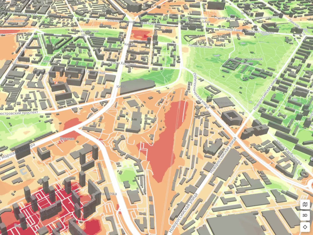
🎨 Map Style Customization: We’ll work together to design and customize the map style, for example, using Mapbox Studio, ensuring it perfectly fits your requirements.
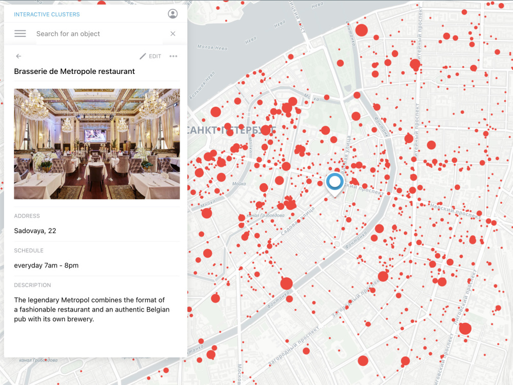
💡 Object Card / Popup Design: We’ll design and implement the object card or popup view, creating a user-friendly and visually appealing interface.
🧹 Geodata Preprocessing: Your geodata will be cleaned and processed, including geometry fixes, georeferencing, and geocoding.
🗂️ Custom Map Layers: Choose between vector or raster maps, with overlay options using basemaps like Mapbox, Google Maps, or OpenStreetMap.
📱 Adaptive Web Application: The application will be responsive across devices, ensuring an optimal experience on both desktop and mobile.
🎨 Map Style Customization: We’ll work together to design and customize the map style, for example, using Mapbox Studio, ensuring it perfectly fits your requirements.
💡 Object Card / Popup Design: We’ll design and implement the object card or popup view, creating a user-friendly and visually appealing interface.
🧹 Geodata Preprocessing: Your geodata will be cleaned and processed, including geometry fixes, georeferencing, and geocoding.
🗂️ Custom Map Layers: Choose between vector or raster maps, with overlay options using basemaps like Mapbox, Google Maps, or OpenStreetMap.
📱 Adaptive Web Application: The application will be responsive across devices, ensuring an optimal experience on both desktop and mobile.
Programming Languages
HTML & CSS, Python, TypeScriptCoding Expertise
Cross Browser & Device Compatibility, Performance Optimization, DesignWhat's included
| Service Tiers |
Starter
$500
|
Standard
$1,000
|
Advanced
$1,500
|
|---|---|---|---|
| Delivery Time | 7 days | 14 days | 21 days |
Number of Revisions | 1 | 2 | 3 |
Design Customization | - | ||
Content Upload | |||
Responsive Design | - | - | |
Source Code | - | - | - |
Optional add-ons
You can add these on the next page.
Additional Revision
+$200
Source Code
+$200
Data cleaning & Georeferencing
(+ 10 Days)
+$800
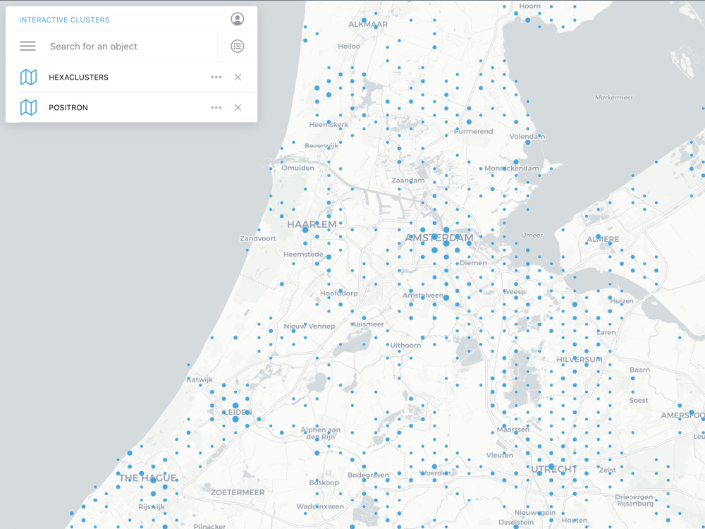
Clustering
(+ 5 Days)
+$500
Set up tile server
(+ 10 Days)
+$1,000
7 reviews
(6)
(1)
(0)
(0)
(0)
This project doesn't have any reviews.
MB
Moishe B.
Jun 26, 2026
API Integration
AT
Alfiya T.
Apr 20, 2026
Python Expert Needed to Create Geoapify Maps API Code Samples
Great experience working with this Python developer. They successfully completed all tasks with high quality and attention to detail. Communication was always clear, and they were very responsive and responsible throughout the project. I would definitely recommend working with them and would be happy to collaborate again in the future.
MB
Moishe B.
Mar 6, 2026
Geoprocessing / Data updating module / auto document generation
DW
Dan W.
Feb 26, 2025
Coordinate Conversion
Alexander was an absolute pleasure to work with, he did everything we asked of him and more. Truly a expert in his subject matter, he provided the guidance we needed and achieved the results we were looking for. I would highly recommend him to anyone.
MB
Moishe B.
Nov 26, 2024
Web development with specialty in GIS and GIS API integration
About Alexander
Full Stack GIS Developer | Web GIS | Python, React, PostGIS, ArcGIS
100%
Job Success
Barcelona, Spain - 5:04 am local time
I'm one of the few GIS developers who covers the full stack - from PostGIS spatial queries and Python automation pipelines to React/Mapbox frontends and real-time 3D visualization with Cesium and Deck.gl. That means you get one accountable person instead of coordinating a backend dev, a frontend dev, and a GIS analyst separately.
I build fast, interactive maps. 10+ years doing it for tourism agencies, urban planners, mining companies, and NGOs. Here's what I handle:
- Custom Web GIS Platforms - scalable, high-performance, built to grow with you
- Interactive Maps - Mapbox, Leaflet, Cesium, OpenLayers, MapLibre, Google Maps, Deck.gl
- Real-time & 3D Geospatial Visualization - live data, moving objects, digital twins
- Automated Spatial Processing - PostGIS, GDAL, Python pipelines that replace manual work
- Location-based Apps - web and mobile PWAs, offline-ready, built for the field
- Map UX/UI - intuitive, visually clean, no manual needed
- Technical SEO for GIS Platforms - a great map no one finds is wasted effort
Tech I work with daily:
- Mapping & GIS: Mapbox, Leaflet, OpenLayers, Cesium, MapLibre, Google Maps API, Deck.gl, QGIS, ArcGIS, GDAL
- Backend: Python, FastAPI, Flask, Node.js, PostgreSQL/PostGIS, Elasticsearch, Redis, Docker, Supabase, Martin, Tileserver-GL, TiTiler
- Frontend: React, Next.js, Angular, Three.js, Tailwind CSS, shadcn, Zustand, TanStack, GraphQL
- Mobile: React Native, Expo, PWAs
- QA: Playwright, Cypress, Postman
CLAIM YOUR FREE 40-MIN CONSULTATION - get expert advice and a tailored roadmap for your GIS project!
Steps for completing your project
After purchasing the project, send requirements so Alexander can start the project.
Delivery time starts when Alexander receives requirements from you.
Alexander works on your project following the steps below.
Revisions may occur after the delivery date.
Receive data and map style from client
Get link to the dataset, description of the desired map (style, idea) and other requirements.
Prepare design layout
Prepare design layout in Mapbox Studio / Figma