You will get Interactive Web Application for Distance and Area Measurement using Leaflet

Project details
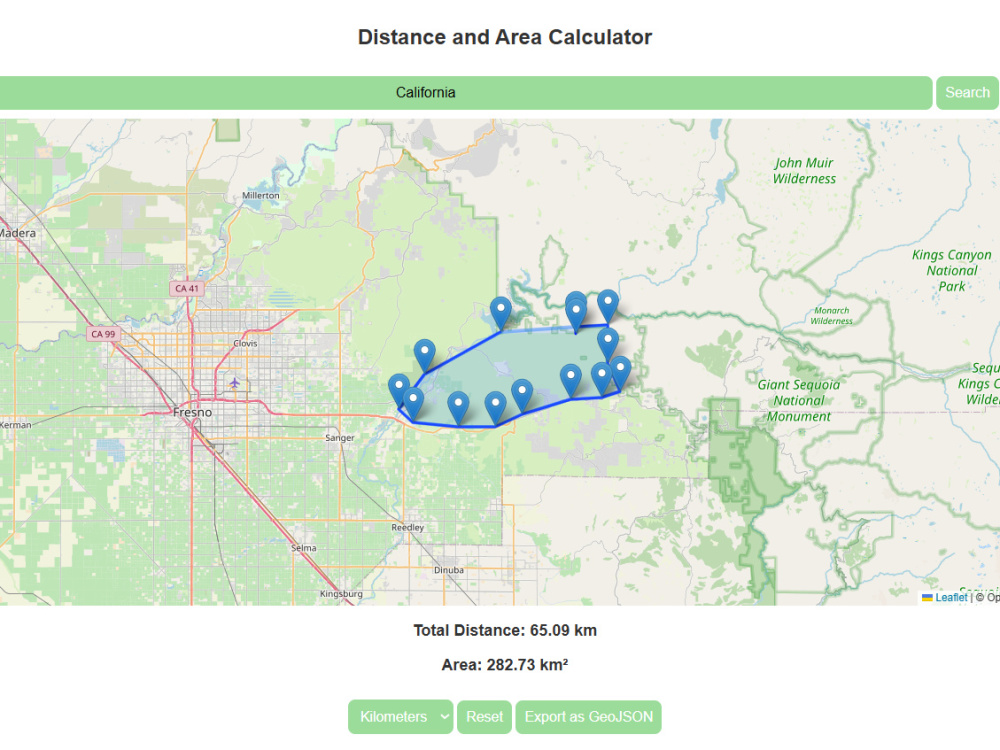
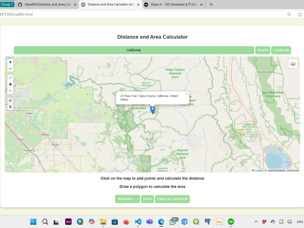
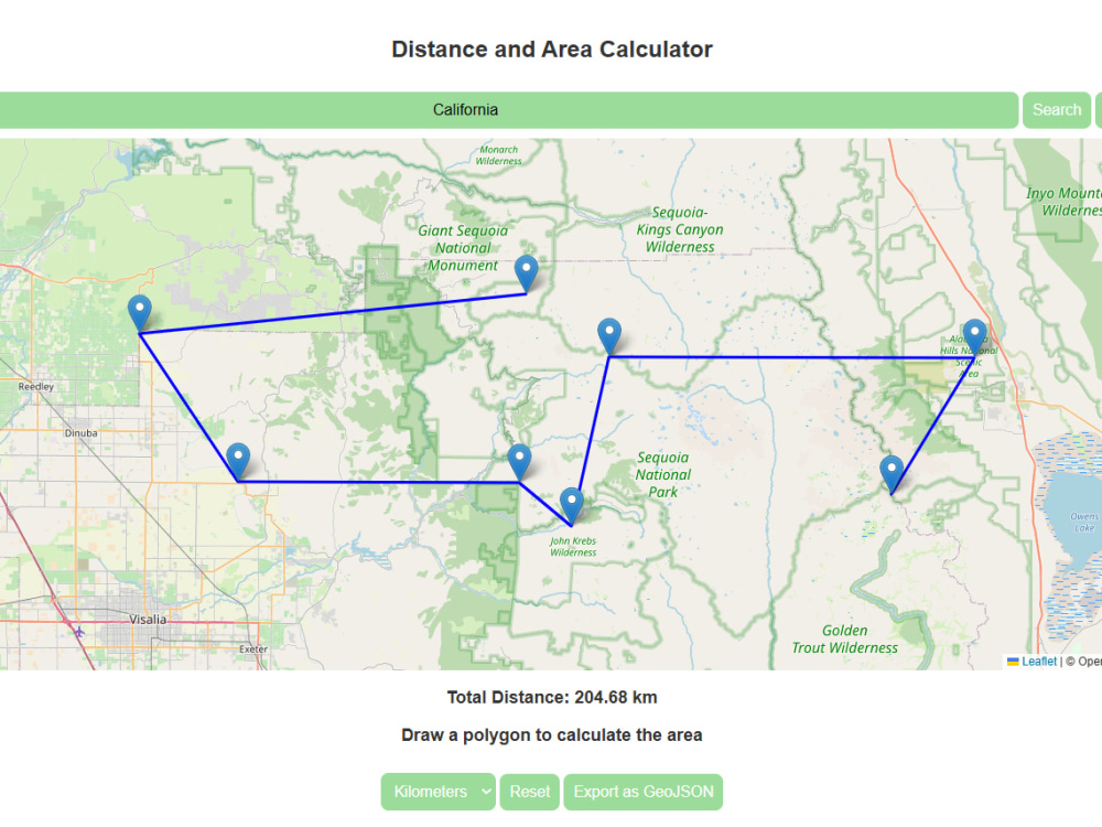
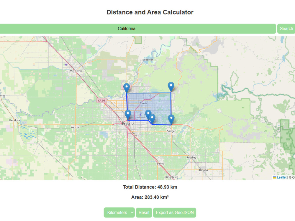
This project provides a fully interactive web-based mapping tool designed to enable users to measure distances and calculate areas accurately and effortlessly. Built with modern mapping technologies, the tool leverages Leaflet.js for map visualization and Leaflet Draw for precise polygon and line drawing. The system is optimized for performance, ensuring a seamless user experience.
Programming Languages
HTML & CSS, JavaScript, PythonCoding Expertise
Cross Browser & Device Compatibility, Performance Optimization, SecurityWhat's included
| Service Tiers |
Starter
$15
|
Standard
$30
|
Advanced
$50
|
|---|---|---|---|
| Delivery Time | 3 days | 5 days | 10 days |
Number of Revisions | 1 | 2 | 3 |
Number of Pages | 1 | 3 | 3 |
Design Customization | - | - | |
Content Upload | - | - | |
Responsive Design | - | - | |
Source Code | - | - |
Optional add-ons
You can add these on the next page.
Design Customization
(+ 3 Days)
+$10
1 review
(1)
(0)
(0)
(0)
(0)
MA
Memo A.
Mar 23, 2025
Alyaa is highly skilled, professional, and delivers excellent results on time. Highly recommended.
MA
Memo A.
Mar 23, 2025
You will get Interactive Web Application for Distance and Area Measurement using Leaflet
Alyaa is highly skilled, professional, and delivers excellent results on time. Highly recommended.
About Alyaa
GIS Developer || ITI Graduate
Cairo, Egypt - 6:03 am local time
Ability to analyze geographic data, produce and draw maps, convert data, ensure data quality, and create geographic databases.
Familiarity with spatial data analysis methods such as spatial analysis, network analysis, and modeling
analysis, and interested in analyzing and managing Geographic Information Systems products for more
effective management and easier decision-making.
Steps for completing your project
After purchasing the project, send requirements so Alyaa can start the project.
Delivery time starts when Alyaa receives requirements from you.
Alyaa works on your project following the steps below.
Revisions may occur after the delivery date.
Project Planning & Data Collection
Review the client's requirements, gather necessary GIS data, and plan the workflow for the project
Map Development & GIS Processing
Develop interactive maps using Leaflet and GeoJSON, process spatial data, and implement required functionalities